
Falaise in Calvados, Normandy, France — Western Europe
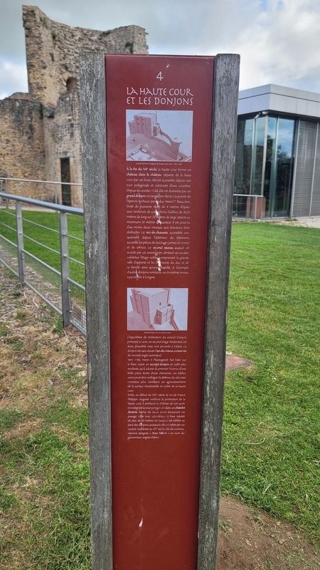
La Haute Cour et les Donjons
⎯⎯⎯
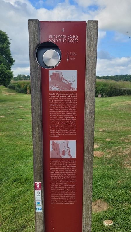
The Upper Yard and the Keeps
Photographed by James Hulse, June 2, 2025
1. La Haute Cour et les Donjons Marker - French Text

À la fin du XIIe siècle, la haute cour forme un château dans le château. Séparée de la basse cour par un fossé, elle est accessible depuis une tour polygonale et ceinturée d'une courtine. Depuis les années 1120, elle est dominée par un grand donjon rectangulaire élevé à la pointe de l'éperon rocheux par le duc Henri Ier Beauclerc. Doté de puissants murs de 4 mètres d'épaisseur renforcés de contreforts, l'édifice de 26,50 mètres de long sur 23 metres de large atteint au minimum 20 mètres de hauteur. Il est pourvu d'au moins deux niveaux aux fonctions bien distinctes. Le rez-de-chaussée, accessible uniquement depuis l'intérieur du bâtiment, accueille les pièces de stockage (armes et vivres) et de service. Le second niveau auquel on accède par un avant-corps abritant un escalier constitue l'étage noble comprenant la grande salle d'apparat et les logements du duc et de sa famille ainsi qu'une chapelle. À l'exemple d'autres donjons similaires, un troisième niveau a pu exister à l'origine.
L'hypothèse de restitution du Grand Donjon, présenté ici avec un second étage résidentiel, est donc plausible mais non prouvée à Falaise. Ce donjon est sans doute l'un des mieux conservés du monde anglo-normand.
Vers 1180, Henri II Plantagenêt fait bâtir sur le flanc ouest un second donjon de taille plus modeste, qu'il adosse au premier. Pourvu d'une belle pièce dotée d'une cheminée, cet édifice vient peut-être renforcer la défense du site mais constitue plus sûrement un agrandissement de la surface résidentielle et noble de la haute cour.
Enfin, au début du XIIIe siècle, le roi de France Philippe Auguste renforce la protection de la haute cour. Il améliore la défense de son accès en intégrant la tour polygonale dans un châtelet d'entrée formé de deux tours encadrant un passage. Une tour cylindrique à base talutée de plus de 20 mètres de hauteur est édifiée au pied des donjons, auxquels elle est reliée par un couloir. Surélevée au XVe siècle, elle est communément désignée «Tour Talbot» du nom du gouverneur anglais d'alors.
Légendes
(Photo #1) Grand et Petit Donjons et haute cour vers 1160-1200.
(Photo #2) Grand Donjon et son avant-corps.
In the late 12th century, the upper yard formed a genuine castle within the castle. Separated from the lower yard by a ditch, it was accessed via a polygonal tower and enclosed by a curtain wall. Since the 1120s, it is dominated by a vast rectangular keep, erected on the extremity of the rocky spur by Duke Henry Ier Beauclerc. Boasting powerful 4 metre-thick walls, reinforced with buttresses, this 26.5 metre-long and 23 metre-wide construction of a maximum height of 20 metres. It comprises at least two levels, each with distinct functions. The ground floor, exclusively accessible from inside the building was used for storage (weapons and food supplies) and services. The second level, accessible via a forebuilding housing a staircase, was the noble floor, comprising a vast ceremonial room, the duke and his family's private apartments and a chapel. Similarly to other keeps from the same period, a third level may have existed in the original building.
A theoretical reconstruction of the Great Keep, presented here with a second residential floor, is therefore plausible, although not proven for Falaise. This is undoubtedly one of the best preserved Anglo-Norman keeps in the world. Around 1180, Henry II Plantagenet had a second, more modestly sized keep built on the west flank, adjoining the first. This second keep housed a splendid hall with a fireplace and, although possibly designed to reinforce the site's defence, its primary purpose was very probably to extend the surface area of the upper yard's noble and residential quarters.
Finally, in the early 13th century, the King of France, Philip Augustus, in turn reinforced protection of the upper yard. He improved defence at access points by integrating the polygonal tower within an entrance barbican comprised of two towers flanking a passageway. A sloped-based cylindrical tower over 20 metres high was erected at the foot of the keeps to which it was linked by a corridor. Raised in the 15th century, it is generally referred to as the «Talbot Tower» after the contemporaneous English governor.
Captions
(Photo #1) Great Keep, Lower Keep and upper yard around 1160-1200.
(Photo #2) Great Keep and its forebuilding.
Erected by Conseil
this page online
Topics. This historical marker is listed in this topic list: Forts and Castles.
Location. 48° 53.599′ N, 0° 12.24′ W. Marker is in Falaise, Normandie (Normandy), in Calvados. It is at the intersection of Place Guillaume le Conquérant and Rue Blacher on Place Guillaume le Conquérant. The marker is located on the grounds of the Château Guillaume-le-Conquérant. Touch for map. Marker is at or near this postal address: 25 Pl Guillaume le Conquérant, Falaise, Normandie 14700, France. Touch for directions.

Regionally, it is in the North Atlantic Region, Europe, the European Union, Atlantic Europe, the Schengen Area, Western Europe, a coastal Mediterranean country, and the Western World. Historically, it finds itself in what was once a French colony and also the Roman Empire.
Other nearby markers. At least 8 other markers are within walking distance of this marker: Le Logis Vicomtal / The Viscount's House (within shouting distance of this marker); La Vie Dans L'enceinte / Life Inside the Enclosure
Photographed by James Hulse, June 2, 2025
2. The Upper Yard and the Keeps Marker - English Text
Also see . . . History. Chateau Guillaume-le-Conquerant
The site of Falaise, situated on the edge of the first foothills of the Armorican massif, has been occupied by man since at least the Mesolithic Age (around 7000 BC). Different types of settlement succeeded one another over the centuries, and it seems that a fortification already exists on the rock in the Carolingian era.(Submitted on June 21, 2025, by James Hulse of Medina, Texas.)
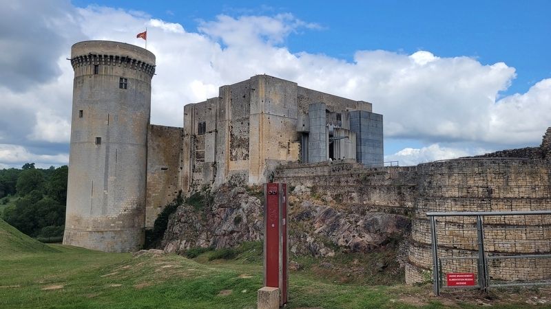
Taking advantage of this protection, the town develops on the rocky spur formed by the two valleys of the Ante and Marescot rivers. The beginning of the 10th century saw the creation of the dukedom of Normandy (the land of the northmen)after the Viking chief Rollo was granted land by Charles III “the simple”, king of franks, in 911. In this new political scene, the town and castle develop and change greatly and Falaise was to become one of the first cities of the new duchy.Photographed by James Hulse, June 2, 20253. The view of the marker with the tower and keep
Photographed by James Hulse, June 2, 2025
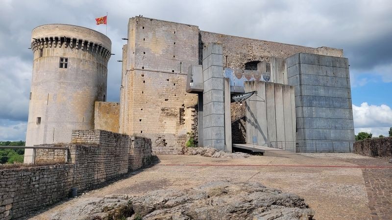
4. Closeup of the Keep and Tower with draw bridge
Photographed by James Hulse, June 2, 2025
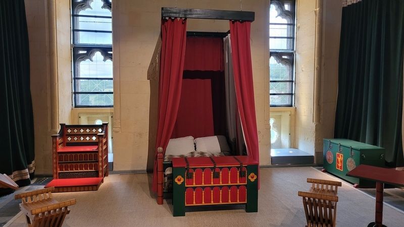
5. Queens Room inside the Keep
Photographed by James Hulse, June 2, 2025
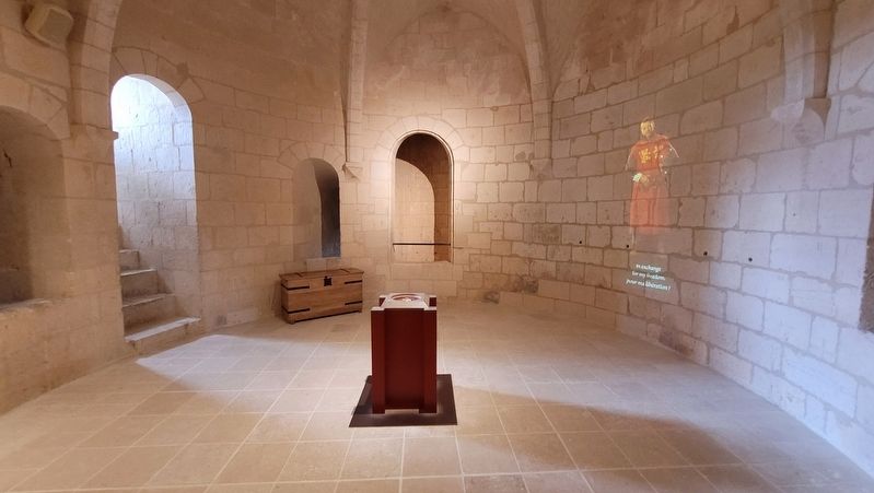
6. An inside view of one of the floors in the tower
Credits. This page was last revised on June 21, 2025. It was originally submitted on June 20, 2025, by James Hulse of Medina, Texas. This page has been viewed 129 times since then and 33 times this year. Photos: 1, 2, 3, 4, 5, 6. submitted on June 20, 2025, by James Hulse of Medina, Texas.
