
Falaise in Calvados, Normandy, France — Western Europe
Le Redent
⎯⎯⎯
The Redan
Photographed by James Hulse, June 2, 2025
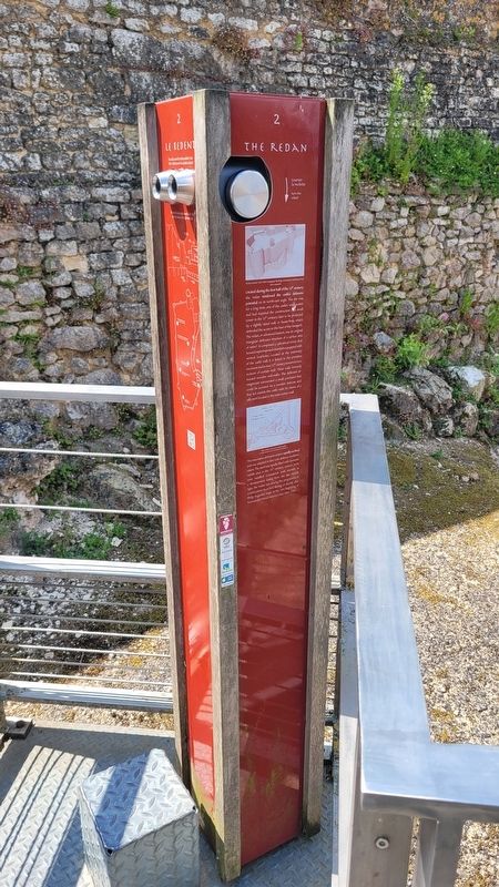
1. Le Redent Marker - French Text

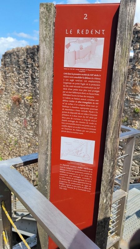
Créé dans la première moitié du XIIIe siècle, le redent vient consolider la défense du château à son angle nordest. Cet emplacement, longtemps un point fragile de la protection du site, avait nécessité la construction au XIIe siècle d'une petite tour, plus tard protégée par un mur faiblement élevé, ou fausse-braie, défendant l'accès à la base des remparts. Le redent, ou bastion avancé, constitue une défense inédite de plan triangulaire de 400 m² de surface. Il se compose d'une tour cylindrique à chambres superposées pourvues de meurtrières à fente verticale. Placée à la pointe du dispositif, elle est reliée à l'enceinte primitive et à deux tours du XIIe siècle par deux pans de courtines. Le long de ceuxci étaient aménagés des chemins de ronde en bois. Cet ensemble enserre une petite cour accessible depuis un escalier en bois et donnant sur l'extérieur du château par une poterne percée dans la courtine ouest.
Le dispositif novateur évolue rapidement tout en s'adaptant à la modernisation de la défense. La cour est rapidement comblée de remblais domestiques et, au XVe siècle, des canonnières sont aménagées. Considéré il y a peu comme un aménagement de la fin du Moyen Âge, le redent appartient bien au programme de constructions du règne de Philippe Auguste ou peu après, au début de la période française de la Normandie (env. 1204-1240).
Légendes
(Photo #1) Redent vers 1160-1200: ouvrage rectangulaire de flanquement et fausse-braie (rempart bas).
(Photo #2) Plan du redent aujourd'hui, ©Joseph Mastrolorenzo, archéologue en architecture.
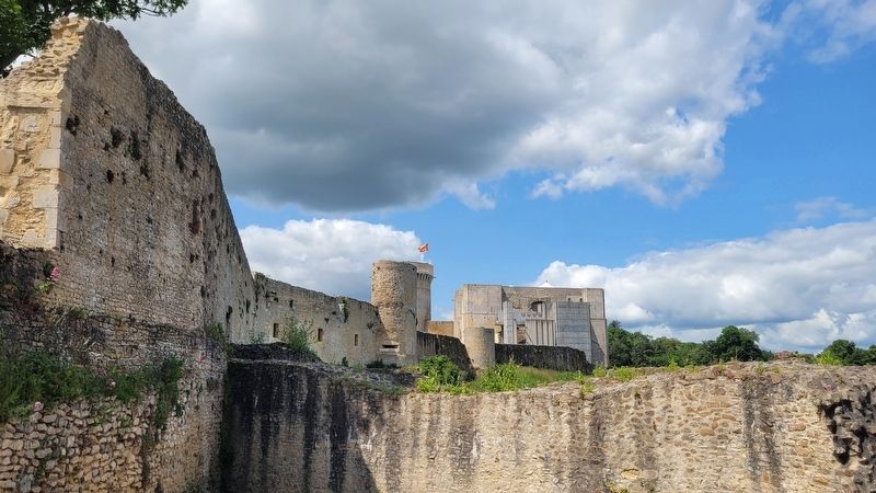
Created during the first half of the 13th century, the redan reinforced the castle's defensive potential on its north-east angle. The site was, for a long time, one of the castle's weak points and had required the construction a small tower in the 12th century, later to be protected by a slightly raised wall, or fausse-bray, which defended the access to the base of the ramparts. The redan, or advanced bastion, was an original triangular defensive structure of a surface area of 400m². It comprised a cylindrical tower that housed superimposed chambers equipped with vertical loopholes. Located at the extremity of the castle wall, it is linked to the primitive enclosure and to two 12th century towers by two sections of curtain wall. These walls formerly housed wooden wall-walks. This defensive arrangement surrounded a small courtyard that could be accessed via a wooden staircase and that led outside the castle walls by means of a sally-port located in the west curtain wall.
This innovative defensive system rapidly evolved and was adapted in line with defence modernisation. The yard was rapidly filled with domestic rubble and, in the 15th century, cannon ports were installed. Considered until recently as a development dating from the late Middle Ages, the redan was among the programme of constructions launched during or shortly after Philip Augustus' reign, at the very beginning of Normandy's French history (circa 1204-1240).
Captions
(Photo #1) Redan around 1160-1200: rectangular flanking construction and fausse-bray (low rampart).
(Photo #2) Plan of the redan as it stands today, ©Joseph Mastrolorenzo, archéologue en architecture.
Erected by Conseil
this page online
Topics. This historical marker is listed in this topic list: Forts and Castles.
Location. 48° 53.615′ N, 0° 12.179′ W. Marker is in Falaise, Normandie (Normandy), in Calvados. It is at the intersection of Place Guillaume le Conquérant and Rue Blacher on Place Guillaume le Conquérant. The marker is located on the grounds of the Château Guillaume-le-Conquérant. Touch for map. Marker is at or near this postal address: 13 Pl Guillaume le Conquérant, Falaise, Normandie 14700, France. Touch for directions.

Regionally, it is in the North Atlantic Region, Europe, the European Union, Atlantic Europe, the Schengen Area, Western Europe, a coastal Mediterranean country, and the Western World. Historically, it finds itself in what was once a French colony and also the Roman Empire.
Other nearby markers. At least 8 other markers are within walking distance of this marker: Les Graffiti / Graffiti (a few steps from this marker); L’apparition des armes à feu / Firearms are introduced (within shouting
Photographed by James Hulse, June 2, 2025
2. The Redan Marker - English Text
Also see . . . History. Chateau Guillaume-le-Conquerant
The site of Falaise, situated on the edge of the first foothills of the Armorican massif, has been occupied by man since at least the Mesolithic Age (around 7000 BC). Different types of settlement succeeded one another over the centuries, and it seems that a fortification already exists on the rock in the Carolingian era.(Submitted on June 21, 2025, by James Hulse of Medina, Texas.)
Taking advantage of this protection, the town develops on the rocky spur formed by the two valleysof the Ante and Marescot rivers. The beginning of the 10th century saw the creation of the dukedom of Normandy (the land of the northmen) after the Viking chief Rollo was granted land by Charles III “the simple”, king of franks, in 911. In this new political scene, the town and castle develop and change greatly and Falaise was to become one of the first cities of the new duchy.Photographed by James Hulse, June 2, 20253. The view of the Redan from the Marker
Photographed by James Hulse, June 2, 2025
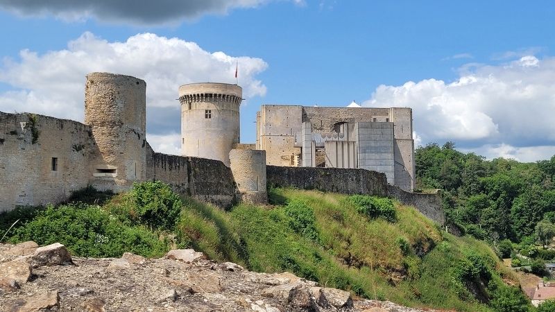
4. The view of the tower and castle wall
Credits. This page was last revised on June 21, 2025. It was originally submitted on June 20, 2025, by James Hulse of Medina, Texas. This page has been viewed 100 times since then and 15 times this year. Photos: 1, 2, 3, 4. submitted on June 21, 2025, by James Hulse of Medina, Texas.
