Patterson Mill in Barnwell County, South Carolina — The American South (South Atlantic)
Lower Three Runs Baptist Church
Photographed by Mike Stroud, 2010
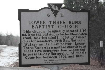
1. Lower Three Runs Baptist Church Marker
This church, originally located 8/10 mi. W on the old Augusta-to-Charleston road, was founded in 1789 by twelve charter members, with Rev. Nathaniel Walker as its first pastor. Lower Three Runs was a mother church to at least five congregations organized in present-day Barnwell or Allendale Counties between 1802 and 1849.
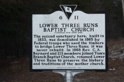
(Reverse text)
The second sanctuary here, built in 1833, was demolished in 1865 by Federal troops who used the timbers to bridge Lower Three Runs; it was never rebuilt. In 1868 Rev. C.A. Baynard and 213 members joined Tom's Branch Baptist Church, renamed Lower Three Runs to preserve the history and traditions of the mother chuch.
Erected 2001 by The Congregation. (Marker Number 6-11.)
Topics. This historical marker is listed in this topic list: Religion & Religious Structures. A significant historical year for this entry is 1789.
Location. 33° 11.538′ N, 81° 28.003′ W. Marker is in Patterson Mill, South Carolina, in Barnwell County. It is on Patterson Mill Road (State Highway 6-60), on the right when traveling south. Located between Moore Road and Poplar Road (State Road 6-361). Touch for map.
this page online

Regionally, this marker is in the Midlands. It is also in the American South and specifically in the Deep South. Globally, it is in North America, the Western Hemisphere, the Western World, and the Anglosphere. Historically, it finds itself in what was once the territory of the Mississippian Culture, one of the original Thirteen Colonies, one of the Confederate States of America, and the Antebellum South.
Other nearby markers. At least 8 other markers are within 7 miles of this marker, measured as the crow flies: Ellenton Agricultural Club / Town of Ellenton (approx. 4.2 miles away); Tarlton Brown (1757 - 1845) (approx. 4.3 miles away); Boiling Springs Academy (approx. 4.4 miles away); Boiling Springs Presbyterian Church (approx. 4½ miles away); Winton County Court House Site (approx. 4.8 miles away); Morris Ford Earthworks (approx. 6.7 miles away); Red Hill At Turkey Creek (approx. 6.7 miles away); Fuller Park (approx. 6.8 miles away).
Photographed by Mike Stroud, February 13, 2010
2. Lower Three Runs Baptist Church Marker, reverse side
Photographed by Mike Stroud, February 13, 2010
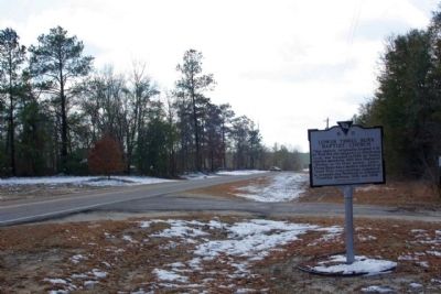
3. Lower Three Runs Baptist Church Marker, looking south along Patterson Mill Road
Photographed by Mike Stroud, February 13, 2010
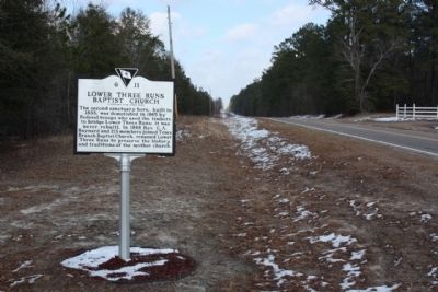
4. Lower Three Runs Baptist Church Marker, looking north
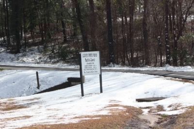
Photographed by Mike Stroud, February 13, 2010
5. Lower Three Runs Baptist Church , sign for present day church location
Organized 1789
Patterson Mill Road (State Road 3-45) and Augusta Highway (State Road 125)
Patterson Mill Road (State Road 3-45) and Augusta Highway (State Road 125)
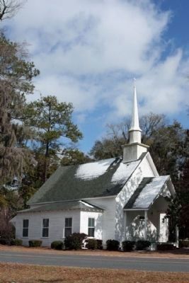
Photographed by Mike Stroud, February 13, 2010
6. Todays Lower Three Runs Baptist Church , and present location
Church Coordinates: 33.09458 -81.490853
Patterson Mill Road (State Road 3-45) and Augusta Highway (State Road 125)
Patterson Mill Road (State Road 3-45) and Augusta Highway (State Road 125)
Credits. This page was last revised on June 16, 2016. It was originally submitted on February 17, 2010, by Mike Stroud of Bluffton, South Carolina. This page has been viewed 1,672 times since then and 36 times this year. Photos: 1, 2, 3, 4, 5, 6. submitted on February 17, 2010, by Mike Stroud of Bluffton, South Carolina. • Craig Swain was the editor who published this page.
