Peoa in Summit County, Utah — The American Mountains (Southwest)
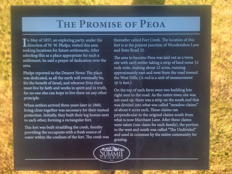
The Promise of Peoa
Photographed by Jeremy Snow, June 20, 2025
1. The Promise of Peoa Marker
Phelps reported in the Deseret News: The place was dedicated, as all the earth will eventually be, for the benefit of Israel, and whoever lives there must live by faith and works in spirit and in truth, for no one else can hope to live there on any other principle.
When settlers arrived three years later in 1860, living close together was necessary for their mutual protection. Initially, they built their log homes next to each other, forming a rectangular fort.
This fort was built straddling the creek, thereby providing the occupants with a fresh source of water within the confines of the fort. The creek was thereafter called Fort Creek. The location of this fort is at the present junction of Woodenshoe Lane and State Road 32.
The area to become Peoa was laid out as a town site with each settler taking a strip of land some 12 rods wide, making about 12 acres, running
this page online
On the top of each farm were two building lots right next to the road. As the entire town site was not used up, there was a strip on the south end that was divided into what was called "meadow claims" of about 6 acres each. These claims ran perpendicular to the original claims south from what is now Marchant Lane. After these claims were taken (one claim for each family), the portion to the west and south was called "The Undivided" and used in common by the entire community for grazing.
Erected by Summit County.
Topics. This historical marker is listed in these topic lists: Forts and Castles • Settlements & Settlers. A significant historical year for this entry is 1860.
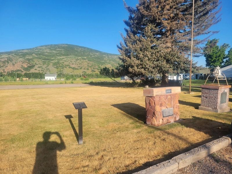
Location. 40° 43.556′ N, 111° 20.564′ W. Marker is in Peoa, Utah, in Summit County. It is on Utah 32, on the right when traveling south. Touch for map. Marker is at or near this postal address: 5589 UT-32, Peoa UT 84061, United States of America. Touch for directions.

Regionally, this marker is in the Uinta Mountains, in the Wasatch Front, and in
Photographed by Jeremy Snow, June 20, 2025
2. The Promise of Peoa Marker
Other nearby markers. At least 8 other markers are within 10 miles of this marker, measured as the crow flies: Fort Sage Bottom (a few steps from this marker); Indian Trail (approx. 2.4 miles away); Rhoades Valley Fort (approx. 6½ miles away); First Settler of Kamas (approx. 6.8 miles away); Wanship Station (approx. 7 miles away); Francis (approx. 8.6 miles away); Park City Pioneers (approx. 9.7 miles away); Marsac School (approx. 9.8 miles away).
Credits. This page was last revised on June 21, 2025. It was originally submitted on June 20, 2025, by Jeremy Snow of Cedar City, Utah. This page has been viewed 91 times since then and 16 times this year. Photos: 1, 2. submitted on June 20, 2025, by Jeremy Snow of Cedar City, Utah. • Andrew Ruppenstein was the editor who published this page.
