
Deer Valley in Park City in Summit County, Utah — The American Mountains (Southwest)
Union Pacific Depot
"One of the finest in the Park"

Photographed by Jeremy Snow, June 20, 2025
1. Union Pacific Depot Marker
The building in front of you was once the Union Pacific Depot. It contained freight and ticket offices, baggage and waiting rooms, and quarters for the station master upstairs. When work was completed in October 1886, the Park Record newspaper lauded the results by asserting. The building is one of the finest in the Park, the design is modern and tasteful and brilliant yellow paint adorns it on all sides."
The depot ceased functioning as a railroad station in 1976-77, and the last trains ran on the "Echo and Park City" spur line in 1986. The rail bed remains today as the Union Pacific Rail Trail.
Erected by Park City.
Topics. This historical marker is listed in this topic list: Railroads & Streetcars. A significant historical month for this entry is October 1886.
Location. 40° 38.784′ N, 111° 29.836′ W. Marker
this page online

Regionally, this marker is in Utah’s Uinta Mountains, in the Wasatch Front, and in Greater Provo. It is also in the American Mountain West and on the Colorado Plateau. Globally, it is in North America, the Rocky Mountains, the Western Hemisphere, the Western World, and the Anglosphere. Historically, it finds itself in what was once New Spain and also Mexico’s Alta California.
Other nearby markers. At least 8 other markers are within walking distance of this marker: Rodney W. Schreurs Centennial Park (within shouting distance of this marker); The Mortuary (about 300 feet away, measured in a direct line); The Claimjumper Hotel (about 400 feet away); Masonic Hall (about 600 feet away); Washington School (about 600 feet away); City Hall Park City (about 700 feet away); City Hall (about 700 feet away); "Ten O'Clock Whistle" and Old Public Library
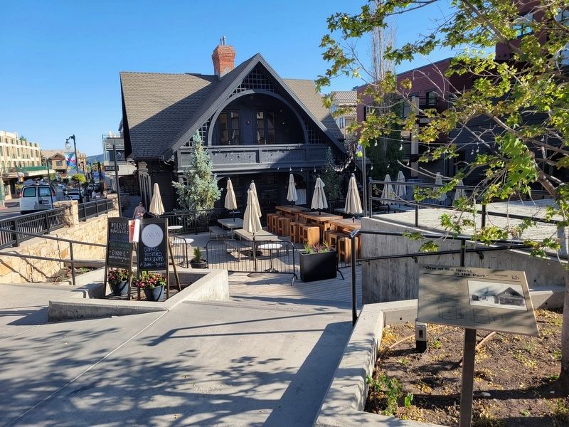
Photographed by Jeremy Snow, June 20, 2025
2. Union Pacific Depot Marker
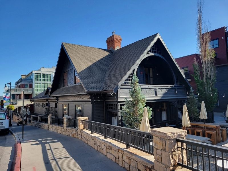
Photographed by Jeremy Snow, June 20, 2025
3. Union Pacific Depot Building
Credits. This page was last revised on June 21, 2025. It was originally submitted on June 20, 2025, by Jeremy Snow of Cedar City, Utah. This page has been viewed 129 times since then and 18 times this year. Photos: 1, 2, 3. submitted on June 20, 2025, by Jeremy Snow of Cedar City, Utah. • Andrew Ruppenstein was the editor who published this page.
