Moweaqua in Shelby County, Illinois — The American Midwest (Great Lakes)
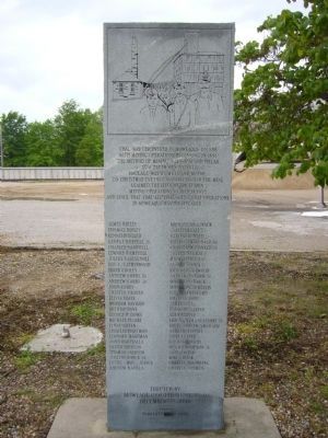
Moweaqua Coal Mine Disaster Memorial
Photographed by Bill Kirchner, April 30, 2012
1. Moweaqua Coal Mine Disaster Memorial
With mining operations beginning in 1891
The method of mining was room and pillar
At a depth of 620 feet
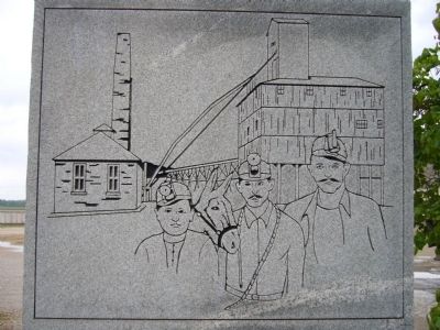
Haulage was by mule and motor
On Christmas Eve 1932 an explosion in the mine
Claimed the lives of these men
Mining operations ceased in 1935
And since that time all evidence of coal operations
In Moweaqua has disappeared
James Birley • Michael Krajnack • Thomas Birley • Joseph Krall • Kenneth Board • Carl McDonald • George Burrell Jr. • Charles McDonald Sr. • Charles Campbell • Charles McDonald Jr. • Edward Campbell • Joseph Negray • Julius Castagnoli • Michael Negray • Roy c Catherwood • George Ondes • David Cooley • Roscoe Portwood • Andrew Corby Sr. • Andrew Potsick Jr. • Andrew Corby Jr. • Michael Potsick • John Corby • Michael Raygellis • Chester Craven • Roy Reatherford • Zelvia Davis • Charles Roff • William Davison • James Roff • Arthur Dove • Raymond Sarver • George P Dowd • Vern Sarver • Michael Floski • Simon Sam Scgloski Jr. • Lynne Green • Louis Andrew Smorado • Charles Hartman • Andrew Supinie • Leonard Hartman
this page online
Artist
Pamela J Moore 1990
Erected 1990 by Moweaqua Coal Mine Museum.
Topics. This historical marker and memorial is listed in this topic list: Disasters. A significant historical year for this entry is 1886.
Location. 39° 37.239′ N, 89° 1.308′ W. Marker is in Moweaqua, Illinois, in Shelby County. It is on West Cherry Street west of South Plum Street, in the median. Marker is on the grounds of the Pogenpohl Ready-Mix Plant. Touch for map. Marker is in this post office area: Moweaqua IL 62550, United States of America. Touch for directions.

Regionally, this marker and memorial is in Central Illinois. It is also in the American Midwest and in the Corn Belt. Globally, it is in North America, the Western Hemisphere, the Western World, and the Anglosphere. Historically, it finds itself in what was once the territory of the Mississippian Culture and also the Northwest Territory.
Other nearby markers. At
Photographed by Bill Kirchner, April 30, 2012
2. Moweaqua Coal Mine Disaster Marker
Photographed by Bill Kirchner, April 30, 2012
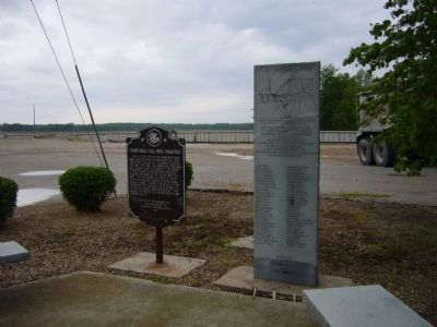
3. Moweaqua Coal Mine Disaster Memorial & Marker
Credits. This page was last revised on June 26, 2025. It was originally submitted on May 24, 2012, by Bill Kirchner of Tucson, Arizona. This page has been viewed 1,547 times since then and 36 times this year. Last updated on June 21, 2025, by Edward Troxel of Creal Springs, Illinois. Photos: 1, 2, 3. submitted on May 23, 2012, by Bill Kirchner of Tucson, Arizona. • Devry Becker Jones was the editor who published this page.
