Lyman in Uinta County, Wyoming — The American West (Mountains)
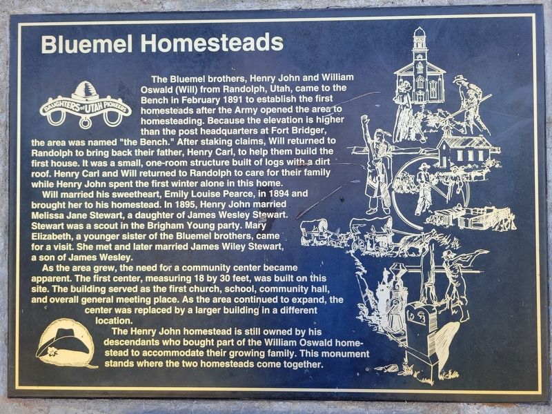
Bluemel Homesteads
Photographed by Jeremy Snow, June 25, 2025
1. Bluemel Homesteads Marker
Will married his sweetheart, Emily Louise Pearce, in 1894 and brought her to his homestead. In 1895, Henry John married Melissa Jane Stewart, a daughter of James Wesley Stewart. Stewart was a scout in the Brigham Young party. Mary Elizabeth, a younger sister of the Bluemel brothers, came for a visit. She met and later married James Wiley Stewart, a son of James Wesley.
As the area grew, the need for a community center became apparent. The first center, measuring 18 by 30 feet, was built on this site. The
this page online
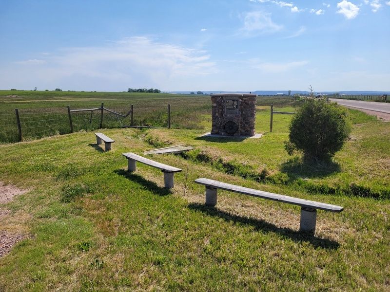
The Henry John homestead is still owned by his descendants who bought part of the William Oswald homestead to accommodate their growing family. This monument stands where the two homesteads come together.
Erected by Daughters of Utah Pioneers. (Marker Number 558.)
Topics and series. This historical marker is listed in this topic list: Settlements & Settlers. In addition, it is included in the Daughters of Utah Pioneers series list. A significant historical month for this entry is February 1891.
Location. 41° 18.996′ N, 110° 17.283′ W. Marker is in Lyman, Wyoming, in Uinta County. It is on County Road 249, on the left when traveling east. Touch for map. Marker is at or near this postal address: 238 Co Rd 249, Lyman WY 82937, United States of America. Touch for directions.

Regionally, this marker is in the Uinta Mountains and in the Westward Expansion Trails Region. It is also in the American Mountain West. Globally, it is in North America,
Photographed by Jeremy Snow, June 25, 2025
2. Bluemel Homesteads Marker
Other nearby markers. At least 8 other markers are within 6 miles of this marker, measured as the crow flies: The Mormon Pioneers (approx. 3.4 miles away); Jim Bridger (approx. 5.2 miles away); Fort Bridger (approx. 5.2 miles away); Old Fort Bridger (approx. 5.3 miles away); a different marker also named Fort Bridger (approx. 5.3 miles away); The Post Trader's Store (approx. 5.3 miles away); The Post Trader (approx. 5.3 miles away); The Lincoln Highway (approx. 5.3 miles away).
Credits. This page was last revised on June 26, 2025. It was originally submitted on June 25, 2025, by Jeremy Snow of Cedar City, Utah. This page has been viewed 114 times since then and 31 times this year. Photos: 1, 2. submitted on June 25, 2025, by Jeremy Snow of Cedar City, Utah. • Andrew Ruppenstein was the editor who published this page.
