
Falaise in Calvados, Normandy, France — Western Europe
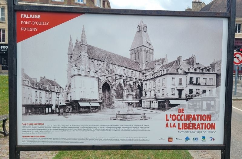
Place et Église Saint-Gervais
⎯⎯⎯
Square and Church "Saint-Gervais
Falaise Pont-d'Ouilly Potigny
Photographed by James Hulse, June 2, 2025
1. Place et Église Saint-Gervais / Square and Church "Saint-Gervais Marker

De l’Occupation à la Libération, Mémoires du Pays de Falaise
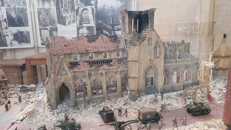
L'église Saint-Gervais est située au cœur de Falaise. Sous l'impulsion de Guillaume le Conquérant, sa construction commence probablement peu avant la conquête de l'Angleterre en 1066, et s'achève sous le règne d'Henri Iᵉʳ Beauclerc (1100-1135), troisième fils de Guillaume. En avril 1124, en présence du duc-roi, l'église est consacrée par Jean de Neuville, évêque de Sées. L'édifice roman initial était inspiré de l'église de la Trinité de l'Abbaye-aux-Dames à Caen, dont il dépendait. Il n'en subsiste que quelques éléments dans le mur sud de la nef, la tour-lanterne et la façade ouest. Dès 1862, l'église est classée aux monuments historiques. Saint-Gervais est très endommagée par les bombardements de la Bataille de Normandie. Sa remarquable reconstruction est entreprise dans les décennies suivantes.
Verso
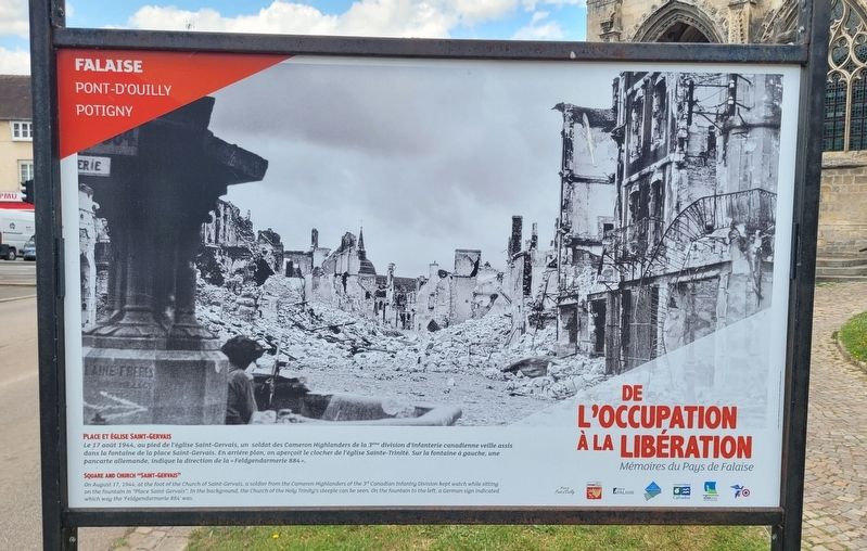
Le 17 août 1944, au pied de l'église Saint-Gervais, un soldat des Cameron Highlanders de la 3ᵉᵐᵉ division d'infanterie canadienne veille assis dans la fontaine de la place Saint-Gervais. En arrière plan, on aperçoit
this page online
From Occupation to Liberation, Memories of the Falaise Region
The Church of Saint-Gervais is set in the heart of Falaise. At William the Conqueror's instigation, its construction probably began shortly before England was conquered in 1066, and was completed under the reign of Henri I Beauclerc (1100-1135), William's third son. In April 1124, in the presence of the Duke who was also King, the church was consecrated by Jean de Neuville, bishop of Sées. The initial Norman building was inspired by the Abbey Church of the Holy Trinity in Caen, of which it was a dependency. Solely a few elements remain on the nave's south wall, the lantern tower and the western façade. As from 1862, the church became a listed historical building. Saint-Gervais was badly damaged by the bombings that occurred during the Battle of Normandy. Its remarkable reconstruction was undertaken over the following decades.
Reverse Side
On August 17, 1944, at the foot of the Church of Saint-Gervais, a soldier from
Photographed by James Hulse, June 2, 2025
2. Place et Église Saint-Gervais / Square and Church "Saint-Gervais Marker - Reverse Side
Erected by Mairie de Pont-d’Ouilly, Potigny, Ville de Falaise, Pays de Falaise, Conseil Général du Calvados, Région Basse-Normandie.
Topics. This historical marker is listed in this topic list: War, World II. A significant historical month for this entry is April 1124.
Location. 48° 53.867′ N, 0° 11.935′ W. Marker is in Falaise, Normandie (Normandy), in Calvados. It is at the intersection of Rue de Caen (Normandie Route D658) and Rue de Brebisson, on the left when traveling east on Rue de Caen. The markers are located on the south side of the cathedral next to the street. Touch for map. Marker is at or near this postal address: 10 Rue de Brebisson, Falaise, Normandie 14700, France. Touch for directions.

Regionally, it is in the North Atlantic Region, Europe, the European Union, Atlantic Europe, the Schengen Area, Western Europe, a coastal
Photographed by James Hulse, June 2, 2025
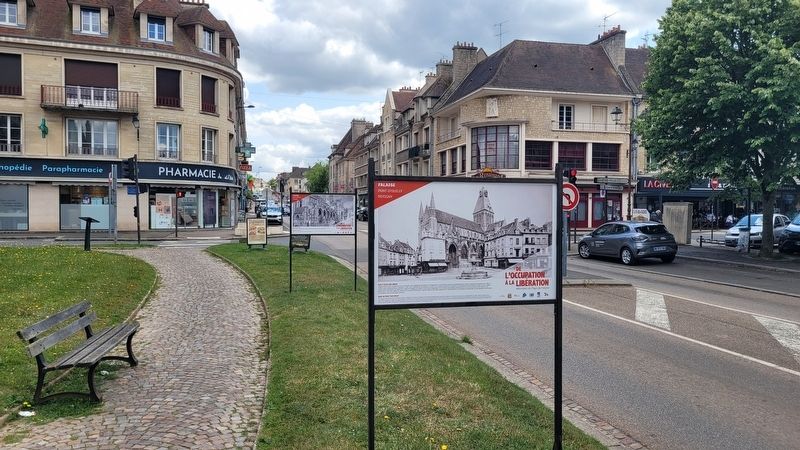
3. The view of the marker along the street
Other nearby markers. At least 8 other markers are within walking distance of this marker: A different marker also named Place et Église Saint-Gervais / Square and Church "Saint-Gervais" (here, next to this marker); a different marker also named Place et Église Saint-Gervais / Square and Church "Saint-Gervais (here, next to this marker); Août 44 : Poche de Falaise, la Dernière Bataille! / August ’44: Falaise Pocket, the Final Battle! (a few steps from this marker); L'église Saint Gervais / Saint Gervais Church (a few steps from this marker); La Porte des Cordeliers / The Cordeliers Gate (about 180 meters away, measured in a direct line); Ce 17 août, les Canadiens / On August 17, Canadian Forces (approx. 0.4 kilometers away); L'église de la Sainte Trinité / The Church of the Holy Trinity (approx. 0.4 kilometers away); Guillaume le Conquérant / William the Conqueror (approx. half a kilometer away). Touch for a list and map of all markers in Falaise.
More about this marker. There are three markers
Photographed by James Hulse, June 2, 2025
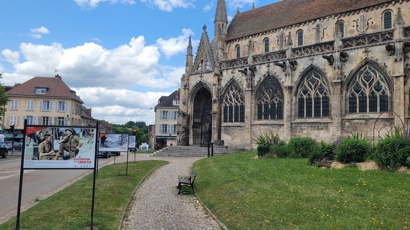
4. The view of the "Saint-Gervais Church with the markers
Photographed by James Hulse, June 2, 2025
5. A model of the damage to the church during the war located in the church
Credits. This page was last revised on June 27, 2025. It was originally submitted on June 26, 2025, by James Hulse of Medina, Texas. This page has been viewed 86 times since then and 8 times this year. Photos: 1, 2, 3, 4, 5. submitted on June 27, 2025, by James Hulse of Medina, Texas.
