
Falaise in Calvados, Normandy, France — Western Europe
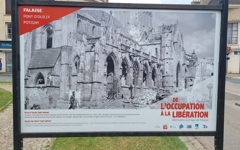
Place et Église Saint-Gervais
⎯⎯⎯
Square and Church "Saint-Gervais
Falaise Pont-d'Ouilly Potigny
Photographed by James Hulse, June 2, 2025
1. Place et Église Saint-Gervais / Square and Church "Saint-Gervais Marker

De l’Occupation à la Libération, Mémoires du Pays de Falaise
Troupes canadiennes devant l'église Saint-Gervais. Dès les bombardements du 7 juin 1944, la place Saint-Gervais est fortement touchée. Pendant la bataille pour la prise de Falaise, les troupes allemandes surnomment l'église Saint-Gervais, «la cathédrale».
Verso
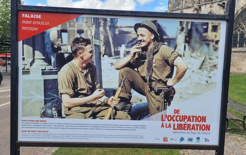
Les soldats Campbell et Lockhart de la 2ème division d'infanterie canadienne prennent une pause sur la fontaine de la place Saint-Gervais. Le soldat Campbell, véréran de la campagne d'Italie porte «The Italy star» décernée à tout soldat ayant été engagé au minimum un mois en Italie ou en Sicile. Le soldat Lockhart est certainement une estafette à moto (soldat chargé de transmettre les messages) comme l'atteste son casque posé sur le rebord de la fontaine.
From Occupation to Liberation, Memories of the Falaise Region
Canadian troops outside the Church of Saint-Gervais. Starting from the bombings of June 7, 1944, "Place Saint-Gervais" was badly hit. During the battle waged for the capture of Falaise, German troops nicknamed the Church of Saint-Gervais "the cathedral".
Reverse Side
Privates
this page online
Erected by Mairie de Pont-d’Ouilly, Potigny, Ville de Falaise, Pays de Falaise, Conseil Général du Calvados, Région Basse-Normandie.
Topics. This historical marker is listed in this topic list: War, World II. A significant historical date for this entry is June 7, 1944.
Location. 48° 53.865′ N, 0° 11.93′ W. Marker is in Falaise, Normandie (Normandy), in Calvados. It is at the intersection of Rue de Caen (Normandie Route D658) and Rue de Brebisson, on the left when traveling east on Rue de Caen. The markers are located on the south side of the cathedral next to the street. Touch for map. Marker is at or near this postal address: 10 Rue de Brebisson, Falaise, Normandie 14700, France.
Photographed by James Hulse, June 2, 2025
2. Place et Église Saint-Gervais / Square and Church "Saint-Gervais Marker - Reverse Side

Regionally, it is in the North Atlantic Region, Europe, the European Union, Atlantic Europe, the Schengen Area, Western Europe, a coastal Mediterranean country, and the Western World. Historically, it finds itself in what was once a French colony and also the Roman Empire.
Other nearby markers. At least 8 other markers are within walking distance of this marker: A different marker also named Place et Église Saint-Gervais / Square and Church "Saint-Gervais (here, next to this marker); L'église Saint Gervais / Saint Gervais Church (a few steps from this marker); a different marker also named Place et Église Saint-Gervais / Square and Church "Saint-Gervais" (a few steps from this marker); Août 44 : Poche de Falaise, la Dernière Bataille! / August ’44: Falaise Pocket, the Final Battle! (a few steps from this marker); La Porte des Cordeliers / The Cordeliers Gate (about 180 meters away, measured in a direct line); Ce 17 août, les Canadiens / On August 17, Canadian Forces (approx. 0.4 kilometers away); L'église de la Sainte Trinité / The Church of the Holy Trinity (approx. 0.4 kilometers away); Guillaume le Conquérant / William the Conqueror
Photographed by James Hulse, June 2, 2025
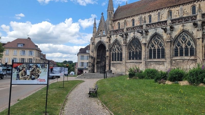
3. The view of the marker along the street
More about this marker. There are three markers at the location with the same title but different text.
Photographed by James Hulse, June 2, 2025
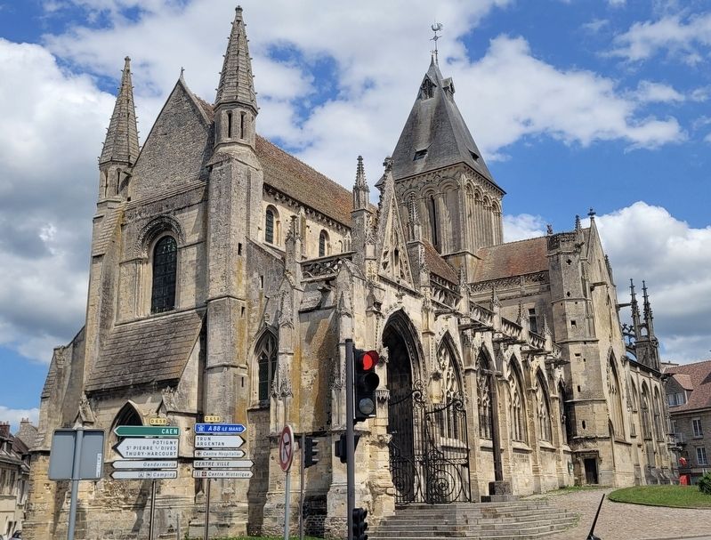
4. Saint-Gervais Church
Credits. This page was last revised on June 27, 2025. It was originally submitted on June 26, 2025, by James Hulse of Medina, Texas. This page has been viewed 80 times since then and 12 times this year. Photos: 1, 2, 3, 4. submitted on June 27, 2025, by James Hulse of Medina, Texas.
