
Falaise in Calvados, Normandy, France — Western Europe
L'église Saint Gervais
⎯⎯⎯
Saint Gervais Church
Falaise
Photographed by James Hulse, June 2, 2025
1. L'église Saint Gervais / Saint Gervais Church Marker

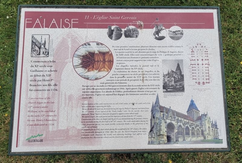
Commencée à la fin du XIᵉ siècle sous Guillaume et achevée au début du XIIᵉ siècle par Henri Iᵉʳ Beauclerc, son fils, elle fut consacrée en 1134.
De cette première construction, plusieurs éléments sont encore visibles comme le mur sud de la nef et la tour qui porte le clocher.
Les parties nord de la nef, détruites par le siège de Philippe II Auguste, datent du XIIIᵉ siècle. Elles sont caractéristiques du style «gothique primitif». À l'extérieur, arcs-boutants et puissants contreforts étaient conçus pour supporter une voûte d'ogives en pierres. Les chapelles latérales, le portail sud et le baptistère datent du XVᵉ siècle. La réalisation du chœur, de ses chapelles, et du porche commencés au siècle précédent s'est achevée dans la première moitié du XVIᵉ siècle. Ces travaux entrepris à une période de prospérité de la ville sont dus à la seule générosité des Falaisiens.
Ravagée par un incendie en 1562 puis reconstruite dans la seconde moitié du XVIᵉ siècle cet édifice fut gravement endommagé en 1944. Après-guerre, l'église a été restaurée de manière
this page online
Légendes
(Photo #1) Détail des arcs-boutants Dessin G. Robert. Archives de la médiatheque du Pays de Falaise.
(Photo #2) ©D. Letorey
(Photo #3) Chevet de l'église au début du XXᵉ siècle. Archives de la médiathèque du Pays de Falaise.
(Photo #4) Plan de l'église Saint Gervais Falaise, S. Roulley, 2009.
(Photo #5) ©D. Letorey
Construction of the church began in the late 11th century under William, to be concluded in the early 12th century by his son, Henry I Beauclerc; it was dedicated in 1134.
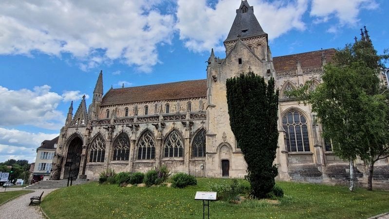
Several features of this early construction are still visible today, of which the south wall of the nave and the tower supporting the belfry.
The north side of the nave was destroyed during the siege by Philip II Augustus and dated from the 13th century. It was typical of the "Early Gothic" style. On the outside, there were impressive "flying” buttresses that were designed to support a stone ribbed vault. The lateral chapels, the south portal and
Photographed by James Hulse, June 2, 2025
2. The south view of the Saint Gervais Church and Marker
Construction of the choir, its chapels and the porch was initiated during the previous century, to be concluded during the first half of the 16th century. This work, undertaken during the town's prosperous period, was made possible exclusively thanks to the generosity of the inhabitants of Falaise.
Destroyed by fire in 1562, then rebuilt during the second half of the 16th century, this edifice was considerably damaged in 1944. After the war, the church benefited from major restoration work. However, the nearby and adjoining buildings had suffered such destruction that they were not rebuilt and the church now stands alone.
Captions
(Photo #1) Detail of the flying buttresses Drawing G. Robert. Archives of the Payo de Falaise media library.
(Photo #2) ©D. Letorey
(Photo #3) Apse of the church at the beginning of the 20th century. Archives of the Pays de Falaise media library.
(Photo #4) Plan of the Saint Gervais Falaise church, S. Roulley, 2009.
(Photo #5) ©D. Letorey
Erected by Ville de Falaise. (Marker Number 11.)
Topics. This historical marker is listed in this
Photographed by James Hulse, June 2, 2025
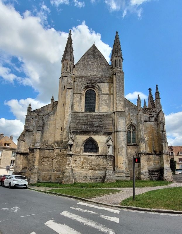
3. The view of the front facade of Saint Gervais Church
Location. 48° 53.865′ N, 0° 11.921′ W. Marker is in Falaise, Normandie (Normandy), in Calvados. It is at the intersection of Rue de Caen (Route D658) and Rue de Brebisson, on the left when traveling east on Rue de Caen. The marker is located on the south side of the cathedral near the grassy area. Touch for map. Marker is at or near this postal address: 10 Rue de Brebisson, Falaise, Normandie 14700, France. Touch for directions.

Regionally, it is in the North Atlantic Region, Europe, the European Union, Atlantic Europe, the Schengen Area, Western Europe, a coastal Mediterranean country, and the Western World. Historically, it finds itself in what was once a French colony and also the Roman Empire.
Other nearby markers. At least 8 other markers are within walking distance of this marker: Place et Église Saint-Gervais / Square and Church "Saint-Gervais (a few steps from this marker); a different marker also named Place et Église Saint-Gervais / Square and Church "Saint-Gervais (a few steps from this marker); a different marker also named
Photographed by James Hulse, June 2, 2025
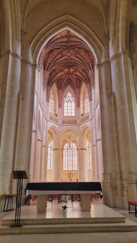
4. The alter of Saint Gervais Church
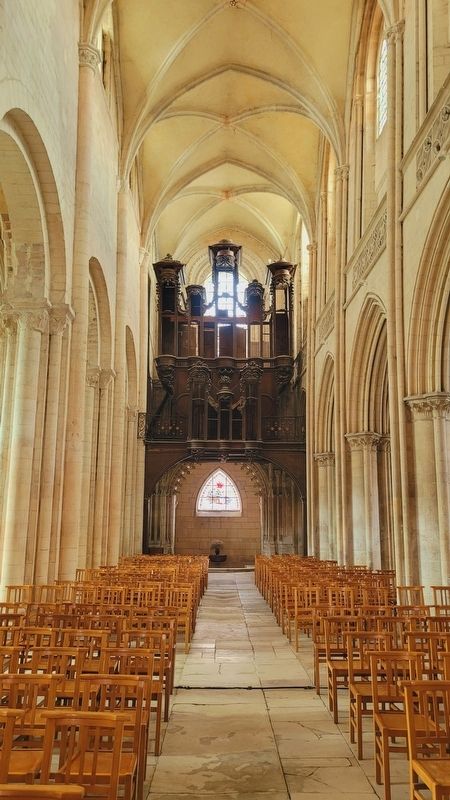
Photographed by James Hulse, June 2, 2025
5. The view of the nave and organ of Saint Gervais Church
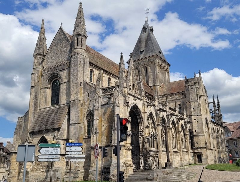
Photographed by James Hulse, June 2, 2025
6. The view of the Saint Gervais Church from across the street
Credits. This page was last revised on June 27, 2025. It was originally submitted on June 26, 2025, by James Hulse of Medina, Texas. This page has been viewed 85 times since then and 12 times this year. Photos: 1, 2, 3, 4, 5, 6. submitted on June 27, 2025, by James Hulse of Medina, Texas.
