Near Bedford in Bedford County, Virginia — The American South (Mid-Atlantic)
Aircraft 129828
(B-25 Bomber Crash)
Photographed by Craig Swain, June 21, 2025
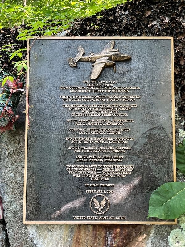
1. Aircraft 129828 Marker
Aircraft 129828
From Columbia Army Air Base, South Carolina,
Crashed into Sharp Top Mountain.
The B-25D Mitchell bomber was on a low-level
Nighttime navigational training mission
This memorial is erected on the crash site
In memory of the five brave airmen
Who lost their lives
In the service of their country.
2nd Lit. George R. Beninga - Bombardier
Age 23, Marietta, Minnesota
Corporal Peter J. Biscan - Engineer
Age 29, Chicago, Illinois
2nd Lt. Hilary S. Blackwell - Navigator
Age 22, Santa Monica, California
2nd Lt. William C. McClure - Co-pilot
Age 22, Indianapolis, Indiana
2nd Lt. Paul M. Pitts - Pilot
Age 21, Poteau, Oklahoma
"In solemn salute to those thousands
of our comrades - great, brave men
that they were - for whom there
will be no homecoming, ever."
Ernie Pyle
In final tribute
February 2, 2001
United States Army Air Corps
Erected 2001.
Topics. This memorial is listed in this topic list: War, World II. A significant historical date for this entry is February 2, 1943.
Location. 37° 25.663′ N, 79° 36.393′ W. Memorial is near Bedford, Virginia, in Bedford County. It can be reached from
this page online

Regionally, this memorial is in Southwest Virginia. It is also in the American South and specifically in the Upper South. Globally, it is in North America, the Western Hemisphere, the Western World, and the Anglosphere. Historically, it finds itself in what was once the territory of the Mississippian Culture, one of the original Thirteen Colonies, one of the Confederate States of America, and the Antebellum South.
Other nearby markers. At least 8 other markers are within 2 miles of this marker, measured as the crow flies: Sharp Top Mountain (approx. 0.4 miles away); a different marker also named Sharp Top Mountain (approx. 1.1 miles away); The Big Spring (approx. 1.1 miles away); Peaks of Otter (approx. 1.2 miles away); Polly Woods' Ordinary (approx. 1.2 miles away); A Community at "the Mons" (approx. 1.2 miles
Photographed by Craig Swain, June 21, 2025
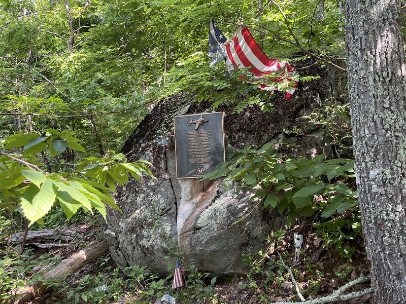
2. Aircraft 129828 Marker
More about this memorial. Caution! The marker may only be reached from a very rough side trail. To reach the marker, use either the Sharp Top Mountain trail (1.5 miles, 1300 foot assent) or the shuttle bus to reach the top of Sharp Top Mountain. From there, take the side trail to Buzzard's Roost. Just past the junction with the main trail, a very poorly marked path runs about 1000 feet down the side of the mountain to the site of the marker. The trail down to the crash and marker site is very rough and steep!
Also see . . .
1. Sharp Top Mountain Trail. While not providing details of the crash site, this link details the trail up Sharp Top Mountain. (Submitted on June 27, 2025, by Craig Swain of Leesburg, Virginia.)
2. Peaks of Otter Bomber Crash. Tribute page providing more details of the training mission and crash. (Submitted on June 27, 2025, by Craig Swain of Leesburg, Virginia.)
3. Hiking to Sharp Top Mountain's Bomber Crash Site. Page detailing the hike
Photographed by Craig Swain, June 21, 2025
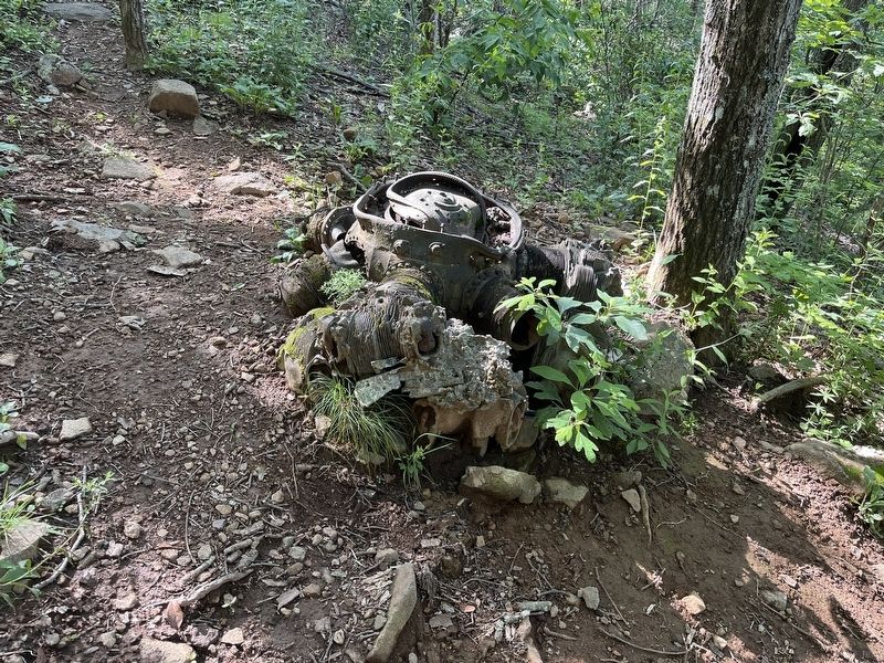
3. Remains of Engine
The cylinders of the radial engine and the crank housing are still easily identified.
Photographed by Craig Swain, June 21, 2025
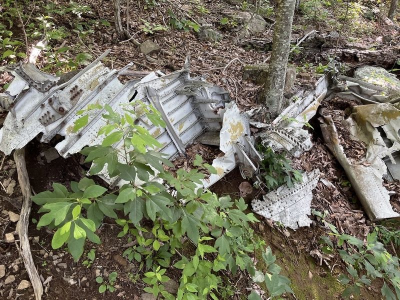
4. Wreckage from the Crash
Debris such as this piece may be found all across the side of the mountain.
Photographed by Craig Swain, June 21, 2025
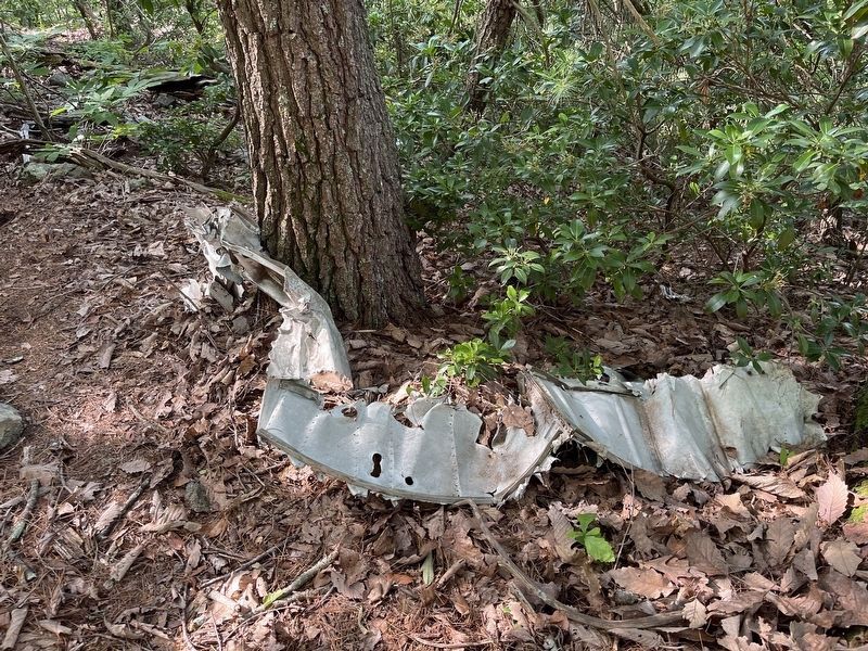
5. Aircraft Wreckage
Another example of twisted aluminum left on the side of Sharp Top, providing evidence of the crash.
Credits. This page was last revised on June 28, 2025. It was originally submitted on June 27, 2025, by Craig Swain of Leesburg, Virginia. This page has been viewed 220 times since then and 87 times this year. Photos: 1, 2, 3, 4. submitted on June 27, 2025, by Craig Swain of Leesburg, Virginia. 5. submitted on June 28, 2025, by Craig Swain of Leesburg, Virginia.
