
Kirk Hammerton in North Yorkshire, England, United Kingdom — Northwestern Europe (the British Isles)
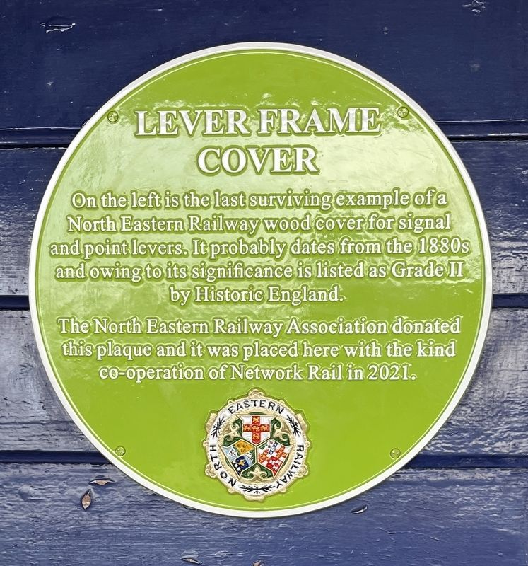
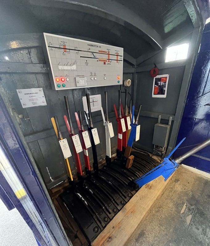
Lever Frame Cover
Photographed by Ray Gurganus, April 18, 2025
1. Lever Frame Cover Marker
The North Eastern Railway Association donated this plaque and it was placed here with the kind co-operation of Network Rail in 2021.
Erected by North Eastern Railway Association.
Topics. This historical marker is listed in this topic list: Railroads & Streetcars.
Location. 53° 59.786′ N, 1° 17.052′ W. Marker is in Kirk Hammerton, England, in North Yorkshire. It can be reached from Station Road. On the platform at the Hammerton train station. Touch for map. Marker is at or near this postal address: 6 Station Road, Kirk Hammerton, England YO26 8DN, United Kingdom. Touch for directions.

Regionally, this marker is in England’s Yorkshire & The Humber. Globally, it is on the Atlantic Ocean, in the North Atlantic Region, in Europe, in Atlantic Europe, on one of the British Isles, in the Western World, and in the Anglosphere. Historically,
this page online
Other nearby markers. At least 8 other markers are within 13 kilometers of this marker, measured as the crow flies: Kirk Hammerton War Memorial (approx. 0.6 kilometers away); Poppleton Tithe Barn and the surrounding area (approx. 9.4 kilometers away); Knaresborough Market (approx. 12 kilometers away); Knaresborough Castle (approx. 12.1 kilometers away); The King's Tower (approx. 12.1 kilometers away); Sallyport (approx. 12.1 kilometers away); a different marker also named Knaresborough Castle (approx. 12.1 kilometers away); The Courthouse Museum (approx. 12.2 kilometers away).
Photographed by Ray Gurganus, April 18, 2025
2. Lever Frame Cover
Credits. This page was last revised on June 28, 2025. It was originally submitted on June 28, 2025, by Ray Gurganus of Washington, District of Columbia. This page has been viewed 64 times since then and 11 times this year. Photos: 1, 2. submitted on June 28, 2025, by Ray Gurganus of Washington, District of Columbia. • Andrew Ruppenstein was the editor who published this page.
