Gardiner in Jefferson County, Washington — The American West (Northwest)
Captain George Vancouver R.N.
Photographed by LaVonne Whitaker
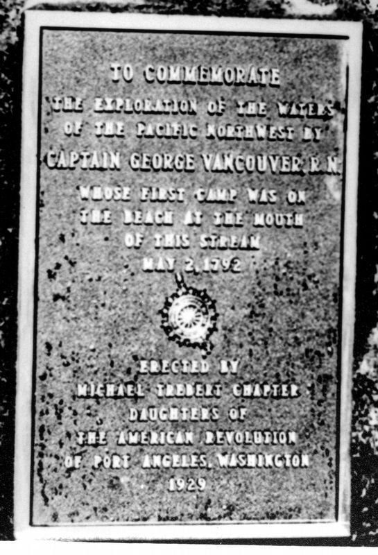
1. Captain George Vancouver R.N. Marker
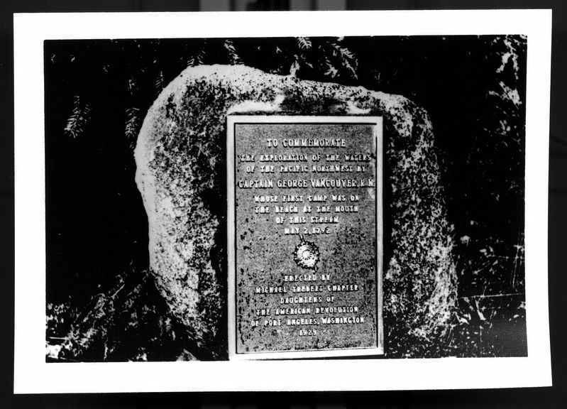
To commemorate the exploration of the waters of the Pacific Northwest by Captain George Vancouver, R.N., whose first camp was on the beach at the mouth of this stream May 2, 1792.
Erected 1929 by Michael Trebert Chapter Daughters of the American Revolution of Port Angeles, Washington.
Topics. This historical marker is listed in this topic list: Exploration. A significant historical date for this entry is May 2, 1792.
Location. This marker has been replaced by another marker nearby. It was located near 48° 2.46′ N, 122° 52.765′ W. Marker was in Gardiner, Washington, in Jefferson County. It was on Olympic Highway (U.S. 101 at milepost 278) north of Old Gardiner Road, on the right when traveling north. Location is at Contractor's Gulch, between Gardiner and Discovery Bay. It is north of Discovery Bay, on Highway 101. Touch for map. Marker was in this post office area: Sequim WA 98382, United States of America. Touch for directions.

Regionally, this marker was in the Olympic Peninsula. It was also on the American Pacific Coast, in the Pacific Northwest, and in the Lewis & Clark Corridor. Globally, it was in North America, on the Pacific Rim, in the Western Hemisphere, in the Western World, and in the Anglosphere.
Other nearby markers. At least 8 other markers are within 8 miles of this location, measured as the crow flies: Captain George Vancouver's Exploration of the Waters (here, next to this marker); Discovery Bay (approx. 1.1 miles away); Honoring Marvin Glenn Shields CMA3, USN (approx. 6.3 miles away); Civil War Memorial (approx. 6.8 miles away); Chief Chetzemoka (approx. 7.1 miles away); Chetzemoka (approx. 7.1 miles away); Sentinel Rock (approx. 7.1 miles away); qatáy Prairie (approx. 7.1 miles away).
Another marker is no longer nearby. Marvin Glenn Shields (was approx. 6.3 miles away
this page online
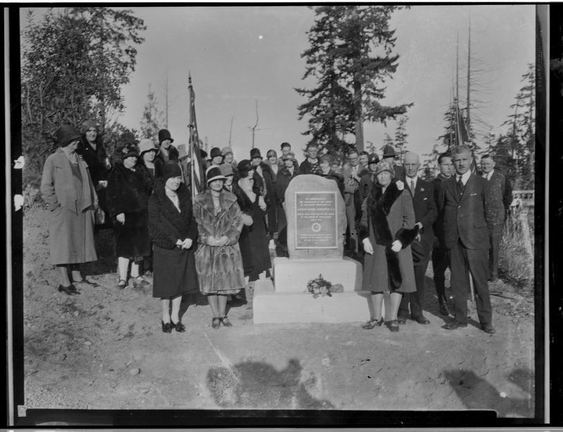
More about this marker. This marker was dedicated on November 2, 1929, but the plaque was stolen in 1942. It was replaced and moved to a new location in the same area on March 11, 1961. It was stolen again in October of 1971 and replaced with a large wooden marker.
Also see . . . George Vancouver. Wikipedia
Captain George Vancouver (22 June 1757 – 10 May 1798) was a Royal Navy officer and explorer best known for leading the Vancouver Expedition, which explored and charted North America's northwestern Pacific Coast regions, including the coasts of what became the Canadian province of British Columbia and the U.S. states of Alaska, Washington, Oregon and California. The expedition also explored the Hawaiian Islands and the southwest coast of Australia.(Submitted on July 11, 2025, by James Hulse of Medina, Texas.)
Photographed by LaVonne Whitaker
2. Captain George Vancouver R.N. Marker
Photographed by Shirley A Stirling
3. Captain George Vancouver R.N. Marker
Credits. This page was last revised on October 6, 2026. It was originally submitted on June 28, 2025, by Shirley A Stirling of Lacey, Washington. This page has been viewed 106 times since then and 46 times this year. Last updated on October 5, 2026, by Shirley A Stirling of Lacey, Washington. Photos: 1, 2, 3. submitted on June 28, 2025, by Shirley A Stirling of Lacey, Washington. • Devry Becker Jones was the editor who published this page.
