Marker Logo
THE HISTORICAL
MARKER DATABASE
“Bite-Size Bits of Local, National, and Global History”
Clarkston in Cache County, Utah — The American Mountains (Southwest)
 

Clarkston Tithing Granary
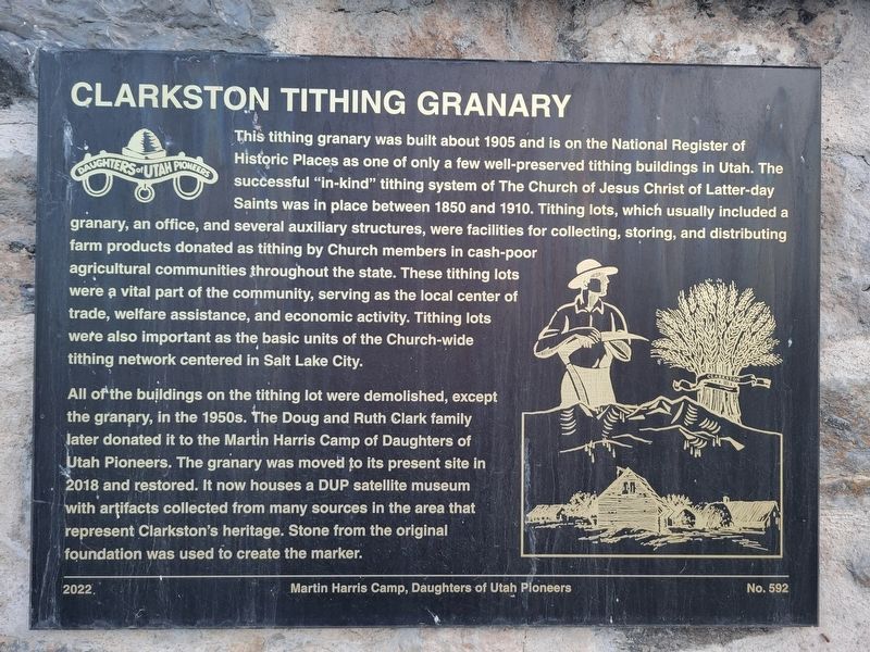
 
 
Clarkston Tithing Granary Marker image. Click for full size.
Photographed by Jeremy Snow, June 21, 2025
1. Clarkston Tithing Granary Marker
Inscription. This tithing granary was built about 1905 and is on the National Register of Historic Places as one of only a few well-preserved tithing buildings in Utah. The successful "in-kind" tithing system of The Church of Jesus Christ of Latter-day Saints was in place between 1850 and 1910. Tithing lots, which usually included a granary, an office, and several auxiliary structures, were facilities for collecting, storing, and distributing farm products donated as tithing by Church members in cash-poor agricultural communities throughout the state. These tithing lots were a vital part of the community, serving as the local center of trade, welfare assistance, and economic activity. Tithing lots were also important as the basic units of the Church-wide tithing network centered in Salt Lake City.

All of the buildings on the tithing lot were demolished, except the granary, in the 1950s. The Doug and Ruth Clark family later donated it to the Martin Harris Camp of Daughters of Utah Pioneers. The granary was moved to its present site in 2018 and restored. It now houses a DUP satellite museum with artifacts collected from many sources
Paid Advertisement
Click or scan to see
this page online
in the area that represent Clarkston's heritage. Stone from the original foundation was used to create the marker.
 
Erected 2022 by Daughters of Utah Pioneers. (Marker Number 592.)
 
Topics and series. This historical marker is listed in this topic list: Religion & Religious Structures. In addition, it is included in the Daughters of Utah Pioneers series list. A significant historical year for this entry is 1905.
 
Location. 41° 55.204′ N, 112° 3.185′ W. Marker is in Clarkston, Utah, in Cache County. It is at the intersection of West Center Street and 100 W, on the right when traveling east on West Center Street. Touch for map. Marker is at or near this postal address: 80 W Center Street, Clarkston UT 84305, United States of America. Touch for directions.

Regionally, this marker is in Utah’s Cache Valley. It is also in the American Mountain West and in Colorado Plateau. Globally, it is in North America, the Rocky Mountains, the Western Hemisphere, the Western World, and the Anglosphere. Historically, it finds itself in what was once New Spain and also Mexico’s Alta California.

Other nearby markers. At least 8 other
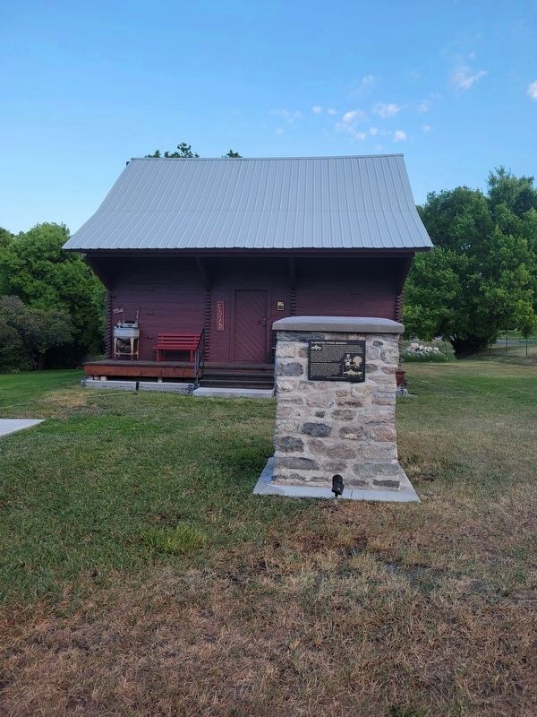
Clarkston Tithing Granary Marker and Building image. Click for full size.
Photographed by Jeremy Snow, June 21, 2025
2. Clarkston Tithing Granary Marker and Building
markers are within 7 miles of this marker, measured as the crow flies: A different marker also named Clarkston Tithing Granary (a few steps from this marker); Clarkston War Veterans Memorial (about 800 feet away, measured in a direct line); Martin Harris Grave (approx. one mile away); Martin Harris Gravesite (approx. one mile away); Martin Harris (approx. one mile away); a different marker also named Martin Harris (approx. one mile away); Newton Reservoir (approx. 5.1 miles away); Wood Stave Water Pipe (approx. 6.9 miles away). Touch for a list and map of all markers in Clarkston.
 
 
Credits. This page was last revised on July 1, 2025. It was originally submitted on June 29, 2025, by Jeremy Snow of Cedar City, Utah. This page has been viewed 101 times since then and 8 times this year. Photos:   1, 2. submitted on June 29, 2025, by Jeremy Snow of Cedar City, Utah. • Andrew Ruppenstein was the editor who published this page.

m=276939

CeraNet Cloud Computing sponsors the Historical Marker Database.
This website earns income from purchases you make after using our links to Amazon.com. We appreciate your support.
Paid Advertisement
Jul. 25, 2026