
Thorold in Niagara Region, Ontario — Central Canada (North America)
The Williams-Daboll House 1876
⎯⎯⎯
The Williams-Daboll Oak, ca. 1820

Photographed by Kevin Westell, June 29, 2025
1. The Williams-Daboll House 1876 / The Williams-Daboll Oak, ca. 1820 Marker
The Williams-Daboll House 1876
Built for John Collier Williams by George and Joseph McFarland, this house represents the hybrid Gothic Revival/Italianate style popularized throughout much of small-town southern Ontario in the second half of the 19th century. The property is linked to Niagara's earliest European settler families such as the Keefers and the McFarlands, as well as the Furney family, owners of the community's last print newspaper.
The Williams-Daboll Oak, ca. 1820
The white oak tree (Quercus alba) to the south of the house links the property to pre-European Indigenous land-use activities. A rare survivor of first-growth Carolinian vegetation in downtown Thorold, it stands as witness to the entire history of the Welland Canal and perhaps that of the Village of Thorold itself. It is estimated to be at least 200 years old
Erected 2024 by Heritage Thorold.
Topics and series. This historical marker is listed in these topic lists: Architecture • Horticulture & Forestry • Settlements & Settlers. In addition, it is included in the Historic Trees series list. A significant historical year for this entry is 1820.
Location. 43° 7.933′ N,
this page online

Regionally, this marker is on Ontario’s Golden Horseshoe and in Niagara Canada. It is also in Central Canada. Globally, it is in North America, on the Great Lakes, in the Western Hemisphere, in the Western World, and in the Anglosphere. Historically, it finds itself in what was once a British colony, the Viceroyalty of New France, the Haudenosaunee (Iroquois) Confederacy, and Rupert’s Land.
Other nearby markers. At least 8 other markers are within walking distance of this marker: Welland Ship Canal (approx. 0.3 kilometers away); Maplehurst 1886 (approx. half a kilometer away); a different marker also named Maplehurst 1886 (approx. half a kilometer away); The Dobbie House c. 1873 (approx. half a kilometer away); Dobbie House 1875 (approx. 0.6 kilometers away); James Beatty House c. 1870 (approx. 0.6 kilometers away); Tribute To Holy Rosary School 1928 - 2001
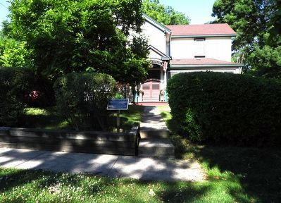
Photographed by Kevin Westell, June 29, 2025
2. The Williams-Daboll House 1876 / The Williams-Daboll Oak, ca. 1820 - Marker in context
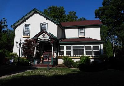
Photographed by Kevin Westell, June 29, 2025
3. The Williams-Daboll House
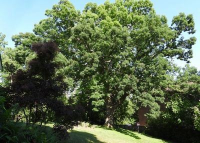
Photographed by Kevin Westell, June 29, 2025
4. The Williams-Daboll Oak
The tree is in the "back yard", south of the house, and easily visible from the street.
Credits. This page was last revised on July 1, 2025. It was originally submitted on June 29, 2025, by Kevin Westell of St. Catharines, Ontario. This page has been viewed 83 times since then and 14 times this year. Photos: 1, 2, 3, 4. submitted on June 29, 2025, by Kevin Westell of St. Catharines, Ontario. • Andrew Ruppenstein was the editor who published this page.
