Beavercreek Township in Riverside in Montgomery County, Ohio — The American Midwest (Great Lakes)
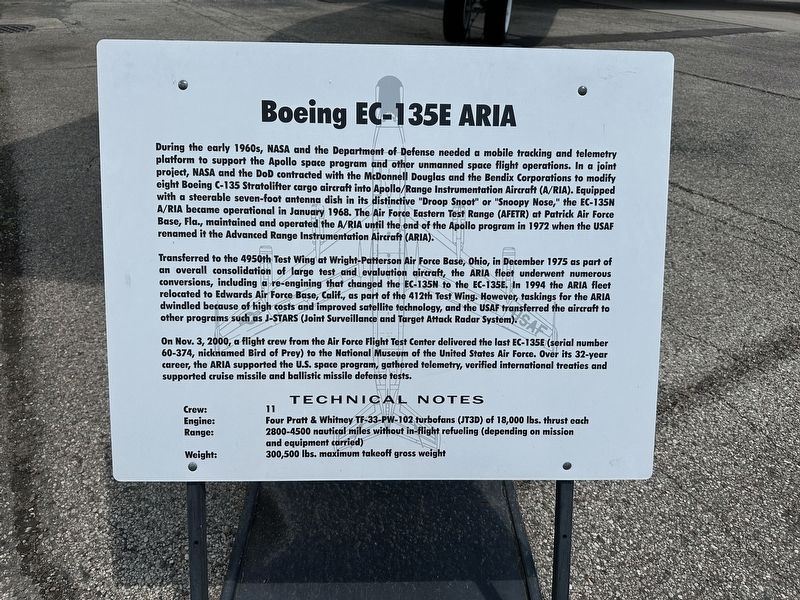
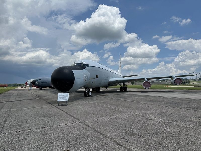
Boeing EC-135E ARIA
Photographed by Pete Skillman, June 28, 2025
1. Boeing EC-135E ARIA Marker
Transferred to the 4950th Test Wing at Wright-Patterson Air Force Base, Ohio, in December 1975 as part of an overall consolidation of large test and evaluation aircraft, the ARIA fleet underwent numerous conversions, including a re-engining that changed the EC-135N to the EC-135E. In 1994 the ARIA fleet relocated to Edwards Air Force Base, Calif., as
this page online
On Nov. 3, 2000, a flight crew from the Air Force Flight Test Center delivered the last EC-135E (serial number 60-374, nicknamed Bird of Prey) to the National Museum of the United States Air Force. Over its 32-year career, the ARIA supported the U.S. space program, gathered telemetry, verified international treaties and supported cruise missile and ballistic missile defense tests.
TECHNICAL NOTES
Crew: 11
Engine: Four Pratt & Whitney TF-33-PW-102 turbofans (JT3D) of 18,000 lbs. thrust each
Range: 2800-4500 nautical miles without in-flight refueling (depending on mission and equipment carried)
Weight: 300,500 lbs. maximum takeoff gross weight
Topics. This historical marker is listed in this topic list: Air & Space.
Location. 39° 47.048′ N, 84° 6.513′ W. Marker is in Riverside, Ohio, in Montgomery County. It is in Beavercreek
Photographed by Pete Skillman, June 28, 2025
2. Boeing EC-135E ARIA Marker - wide view with aircraft

Regionally, this marker is in the Dayton Metro and in the Miami Valley. It is also in the American Midwest and in the Corn Belt. Globally, it is in North America, the Western Hemisphere, the Western World, and the Anglosphere. Historically, it finds itself in what was once the Haudenosaunee (Iroquois) Confederacy, the territory of the Mississippian Culture, and the Northwest Territory.
Other nearby markers. At least 8 other markers are within walking distance of this marker: Lockheed AC-130A (within shouting distance of this marker); Conair NC-131H Total In-Flight Simulatot (TIFS) (within shouting distance of this marker); The Belly Tank (within shouting distance of this marker); American Air Forces in England, WWII (within shouting distance of this marker); 8th Air Force Control Tower (within shouting distance of this marker); Boeing KC-135R Stratotanker (within shouting distance of this marker); White Square (within shouting distance of this marker); McDonnell Douglas KC-10A Extender (about 500 feet away, measured in a direct line). Touch for a list and map of all markers in Riverside.
Credits. This page was last revised on June 30, 2025. It was originally submitted on June 30, 2025, by Pete Skillman of Wilmington, Delaware. This page has been viewed 127 times since then and 22 times this year. Photos: 1, 2. submitted on June 30, 2025, by Pete Skillman of Wilmington, Delaware.
