Wellsville in Cache County, Utah — The American Mountains (Southwest)
Wellsville Pioneers
Photographed by Jeremy Snow, June 22, 2025
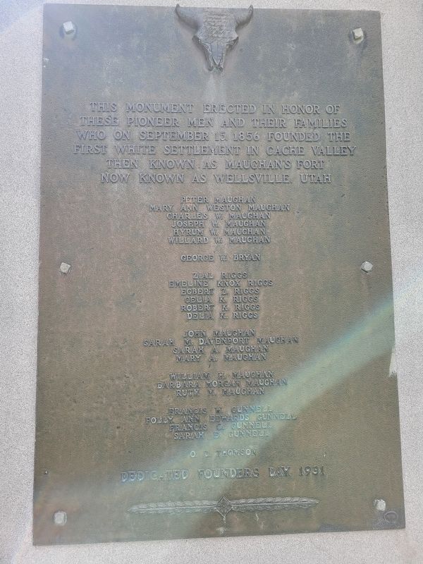
1. Wellsville Pioneers Marker
Peter Maughan · Mary Ann Weston Maughan · Charles W. Maughan · Joseph W. Maughan · Hyrum W. Maughan · Willard W. Maughan
George W. Bryan
Zial Riggs · Eveline Knox Riggs · Egbert Z. Riggs · Celia k Riggs · Robert K. Riggs · Delia K. Riggs
John Maughan · Sarah M. Davenport Maughan · Sarah A. Maughan · Mary A. Maughan · William H. Maughan · Barbara Morgan Maughan · Ruth Maughan
Francis W. Gunnell · Polly Ann Edwards Gunnell · Francis C. Gunnell · Sarah E. Gunnell
O.D. Thomson
Dedicated Founders Day 1931
Erected 1931.
Topics. This historical marker is listed in this topic list: Settlements & Settlers. A significant historical date for this entry is September 15, 1856.
Location. 41° 38.312′ N, 111° 56.045′ W. Marker is in Wellsville, Utah, in Cache County. It is at the intersection of South Center Street and East Main Street, on the right when traveling north on South Center
this page online

Regionally, this marker is in the Cache Valley. It is also in the American Mountain West and on the Colorado Plateau. Globally, it is in North America, the Rocky Mountains, the Western Hemisphere, the Western World, and the Anglosphere. Historically, it finds itself in what was once New Spain and also Mexico’s Alta California.
Other nearby markers. At least 8 other markers are within 5 miles of this marker, measured as the crow flies: Mountain Man (about 600 feet away, measured in a direct line); Wellsville Tabernacle (about 600 feet away); Wellsville Schools (approx. 0.2 miles away); Soren Hansen Castle (approx. 3.9 miles away); Elite Hall (approx. 4 miles away); Hyrum Smith (approx. 4 miles away); The Great Fur Cache (approx. 4.1 miles away); Old Hyrum First Ward Meetinghouse (approx. 4.1 miles away). Touch for a list and map of all markers in Wellsville.
Photographed by Jeremy Snow, June 22, 2025
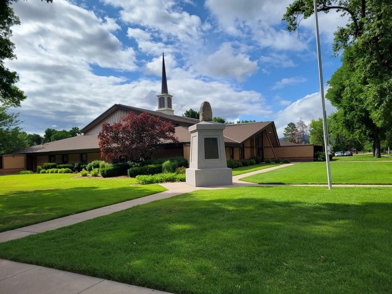
2. Wellsville Pioneers Marker
Credits. This page was last revised on July 11, 2025. It was originally submitted on July 1, 2025, by Jeremy Snow of Cedar City, Utah. This page has been viewed 126 times since then and 38 times this year. Photos: 1, 2. submitted on July 1, 2025, by Jeremy Snow of Cedar City, Utah. • Andrew Ruppenstein was the editor who published this page.
