Frankenlust Township in Bay City in Bay County, Michigan — The American Midwest (Great Lakes)
Howard F. and Helen S. Smith House
c. 1912
| — | Center Avenue Neighborhood Association | — |
Photographed by Mark Parker, June 23, 2025
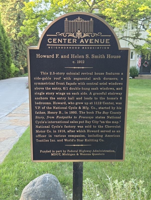
1. Howard F. and Helen S. Smith House Marker
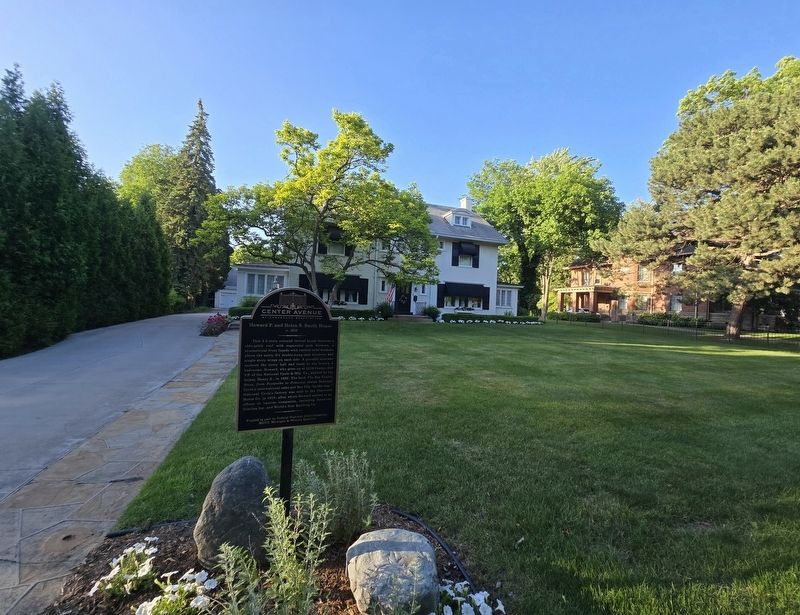
This 2.5-story colonial revival house features a side-gable roof with segmental arch dormers; a symmetrical front façade with central oriel windows above the entry, 6/1 double-hung sash windows, and single story wings on each side. A graceful stairway anchors the entry hall and leads to the home's 6 bedrooms. Howard, who grew up at 1112 Center, was V.P. of the National Cycle & Mfg. Co., started by his father, Henry B., in 1892. The book The Bay County Story, from Footpaths to Freeways states National Cycle's international sales put Bay City "on the map." National Cycle's factory was sold to the Chevrolet Motor Co. in 1916, after which Howard served as an officer in various companies, including American Textiles Inc. and World's Star Knitting Co.
Erected by Federal Highway Administration, MDOT and Michigan and Wenona Questers.
Topics. This historical marker is listed in this topic list: Industry & Commerce. A significant historical year for this entry is 1912.
Location. 43° 35.776′ N, 83° 51.8′ W. Marker is in Bay City, Michigan, in Bay County. It is in Frankenlust Township. It is on Center Avenue (Michigan Route
this page online

Regionally, this marker is in Mid-Michigan and in one of the Lake Huron Shore counties. It is also in the American Midwest. Globally, it is in North America, on the Great Lakes, in the Western Hemisphere, in the Western World, and in the Anglosphere. Historically, it finds itself in what was once the Northwest Territory.
Other nearby markers. At least 8 other markers are within walking distance of this marker: Center Avenue (approx. 0.4 miles away); Franck Chicory Company (approx. half a mile away); Henry & Luella Clements House (approx. half a mile away); Fremont & Matilda (McCormick) Chesbrough House (approx. half a mile away); St. Joseph Catholic Church (approx. 0.8 miles away); Charles B. & Georgiana (McGraw) Curtiss House (approx. 0.9 miles away); Trinity Church/Trinity Episcopal Church (approx. 0.9 miles away); First Presbyterian Church (approx. 0.9 miles away). Touch for a list and map of all markers in Bay City.
Photographed by Mark Parker, June 23, 2025
2. Howard F. and Helen S. Smith House and Marker
Credits. This page was last revised on July 5, 2025. It was originally submitted on July 2, 2025, by Mark Parker of Hickory, North Carolina. This page has been viewed 100 times since then and 18 times this year. Photos: 1, 2. submitted on July 2, 2025, by Mark Parker of Hickory, North Carolina. • J. Makali Bruton was the editor who published this page.
