Bénouville in Calvados, Normandy, France — Western Europe
Bénouville - Pegasus Bridge
"Ham and Jam!"
Photographed by James Hulse, June 2, 2025
1. Bénouville - Pegasus Bridge Marker

French:
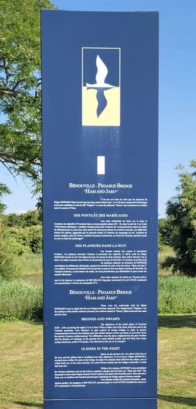
C'est par ces mots de code que les hommes du Major Howard firent savoir que les deux ponts étaient pris. La 6ª division aéroportée britannique avait pour emblème le cheval ailé "Pégase"; ce sont des planeurs "Horsa" qui amenèrent les soldats entre le canal et l'Orne.
Des ponts et des marécages
Aux deux extrémités du front, ici, et dans le Cotentin, les objectifs d'Overlord, dans sa toute première phase (Oh - 3h, dans la nuit du 5 au 6 juin 1944) étaient identiques: contrôler certains ponts afin d'assurer les communications entre les unités du débarquement et, plus loin, faire sauter les autres pour freiner les renforts ennemis. Les difficultés étaient les mêmes, aggravées par le mauvais temps et l'absence de marquage au sol: combien de jeunes Anglais, près de l'Orne, combien de jeunes Américains, au Nord de Carentan, périrent noyés en mer ou dans les marécages?
Des planeurs dans la nuit
Les terrains étaient très courts et encombrés d'arbres: les planeurs devaient s'écraser à proximité des objectifs. À 0h16, celui du Major Howard touche le sol à 50 mètres du pont. En moins de deux minutes, deux autres suivent, l'un se brise. Au même moment, deux Horsa se posent près du pont de Ranville. Un sixième avait été perdu.
En quelques minutes, les hommes de Howard neutralisent les défenseurs allemands, coupent les circuits de mise à feu des mines. "Ham and Jam!" Les milliers d'hommes du Général Gale peuvent se poser à leur tour dans le secteur de Ranville. Ils viennent renforcer, à trois heures du matin, les cent parachutistes qui défendaient le pont contre les assauts allemands.
Avec deux minutes de retard sur l'horaire prévu, sous le feu intense, la cornemuse de Bill Millin, bag-piper personnel de Lord Lovat, annonçait aux parachutistes l'arrivée du commando N°4.
These were
this page online
Bridges and Swamps
The objectives of the initial phase of Overlord (0.00-3.00 a.m.during the night of 5 to 6 June 1944) at either end of the front, both here and in the Cotentin peninsula, were identical: to gain control of certain bridges in order to protect communications between the landing units and, further inland, to blow up others so as to slow down the arrival of enemy reinforcements. The difficulties were the same, heightened by the poor weather and the absence of markings on the ground; how many British youths, near the Orne, how many young Americans, north of Carentan, were drowned in the sea or in swamps?
Gliders in the Night
Space on the ground was very short with trees in the way and the gliders had to crashland near their objectives. At 0.16 hours, Major Howard's touched down within 50 yards of the bridge. In under two minutes there followed two others, one of which broke up.
Photographed by James Hulse, June 2, 2025
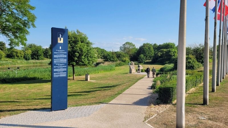
2. The view of the Bénouville - Pegasus Bridge Marker along the pathway
Within a few minutes, Howard's men neutralized the German defenders and cut the leads to explosive charges that had been set. "Ham and Jam!" The thousands of men under Major-General Gale could in turn land in the Ranville sector. They arrived at three a.m. to reinforce the hundred paratroopers defending the bridge against German assaults.
Two minutes behind the planned timetable, under intense gunfire, the bagpipes of Bill Millin, personal piper to Lord Lovat, heralded the arrival of N°4 commando to the paratroops.
Topics. This historical marker is listed in this topic list: War, World II. A significant historical date for this entry is June 6, 1944.
Location. 49° 14.517′ N, 0° 16.416′ W. Marker is in Bénouville, Normandie (Normandy), in Calvados. It is on Avenue du Commandant Kieffer just west of Av. Major John Howard, on the left when traveling west. The marker is located southeast of the Pegasus Bridge. Touch for map. Marker is at or near this postal address: 22 Av du Commandant Kieffer, Bénouville, Normandie 14970, France. Touch for directions.

Regionally,
Photographed by James Hulse, June 2, 2025
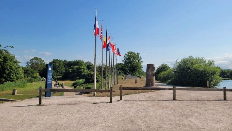
3. The view of the Bénouville - Pegasus Bridge Marker from the Pegasus Bridge
Other nearby markers. At least 8 other markers are within walking distance of this marker: Les rives de l’Orne / The Banks of the Orne (a few steps from this marker); Le Pegasus Bridge - Du prélude à la Libération / The Pegasus Bridge - From Prelude to Liberation (a few steps from this marker); «L’arbre de la liberté» / «The Liberty Tree» (within shouting distance of this marker); Major R. J. Howard (within shouting distance of this marker); Major John Howard (within shouting distance of this marker); Pegasus Bridge Site (within shouting distance of this marker); L/Cpl Fred Greenhalgh (within shouting distance of this marker); Lieutenant R.A. Smith (within shouting distance of this marker). Touch for a list and map of all markers in Bénouville.
Also see . . . Capture of the Caen canal and Orne river bridges. Wikipedia
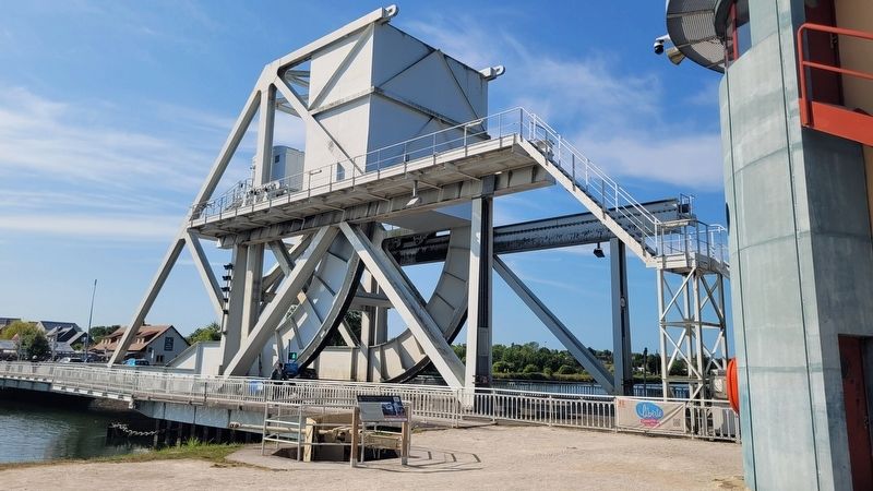
The capture of the Caen canal and(Submitted on July 3, 2025, by James Hulse of Medina, Texas.)Orne river bridges (wrongly known as Operation Deadstick [which in fact was a specialized glider exercise], and in official documents as Operation Coup de Main) was an operation by airborne forces of the British Army that took place in the early hours of 6 June 1944 as part of the Normandy landings of the Second World War. The objective was to capture intact two road bridges in Normandy across the River Orne and the Caen canal, providing the only exit eastwards for British forces from their landing on Sword Beach. Intelligence reports said both bridges were heavily defended by the Germans and wired for demolition. Once captured, the bridges had to be held against any counter-attack, until the assault force was relieved by commandos and other infantry advancing from the landing beach.Photographed by James Hulse, June 2, 20254. The new Pegasus Bridge
Credits. This page was last revised on November 6, 2025. It was originally submitted on July 3, 2025, by James Hulse of Medina, Texas. This page has been viewed 102 times since then and 27 times this year. Photos: 1, 2, 3, 4. submitted on July 3, 2025, by James Hulse of Medina, Texas.
