
Deer Valley in Park City in Summit County, Utah — The American Mountains (Southwest)
Anderson Apartments

Photographed by Jeremy Snow, June 20, 2025
1. Anderson Apartments Marker
The frame construction with rectangular gable roof and modified false front is a typical example of the vernacular commercial buildings of turn-of-the-century Park City. The facade originally included a canopy and second floor balcony, as well as a different window configuration.
The building was originally occupied by E.D. Sutton & Co., which established a grocery and meat business in Park City in 1890. Because the second floor was used as a meeting place for the Masons and other social organizations, the building was called Social Hall. The ground floor has been used by various commercial concerns in recent years, and also housed the Park City offices for Summit County services. The upper floors have long been used as rental apartments.
Erected 1984 by Park City Centennial Commission.
Topics. This historical marker is listed in these topic lists: Architecture
this page online
Location. 40° 38.644′ N, 111° 29.772′ W. Marker is in Park City, Utah, in Summit County. It is in Deer Valley. It is at the intersection of Main Street and 5th Street, on the right when traveling south on Main Street. Touch for map. Marker is at or near this postal address: 467 Main Street, Park City UT 84060, United States of America. Touch for directions.

Regionally, this marker is in Utah’s Uinta Mountains, in the Wasatch Front, and in Greater Provo. It is also in the American Mountain West and on the Colorado Plateau. Globally, it is in North America, the Rocky Mountains, the Western Hemisphere, the Western World, and the Anglosphere. Historically, it finds itself in what was once New Spain and also Mexico’s Alta California.
Other nearby markers. At least 8 other markers are within walking distance of this marker: The Club (a few steps from this marker); The Alamo (a few steps from this marker); Fifth Street (within shouting distance of this marker); Summit County Sheriff's Office (within shouting distance of this marker); Frank Andrew Building
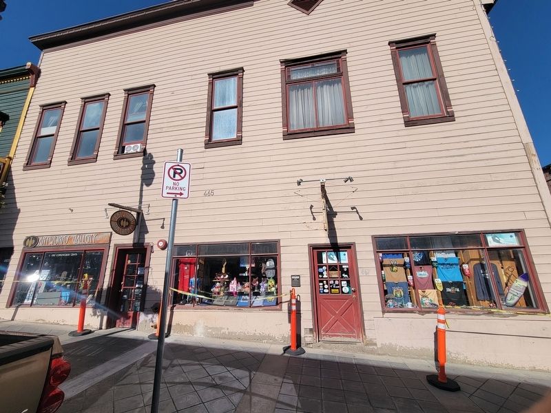
Photographed by Jeremy Snow, June 20, 2025
2. Anderson Apartments Marker
Credits. This page was last revised on July 8, 2025. It was originally submitted on July 3, 2025, by Jeremy Snow of Cedar City, Utah. This page has been viewed 110 times since then and 12 times this year. Photos: 1, 2. submitted on July 3, 2025, by Jeremy Snow of Cedar City, Utah. • Andrew Ruppenstein was the editor who published this page.
