Richmond in Fort Bend County, Texas — The American South (West South Central)
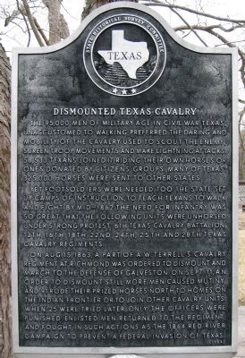
Dismounted Texas Cavalry
Yet footsoldiers were needed, too. The state set up camps of instruction, to teach Texans to walk and fight. By mid-1862 the need for infantry was so great that the following units were unhorsed under strong protest: 6th Texas Cavalry Battalion, 13th, 16th, 18th, 22nd, 24th, 25th and 28th Texas Cavalry regiments.
On Aug. 15, 1863, a part of A. W. Terrell's Cavalry regiment at Richmond was ordered to dismount and march to the defense of Galveston. On Sept. 11, an order to dismount still more men caused mutiny, and 91 rode their prized horses north to homes on the Indian frontier or to join other cavalry units. When 25 were tried later, only the officers were punished. Enlisted men returned to the regiment, and fought in such actions as the 1864 Red River campaign to prevent a Federal invasion of Texas.
Erected 1964 by State Historical Survey Committee. (Marker Number 8989.)
Topics. This historical marker is listed in this topic list: War, US Civil. A significant historical month for this entry is September 1825.
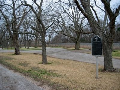
Location. 29° 35.648′ N, 95° 44.566′ W. Marker is in Richmond, Texas, in Fort Bend County. Marker is at the intersection of State Highway 90A and State Highway FM 359, on the right when traveling west on State Highway 90A. Located in park on NW corner of the intersection. Touch for map. Marker is in this post office area: Richmond TX 77406, United States of America. Touch for directions.
Other nearby markers. At least 8 other markers are within 2 miles of this marker, measured as the crow flies. Morton-McCloy House (approx. 1.2 miles away); The Old Fort (approx. 1.3 miles away); Pioneer Artifacts (approx. 1.3 miles away); Cisterns (approx. 1.3 miles away); Lamar's Last Years in Richmond (approx. 1.3 miles away); The Second Mrs. Lamar (approx. 1.3 miles away); The Lamar Slaves (approx. 1.3 miles away); Site of the Home of Mirabeau B. Lamar (approx. 1.3 miles away). Touch for a list and map of all markers in Richmond.
Credits. This page was last revised on June 16, 2016. It was originally submitted on February 20, 2010, by Gregory Walker of La Grange, Texas. This page has been viewed 2,129 times since then and 56 times this year. Photos: 1, 2. submitted on February 20, 2010, by Gregory Walker of La Grange, Texas. • Craig Swain was the editor who published this page.

