
Deer Valley in Park City in Summit County, Utah — The American Mountains (Southwest)
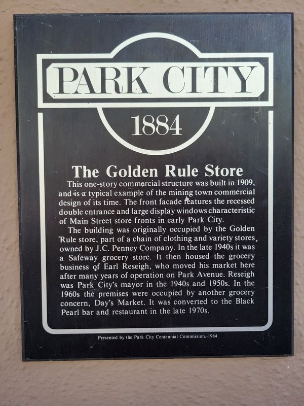
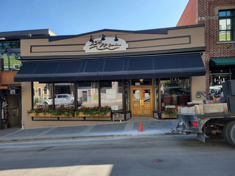
The Golden Rule Store
Photographed by Jeremy Snow, June 20, 2025
1. The Golden Rule Store Marker
The building was originally occupied by the Golden Rule store, part of a chain of clothing and variety stores, owned by J.C. Penney Company. In the late 1940s it was a Safeway grocery store. It then housed the grocery business of Earl Reseigh, who moved his market here after many years of operation on Park Avenue. Reseigh was Park City's mayor in the 1940s and 1950s. In the 1960s the premises were occupied by another grocery concern, Day's Market. It was converted to the Black Pearl bar and restaurant in the late 1970s.
Erected 1984 by Park City Centennial Commission.
Topics. This historical marker is listed in this topic list: Industry & Commerce.
Location. 40° 38.562′ N, 111° 29.71′ W. Marker is in Park City, Utah, in Summit County. It is in Deer Valley. It is on Main Street south of 4th Street,
this page online

Regionally, this marker is in Utah’s Uinta Mountains, in the Wasatch Front, and in Greater Provo. It is also in the American Mountain West and on the Colorado Plateau. Globally, it is in North America, the Rocky Mountains, the Western Hemisphere, the Western World, and the Anglosphere. Historically, it finds itself in what was once New Spain and also Mexico’s Alta California.
Other nearby markers. At least 8 other markers are within walking distance of this marker: The Egyptian Theater (a few steps from this marker); Giacoma Building (within shouting distance of this marker); Hulbert's Drugs (within shouting distance of this marker); Bardsley Building (within shouting distance of this marker); The First National Bank (within shouting distance of this marker); Miner's Plaza (within shouting distance of this marker); Park City Community Church (about 300 feet away, measured in a direct line); a different marker also named Park City Community Church
Photographed by Jeremy Snow, June 20, 2025
2. The Golden Rule Store Marker
Credits. This page was last revised on July 8, 2025. It was originally submitted on July 4, 2025, by Jeremy Snow of Cedar City, Utah. This page has been viewed 143 times since then and 25 times this year. Photos: 1, 2. submitted on July 4, 2025, by Jeremy Snow of Cedar City, Utah. • Andrew Ruppenstein was the editor who published this page.
