
Palmetto in Manatee County, Florida — The American South (South Atlantic)
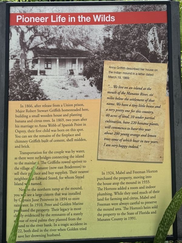
Pioneer Life in the Wilds
| — | Emerson Point Preserve | — |
Photographed by Brandon D Cross, July 3, 2025
1. Pioneer Life in the Wilds Marker
Transportation for the couple was by water, as there were no bridges connecting the island to the mainlar 1. The Griffiths rowed upriver to the village of Manatee (now east Bradenton) to sell their produce and buy supplies. Their nearest neighbor as Edward Sneed, for whom Snead Island was named.
Next to the northern ramp at the mound, you will see a large cistern that was installed by Captain June Poitevent in 1894 to store rainwater. In 1910, Peter and Golden Marine purchased the property. Their legacy is most clearly evidenced by the remnants of a stately avenue of royal palms they planted from the mound to the river bank. In a tragic accident in 22, both died in the river when Golden tried to save her drowning husband.
In 1924, Mabel
this page online
(sidebar)
Anna Griffith described her house on the Indian mound in, a letter dated March 19, 1869:
"... We live on an island at the mouth of the Manatee River, six miles below the settlement of that name. We have a tiny little house and a very pretty one for this country, 40 acres of land, 10 under partial cultivation, have 220 banana plants, will commence to have this year about 200 young orange and lemon trees some of which bear in two years. I am very happy indeed."
Topics. This historical marker is listed in this topic list: Settlements & Settlers. A significant historical year for this entry is 1866.
Location. 27° 31.868′ N, 82° 37.594′ W. Marker is in Palmetto, Florida, in Manatee County. It can be reached from 17th Street West 0.2 miles west of 57th Terrace West, on the left when
Photographed by Brandon D Cross, July 3, 2025
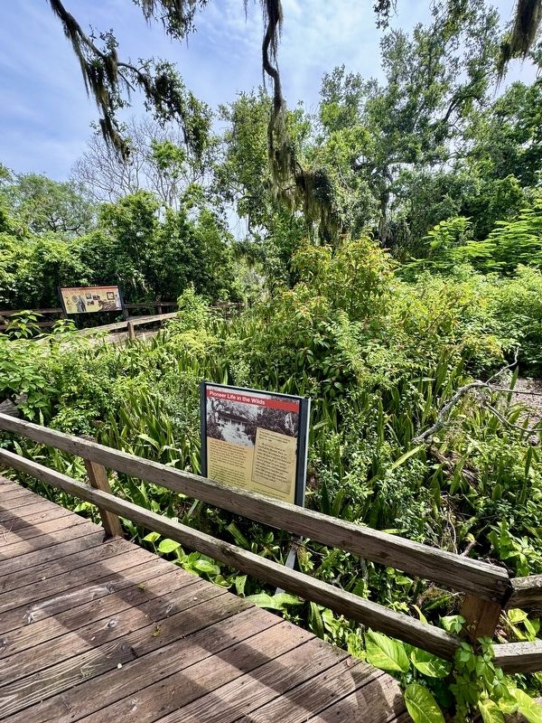
2. Pioneer Life in the Wilds Marker

Regionally, this marker is on Florida’s Gulf Coast and on Tampa Bay. It is also in the American South and on the Gulf Coast. Globally, it is in the North Atlantic Region, North America, a Gulf of Mexico state, the Western Hemisphere, the Western World, and the Anglosphere. Historically, it finds itself in what was once New Spain, the territory of the Mississippian Culture, one of the Confederate States of America, and the Antebellum South.
Other nearby markers. At least 8 other markers are within walking distance of this marker: Glimpse into Prehistory (here, next to this marker); A Look Back in Time (here, next to this marker); Adapting to Island Living (here, next to this marker); Seeds of the Future (a few steps from this marker); Mysteries of the Mounds (within shouting distance of this marker); Temple Mound at Emerson Point (about 300 feet away, measured in a direct line); A Bountiful Harvest (about 300 feet away); Snead Island / Seventh Day Adventist School (approx. 0.7 miles away). Touch for a list and map of all markers in Palmetto.
Also see . . .
1. Portavant Temple Mound at Emerson Point Preserve. (Submitted on July 4, 2025, by Brandon D Cross of Flagler Beach, Florida.)
2. Emerson Point Timeline. (Submitted on July 4, 2025, by Brandon D Cross of Flagler Beach, Florida.)
Credits. This page was last revised on July 5, 2025. It was originally submitted on July 4, 2025, by Brandon D Cross of Flagler Beach, Florida. This page has been viewed 105 times since then and 24 times this year. Photos: 1, 2. submitted on July 4, 2025, by Brandon D Cross of Flagler Beach, Florida. • Bernard Fisher was the editor who published this page.
