Knaresborough in North Yorkshire, England, United Kingdom — Northwestern Europe (the British Isles)
The Mitre
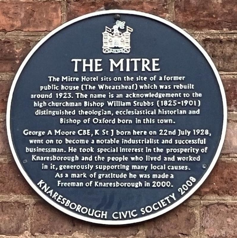
Photographed by Ray Gurganus, April 18, 2025
1. The Mitre Marker
George A. Moore CBE, K St J born here on 22nd July 1928, went on to become a notable industrialist and successful businessman. He took special interest in the prosperity of Knaresborough and the people who lived and worked in it, generously supporting many local causes. As a mark of gratitude he was made a Freeman of Knaresborough in 2000.
Erected 2008 by Knaresborough Civic Society.
Topics. This historical marker is listed in this topic list: Industry & Commerce.
Location. 54° 0.543′ N, 1° 28.248′ W. Marker is in Knaresborough, England, in North Yorkshire. It is on Station Road, on the left when traveling north. Touch for map. Marker is at or near this postal address: 4 Station Road, Knaresborough, England HG5 9AB, United Kingdom. Touch for directions.

Regionally, this marker
this page online
Other nearby markers. At least 8 other markers are within walking distance of this marker: Welcome to Knaresborough Station (within shouting distance of this marker); Blind Jack (within shouting distance of this marker); Nidd Gorge (about 240 meters away, measured in a direct line); Knaresborough Castle (about 240 meters away); The King's Tower (about 240 meters away); The Courthouse (approx. 0.2 kilometers away); Knaresborough Market (approx. 0.2 kilometers away); a different marker also named The King's Tower (approx. 0.3 kilometers away). Touch for a list and map of all markers in Knaresborough.
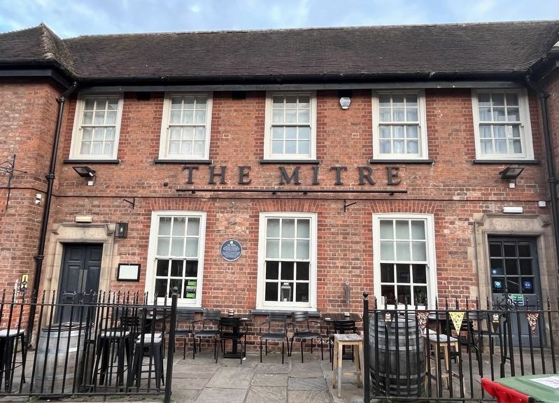
Photographed by Ray Gurganus, April 18, 2025
2. The Mitre Marker
Credits. This page was last revised on July 7, 2025. It was originally submitted on July 5, 2025, by Ray Gurganus of Washington, District of Columbia. This page has been viewed 74 times since then and 13 times this year. Photos: 1, 2. submitted on July 5, 2025, by Ray Gurganus of Washington, District of Columbia. • Andrew Ruppenstein was the editor who published this page.
