
Deer Valley in Park City in Summit County, Utah — The American Mountains (Southwest)
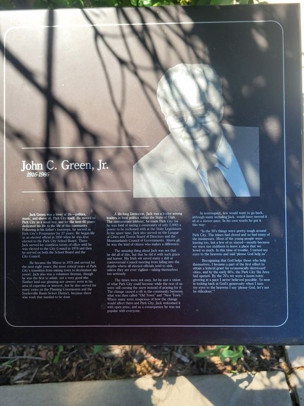
John C. Green, Jr.
1916-1986
Photographed by Jeremy Snow, June 20, 2025
1. John C. Green, Jr. Marker
He became the Mayor in 1978 and served for the next eight years, the most critical years of Park City's transition from mining town to destination ski resort. Jack also was a volunteer fireman, though he was the first to admit, not a very good etc. Neither land use planning nor sewers were in his area of expertise or interest, but he also served for many years on the Planning Commission and the Snyderville Basin Sewer District, because there was work that needed to be done.
A life-long Democrat, Jack was a leader among leaders in local politics within the State of Utah. The consummate
this page online
The amazing thing about Jack was not that be did all of this, but that he did it with such grace and humor. His Irish wit saved many a dull or controversial Council meeting from falling into the depths where all elected officials tend to sink, unless they are ever vigilant-taking themselves too seriously.
The times were not easy, for he saw a vision of what Park City could become while the rest of us were still cursing the snow instead of praying for it. The change caused a rift in the community between what was then called "Old Town" and "New Town." Where many were suspicious of how the change would affect them and Park City, Jack welcomed it with open arms, and as a consequence he was not popular with everyone.
In retrospect, few would want to go back, although many including Jack, would have moved
Photographed by Jeremy Snow, June 20, 2025
2. John C. Green, Jr. Marker
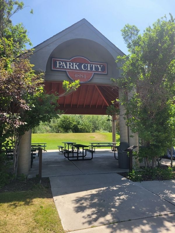
Marker next to the right pillar.
"In the 50's things were pretty tough around Park City. The mines had closed and so had many of the businesses. Most of the young people were leaving too, but a few of us stayed-mostly because we were too stubborn to leave a place that we loved so much. In this time of trouble, I turned my eyes to the heavens and said ‘please God help us’.
Recognizing that God helps those who help themselves, I became a part of the first effort to obtain a federal grant for economically distressed cities, and by the early 60's, the Park City Ski Area had opened. By the 70's we were a boom town growing at a pace I never believed possible. So now in looking back at God's generosity when I turn my eyes to the heavens I say 'please God, let's not be ridiculous'."
Topics. This historical marker is listed in this topic list: Government & Politics. A significant historical year for this entry is 1978.
Location. 40° 39.17′ N, 111° 30.176′ W. Marker is in Park City, Utah, in Summit County. It is in Deer Valley. It is on Sullivan Road, on the right when traveling north. Touch for map. Marker is at or near this postal address: 1312 Sullivan Road, Park City UT 84060, United States of America. Touch for directions.

Regionally, this marker is in Utah’s Uinta Mountains, in the Wasatch Front, and in Greater Provo. It is also in the American Mountain West and on the Colorado Plateau. Globally, it is in North America, the Rocky Mountains, the Western Hemisphere, the Western World, and the Anglosphere. Historically, it finds itself in what was once New Spain and also Mexico’s Alta California.
Other nearby markers. At least 8 other markers are within walking distance of this marker: Park City Miners Hospital (within shouting distance of this marker); City Park (within shouting distance of this marker); The Roger Harlan Memorial Skate Park (about 300 feet away, measured in a direct line); Library & Education Center & Park (about 700 feet away); Union Pacific Depot (approx. half a mile away); Rodney W. Schreurs Centennial Park (approx. 0.6 miles away); The Mortuary (approx. 0.6 miles away); Park City Pioneers (approx. 0.6 miles away). Touch for a list and map of all markers in Park City.
Credits. This page was last revised on July 6, 2025. It was originally submitted on July 5, 2025, by Jeremy Snow of Cedar City, Utah. This page has been viewed 203 times since then and 52 times this year. Photos: 1, 2. submitted on July 5, 2025, by Jeremy Snow of Cedar City, Utah. • Andrew Ruppenstein was the editor who published this page.
