First Ward in Buffalo in Erie County, New York — The American Northeast (Mid-Atlantic)
Buffalo Creek Railroad
Photographed by Paige Miller, July 5, 2025
1. Buffalo Creek Railroad Marker
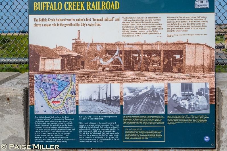
The Buffalo Creek Railroad, established in 1869, was just six miles long and ran from the New York Central Railroad tracks on William Street south, across and around the Buffalo River, and then turning north along Ganson Street. The railroad was constructed initially to serve the new Lehigh Valley Railroad coal trestle, which opened on the Buffalo River in 1871.
This was the first of an eventual half dozen trestles to serve the massive movement of coal west from Buffalo. With its rails skirting the Buffalo River and City Ship Canal, the Buffalo Creek also served the lumber docks and grain elevators which soon sprung up along the water's edge.
The Buffalo Creek Railroad was the first "terminal railroad" in the country. Because of the limited space along the waterfront, the Buffalo Creek was granted exclusive rights by the City to do all the switching for the dozen railroads entering Buffalo. All railroads were charged a uniform switching rate and most had to use the Buffalo Creek's
this page online
While most railroads in the country merged, closed or changed names numerous times since 1869, the Buffalo Creek Railroad was unique in maintaining its name and corporate identity for 124 years, until 1983 when it merged into Conrail. The Buffalo Creek Railroad was a major factor in the growth of the Buffalo waterfront. Its track system is still in place, its bridge still the primary crossing of the Buffalo River for all the railroads serving Buffalo.
The Buffalo Creek Railroad maintained a large yard parallel to the City Ship Canal, along Ganson and Ohio Streets. This yard served the milling industry on Ganson Street. In the early 1950's, when this photo was taken, flour and grain moved in boxcars. The Buffalo Creek Railroad purchased 2,000 boxcars at this time with its famous "flour bag" emblem, which was recognized throughout
Photographed by Paige Miller, July 5, 2025
2. Buffalo Creek Railroad Marker
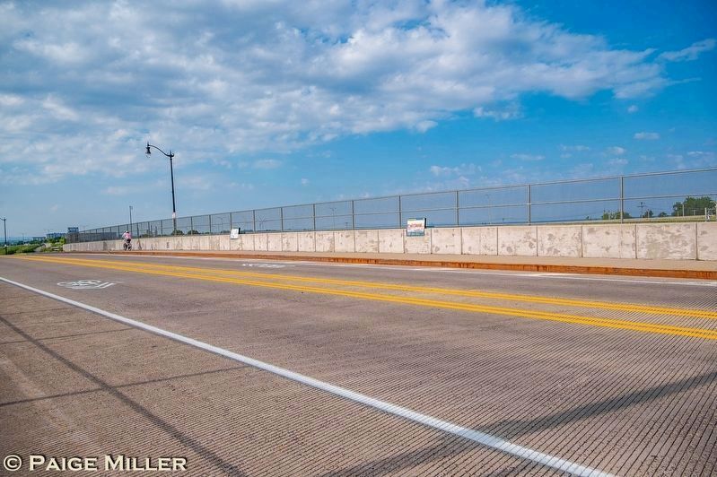
The marker is on the sidewalk on the west side of Empire State Trail, in this photo it is the closer of the two markers.
James D. Griffin (Mayor from 1978-1993), was employed by the Buffalo Creek Railroad after his service with the U.S. Army in Korea. He soon attained the position of engineer and was assigned the switching of grain cars on Ganson Street. In this 1955 photograph we see him seated on the left, eating lunch in the Buffalo Creek engine house.
What is a Terminal Railroad?
A switching and terminal railroad is a railroad company whose primary function is to perform switching services for other railroads along its rail line. This involves breaking up trains, sorting and storing cars and serving the industries within the facility's yard limits. These operations are performed at slow speeds and under exacting yard rules.
Erected by Heritage Discovery Center.
Topics. This historical marker is listed in these topic lists: Industry & Commerce • Railroads & Streetcars. A significant historical year for this entry is 1869.
Location. 42° 51.327′ N, 78° 51.894′ W. Marker is in Buffalo, New York, in Erie County. It is in the First Ward. It is on Empire State Trail 0.4 miles south of Ganson Street/Silo City Row, on the right when traveling south. Although you can see this marker from the car, there is no place to stop or park at this location. You can park on Silo City Row (which is 0.4 miles north of the marker) or Fuhrmann Boulevard (which is to the south of the marker) and walk to the marker. Touch for map. Marker is in this post office area: Buffalo NY 14203, United States of America. Touch for directions.

Regionally, this marker is in Upstate New York and specifically in Western New York. It is also in the American Northeast and in the Mid-Atlantic. Globally, it is in North America, on the Great Lakes, in the Western Hemisphere, in the Western World, and in the Anglosphere. Historically, it finds itself in what was once the Viceroyalty of New France, the Haudenosaunee (Iroquois) Confederacy, New Netherland, and one of the original Thirteen Colonies.
Other nearby markers. At least 8 other markers are within walking distance of this marker: The Concrete Central and Cargill Superior Elevators (a few steps from this marker); The Concrete Central Elevator (approx. 0.2 miles away); The Electric Elevator Annex (approx. 0.2 miles away); The Cargill Superior Elevator (approx. 0.2 miles away); The American Elevator (approx. 0.2 miles away); The Perot Malting Elevator (approx. 0.2 miles away); The Lake and Rail Elevator (approx. 0.2 miles away); The Marine "A" Elevator (approx. 0.2 miles away). Touch for a list and map of all markers in Buffalo.
Credits. This page was last revised on July 7, 2025. It was originally submitted on July 6, 2025, by Paige Miller of Getzville, New York. This page has been viewed 270 times since then and 134 times this year. Photos: 1, 2. submitted on July 6, 2025, by Paige Miller of Getzville, New York. • Andrew Ruppenstein was the editor who published this page.
