
Hexham in Northumberland, England, United Kingdom — Northwestern Europe (the British Isles)
From Cathedral to Priory Church
Photographed by Ray Gurganus, April 23, 2025
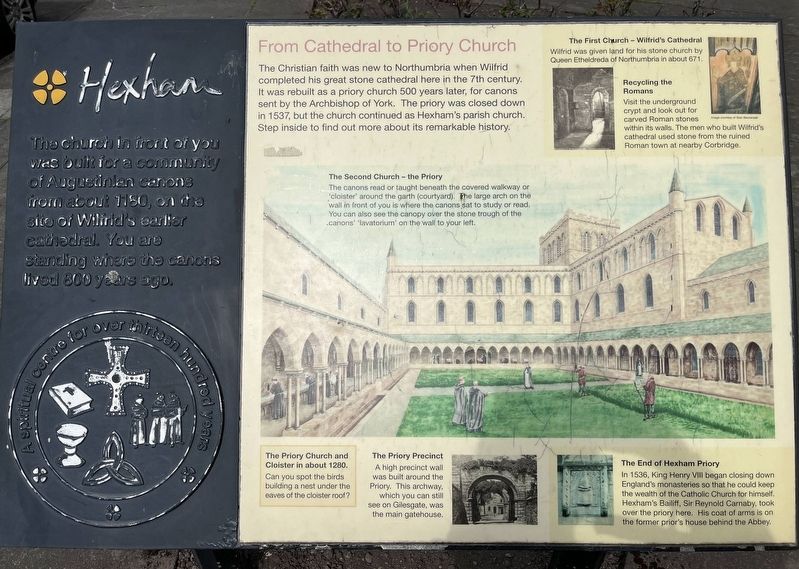
1. From Cathedral to Priory Church Marker
The Christian faith was new to Northumbria when Wilfrid completed his great stone cathedral here in the 7th century. It was rebuilt as a priory church 500 years later, for canons sent by the Archbishop of York. The priory was closed down in 1537, but the church continued as Hexham's parish church. Step inside to find out more about its remarkable history.
The Second Church - the Priory
The canons read or taught beneath the covered walkway or cloister around the garth (courtyard). The large arch on the wall in front of you is where the canons sat to study or read. You can also see the canopy over the stone trough of the canons lavatorium on the wall to your left.
The First Church-Wilfrid's Cathedral
Wilfrid was given land for his stone church by Queen Etheldreda of Northumbria in about 671.
Recycling the Romans
Visit the underground crypt and look out for carved Roman stones within its walls. The men who built Wilfrid's
this page online
The Priory Precinct
A high precinct wall was built around the Priory. This archway, which you can still see on Gilesgate, was the main gatehouse.
The End of Hexham Priory
In 1536, King Henry VIII began closing down England's monasteries so that he could keep the wealth of the Catholic Church for himself. Hexham's Bailiff, Sir Reynold Carnaby, took over the priory here. His coat of arms is on the former prior's house behind the Abbey.
Topics. This historical marker is listed in this topic list: Religion & Religious Structures. A significant historical year for this entry is 1180.
Location. 54° 58.264′ N, 2° 6.173′ W. Marker is in Hexham, England, in Northumberland. It is on Beaumont Street. Touch for map. Marker is at or near this postal address: 9 Beaumont Street, Hexham, England NE46 3NB, United Kingdom. Touch for directions.

Regionally, this marker is in North East England. It is also in British Border Reivers Country. Globally, it is on the Atlantic Ocean, in the North Atlantic Region, in Europe, in Atlantic Europe, on one of the British Isles,
Photographed by Ray Gurganus, April 23, 2025
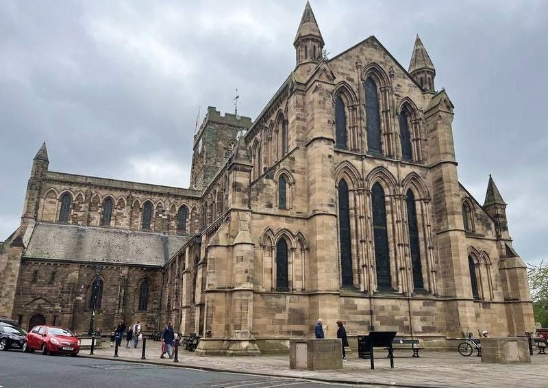
2. Hexham Abbey
Other nearby markers. At least 8 other markers are within 5 kilometers of this marker, measured as the crow flies: The Heart of Hexham (about 90 meters away, measured in a direct line); The West Headquarters Building (approx. 4.7 kilometers away); The West Military Compound (approx. 4.7 kilometers away); The Main Street (approx. 4.7 kilometers away); Corbridge Roman Site (approx. 4.7 kilometers away); The Granaries (approx. 4.7 kilometers away); The Side Street (approx. 4.8 kilometers away); The Fountain House (approx. 4.8 kilometers away).
Credits. This page was last revised on July 6, 2025. It was originally submitted on July 6, 2025, by Ray Gurganus of Washington, District of Columbia. This page has been viewed 103 times since then and 4 times this year. Photos: 1, 2. submitted on July 6, 2025, by Ray Gurganus of Washington, District of Columbia. • Andrew Ruppenstein was the editor who published this page.
