Chippawa in Niagara Falls in Niagara Region, Ontario — Central Canada (North America)
Chippawa Town Hall
Photographed by Kevin Westell, July 3, 2025
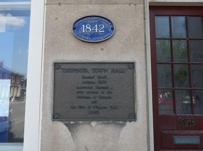
1. Chippawa Town Hall Marker
Addition 1965
Renovated through a joint project of the Province of Ontario and the City of Niagara Falls
1983
Topics. This historical marker is listed in this topic list: Government & Politics. A significant historical year for this entry is 1842.
Location. 43° 3.537′ N, 79° 3.064′ W. Marker is in Niagara Falls, Ontario, in Niagara Region. It is in Chippawa. It is at the intersection of Cummington Square West and Main St, on the right when traveling east on Cummington Square West. The marker is on the wall to the left of the main entrance. Touch for map. Marker is at or near this postal address: 8196 Cummington Square W, Niagara Falls ON L2G 6V9, Canada. Touch for directions.

Regionally, this marker is on Ontario’s Golden Horseshoe and in Niagara Canada. It is also in Central Canada. Globally, it is in North America, on the Great Lakes, in the Western Hemisphere, in the Western World, and in the Anglosphere. Historically, it finds itself in what was once a British colony, the Viceroyalty of New France, the Haudenosaunee (Iroquois) Confederacy, and Rupert’s Land.
Other nearby markers. At
this page online
Regarding Chippawa Town Hall. The original, ancient portage road around the falls was on the east shore. After the US war of independence, the British set up a new portage road on the west shore, and settlements grew at each end: Chippawa at this southern end, and Queenston at the northern end.
The name "Chippawa" was the original name for the river now named The Welland River. (Governor-General Simcoe slapped English names on everything.)
The village of Chippawa was amalgamated into the City of Niagara Falls in 1970.
The city designated
Photographed by Kevin Westell, July 3, 2025
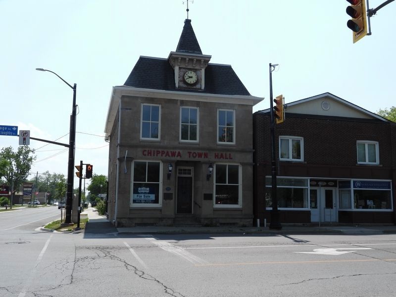
2. Chippawa Town Hall
Also see . . . Niagara Falls By-law Describing This Heritage Property. The by-law lists these architectural and historical attributes, that define its heritage value: 2 storey Classical Revival building; symmetrical three-bay ashlar stone facade; four-sided mansard roof with a clock tower was a later addition; two over two sash windows found along the front and side facades; heavy limestone quoins, sills and lintel surrounds on the south facade; four limestone pilasters with Doric capitals; two large single pane windows found between pilasters on front; unornamented frieze with a simple cornice separating the first and second storeys; quoins found along the building's northeast and northwest corners; foundation and side facades of the building composed of course rubble, a prevalent building material of the area; central raised, recessed entrance with a 12-light wood door; ribbon-pointing on the southeast (side)facade; one of the few remaining original facades fronting on the heritage-designated Cummington Square; a common meeting centre for social activity in the community; significant
Photographed by Kevin Westell, July 3, 2025
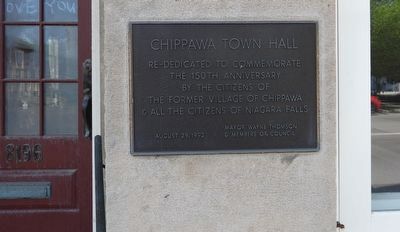
3. Chippawa Town Hall - This related plaque is the right of the main entrance
Credits. This page was last revised on December 22, 2025. It was originally submitted on July 6, 2025, by Kevin Westell of St. Catharines, Ontario. This page has been viewed 52 times since then and 15 times this year. Photos: 1, 2, 3. submitted on July 6, 2025, by Kevin Westell of St. Catharines, Ontario. • J. J. Prats was the editor who published this page.
