Rotherham in South Yorkshire, England, United Kingdom — Northwestern Europe (the British Isles)
Welcome to Rotherham Minster
One of Yorkshire's largest churches sketched by Turner
| — | Turner Trails | — |
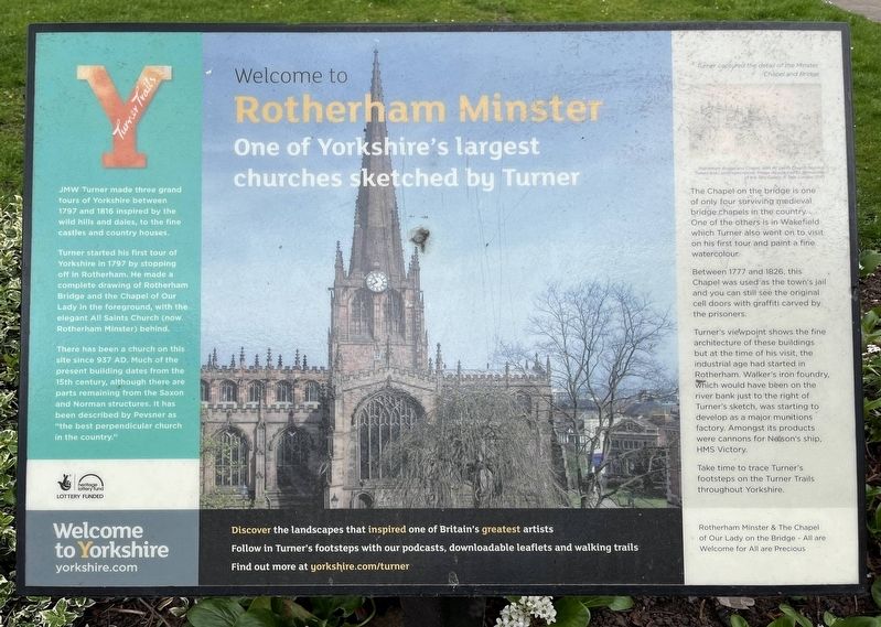
Photographed by Ray Gurganus, April 20, 2025
1. Welcome to Rotherham Minster Marker
Turner started his first tour of Yorkshire in 1797 by stopping off in Rotherham. He made a complete drawing of Rotherham Bridge and the Chapel of Our Lady in the foreground, with the elegant All Saints Church (now Rotherham Minster) behind.
There has been a church on this site since 937 AD. Much of the present building dates from the 15th century, although there are parts remaining from the Saxon and Norman structures. It has been described by Pevsner as "the best perpendicular church in the country."
The Chapel on the bridge is one of only four surviving medieval bridge chapels in the country. One of the others is in Wakefield which Turner also went on to visit on his first tour and paint a fine watercolour.
Between 1777 and 1826, this Chapel was used as the town's jail and you can still see the original cell doors with graffiti carved by the prisoners.
Turner's viewpoint shows the fine architecture of these buildings but at the time of his visit, the industrial
this page online
Take time to trace Turner's footsteps on the Turner Trails throughout Yorkshire.
Topics. This historical marker is listed in these topic lists: Arts, Letters, Music • Religion & Religious Structures. A significant historical year for this entry is 1797.
Location. 53° 25.829′ N, 1° 21.397′ W. Marker is in Rotherham, England, in South Yorkshire. It is on High Street. Touch for map. Marker is at or near this postal address: 32a High Street, Rotherham, England S60, United Kingdom. Touch for directions.

Regionally, this marker is in Yorkshire & The Humber. Globally, it is on the Atlantic Ocean, in the North Atlantic Region, in Europe, in Atlantic Europe, on one of the British Isles, in the Western World, and in the Anglosphere. Historically, it finds itself in what was once the Roman Empire.
Other nearby markers. At least 8 other markers are within 10 kilometers of this marker, measured as the crow flies: Rotherham Parish Church (a few steps from this marker); The Old Market (within shouting distance of this marker); Tommy James (about 90 meters away, measured in a direct line); Chantry Bridge (approx. 0.2 kilometers away); The Forge (approx. 0.3 kilometers away); Tudor Square (approx. 9.2 kilometers away); Heads or Tails? (approx. 9.2 kilometers away); Leopold Street (approx. 9.3 kilometers away). Touch for a list and map of all markers in Rotherham.
Credits. This page was last revised on July 6, 2025. It was originally submitted on July 6, 2025, by Ray Gurganus of Washington, District of Columbia. This page has been viewed 79 times since then and 8 times this year. Photo 1. submitted on July 6, 2025, by Ray Gurganus of Washington, District of Columbia. • Andrew Ruppenstein was the editor who published this page.
Editor’s want-list for this marker. photo of the marker within its surroundings • Can you help?
