Near Lakeville in St. Joseph County, Indiana — The American Midwest (Great Lakes)
Huggart Settlement
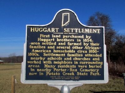
Photographed by Duane Hall, December 14, 2012
1. Huggart Settlement Marker
Erected 1998 by Indiana Historical Bureau and Huggart Settlement Task Force. (Marker Number 71.1998.1.)
Topics and series. This historical marker is listed in these topic lists: African Americans • Settlements & Settlers. In addition, it is included in the Indiana Historical Bureau Markers series list. A significant historical year for this entry is 1834.
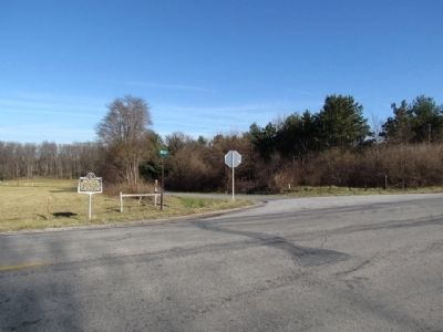
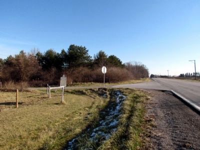
Location. 41° 32.117′ N, 86° 18.729′ W. Marker is near Lakeville, Indiana, in St. Joseph County. It is at the intersection of Pierce Road (State Road 4) and Mulberry Road, on the right when traveling west on Pierce Road. Touch for map. Marker is at or near this postal address: 65989 Mulberry Rd, Lakeville IN 46536, United States of America. Touch for directions.

Regionally, this marker is in Northern Indiana and in
this page online
Other nearby markers. At least 8 other markers are within 3 miles of this marker, measured as the crow flies: Shuppert/Shupert Family (approx. 2.1 miles away); The Springhouse (approx. 2.2 miles away); Porter (Rea) Cemetery (approx. 2.3 miles away); A Champion of Farmland to Parkland (approx. 2½ miles away); People Make the Difference (approx. 2½ miles away); Indiana State Parks: the First 100 Years 1916-2016 (approx. 2.6 miles away); Farming Potato Creek (approx. 2.7 miles away); The Naragon Barn (approx. 2.7 miles away).
Another marker is no longer nearby. Farm Equipment (was approx. 2.7 miles away but has been permanently removed).
Also see . . . The Huggart Settlement. Indiana Department of Natural Resources Story Map describes the Huggart Settlement and the people who lived there.
The Huggart Settlement(Submitted on March 26, 2025, by Daniel Barriball of Chesterton, Indiana.)was established by Samuel Huggart, a free African-American. He came to Indiana with his family in 1834 at a time when many other African-Americans were enslaved in the South. The settlement was part of a community of anti-slavery Quakers who played an important in the movement to abolish slavery.Photographed by Duane Hall, December 14, 20122. Intersection of Pierce Rd (SR 4) and Mulberry RdMarker is at northwest corner of intersection
Photographed by Duane Hall, December 14, 2012
3. View to East Along Pierce Road (SR 4)
Credits. This page was last revised on July 8, 2025. It was originally submitted on December 17, 2012, by Duane Hall of Abilene, Texas. This page has been viewed 1,108 times since then and 48 times this year. Last updated on July 6, 2025, by Trevor L Whited of Kokomo, Indiana. Photos: 1, 2. submitted on December 17, 2012, by Duane Hall of Abilene, Texas. 3. submitted on July 13, 2015, by Duane Hall of Abilene, Texas. • Devry Becker Jones was the editor who published this page.
