Ms City in Weber County, Utah — The American Mountains (Southwest)
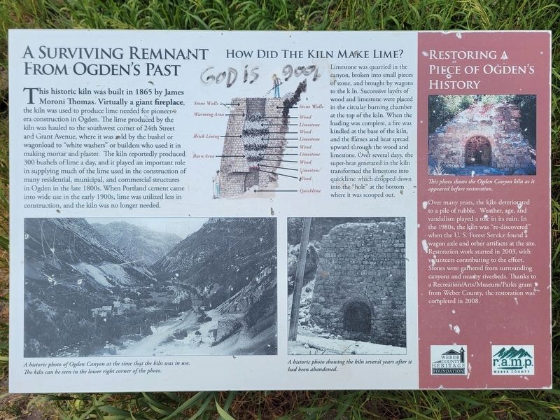
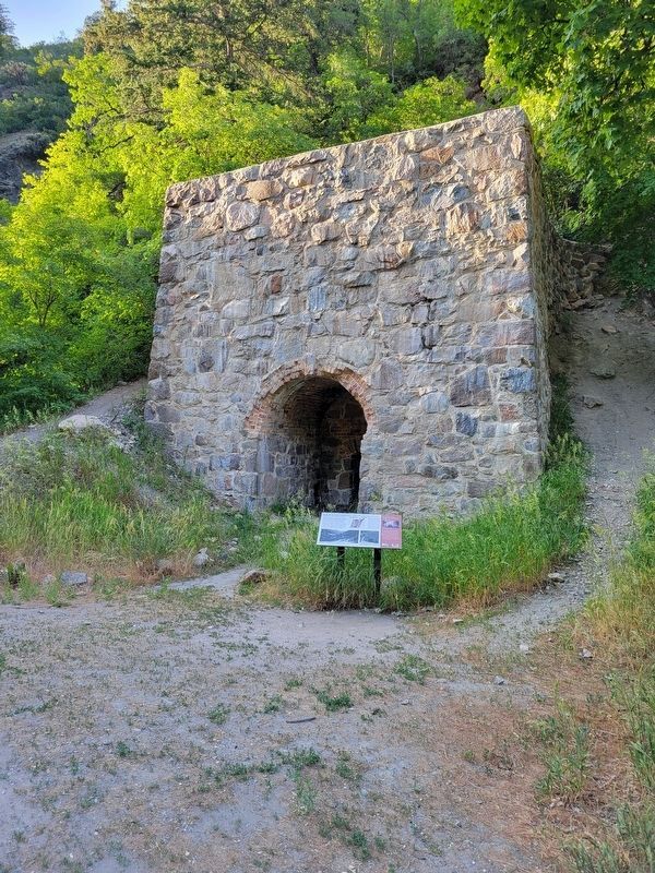
A Surviving Remnant From Ogden's Past
Photographed by Jeremy Snow, June 21, 2025
1. A Surviving Remnant From Ogden's Past Marker
How Did the Kiln Make Lime?
Limestone was quarried in the canyon, broken into small pieces of stone, and brought by wagons to the kiln. Successive layers of wood and limestone were placed in the circular burning chamber at the top of the kiln. When the loading was complete, a fire was kindled at the base of the kiln, and the flames and heat spread upward through the wood and
this page online
Restoring a Piece of Ogden's History
(photo caption)This photo shows the Ogden Canyon kiln as it appeared before restoration.
Over many years, the kiln deteriorated to a pile of rubble. Weather, age, and vandalism played a role in its ruin. In the 1980s, the kiln was "re-discovered" when the U. S. Forest Service found a wagon axle and other artifacts at the site. Restoration work started in 2003, with volunteers contributing to the effort. Stones were gathered from surrounding canyons and nearby riverbeds. Thanks to a Recreation/Arts/Museum/Parks grant from Weber County, the restoration was completed in 2008.
(photo captions)
A historic photo of Ogden Canyon at the time that the kiln was in use. The kiln can be seen in the lower right corner of the photo
A historic photo showing the kiln several years after it had been abandoned.
Topics. This historical marker is listed in this topic list: Industry & Commerce. A significant historical year for this entry is 1865.
Location. 41° 14.411′ N,
Photographed by Jeremy Snow, June 21, 2025
2. A Surviving Remnant From Ogden's Past Marker

Regionally, this marker is in the Wasatch Front and in Greater Salt Lake. It is also in the American Mountain West and on the Colorado Plateau. Globally, it is in North America, the Rocky Mountains, the Western Hemisphere, the Western World, and the Anglosphere. Historically, it finds itself in what was once New Spain and also Mexico’s Alta California.
Other nearby markers. At least 8 other markers are within 3 miles of this marker, measured as the crow flies: Ogden Canyon Toll Gate (approx. 1.3 miles away); First Grist Mill in Weber County (approx. 2.3 miles away); The Old Mill (approx. 2.3 miles away); Farr's Fort / The Mills / Lorin Farr (approx. 2½ miles away); Malan Heights (approx. 2.7 miles away); First Camp Site of Hayden's 1871 Yellowstone Survey (approx. 2.9 miles away); John Shannon Houtze Home (approx. 2.9 miles away); Virginia Houtz Green/William H. Shearman Home (approx. 2.9 miles away).
Credits. This page was last revised on July 7, 2025. It was originally submitted on July 6, 2025, by Jeremy Snow of Cedar City, Utah. This page has been viewed 126 times since then and 20 times this year. Photos: 1, 2. submitted on July 6, 2025, by Jeremy Snow of Cedar City, Utah. • Andrew Ruppenstein was the editor who published this page.
