THE HISTORICAL
MARKER DATABASE
“Bite-Size Bits of Local, National, and Global History”
Gouda, South Holland, Netherlands — Northwestern Europe
 

Voormalig postkantoor
⎯⎯⎯
Former Post Office
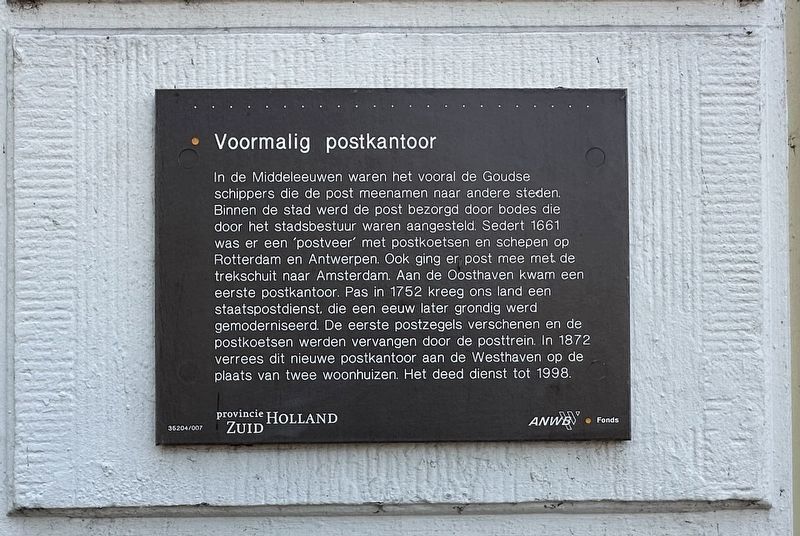
 
 
Voormalig postkantoor / Former Post Office Marker image. Click for full size.
Photographed by Andrew Ruppenstein, June 21, 2025
1. Voormalig postkantoor / Former Post Office Marker
Inscription.  
In de Middeleeuwen waren het vooral de Goudse schippers die de post meenamen naar andere steden. Binnen de stad werd de post bezorgd door bodes die door het stadsbestuur waren aangesteld. Sedert 1661 was er een 'postveer' met postkoetsen en schepen op Rotterdam en Antwerpen. Ook ging er post mee met de trekschuit naar Amsterdam. Aan de Oosthaven kwam een eerste postkantoor. Pas in 1752 kreeg ons land een staatspostdienst. die een eeuw later grondig werd gemoderniseerd. De eerste postzegels verschenen en de postkoetsen werden vervangen door de posttrein. In 1872 verrees dit nieuwe postkantoor aan de Westhaven op de plaats van twee woonhuizen. Het deed dienst tot 1998.

(English translation:)
In the Middle Ages, it was mainly the Gouda skippers who took the mail to other cities. Within the city, the mail was delivered by messengers appointed by the city council. From 1661 on there was a 'post ferry' with stagecoaches and ships to Rotterdam and Antwerp. Mail was also taken by canal barge to Amsterdam. The first post office was built at the Oosthaven. It was not until 1752 that our country got
Paid Advertisement
Click or scan to see
this page online
a state postal service. which was thoroughly modernized a century later. The first stamps appeared and the stagecoaches were replaced by the mail train. In 1872, this new post office was built at the Westhaven on the site of two houses. It was in service until 1998.
 
Erected by Provincie Zuid-Holland, ANWB, VVV. (Marker Number 35204/007.)
 
Topics. This historical marker is listed in this topic list: Communications.
 
Location. 52° 0.519′ N, 4° 42.721′ E. Marker is in Gouda, Zuid-Holland (South Holland). It is at the intersection of Westhaven and Korte Noodgodsstraat, on the right on Westhaven. Touch for map. Marker is at or near this postal address: Westhaven 37, Gouda, Zuid-Holland 2801 PL, Netherlands. Touch for directions.

Regionally, it is in Europe, the European Union, Atlantic Europe, the Benelux Low Countries, the Schengen Area, Western Europe, and the Western World. Historically, it finds itself in what was once the Roman Empire and specifically also the Holy Roman Empire.

Other nearby markers. At least 8 other markers are within walking distance of this
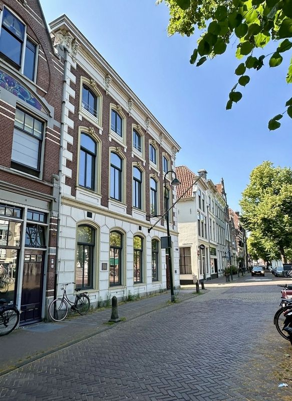
Voormalig postkantoor / Former Post Office Marker - wide view image. Click for full size.
Photographed by Andrew Ruppenstein, June 21, 2025
2. Voormalig postkantoor / Former Post Office Marker - wide view
marker: Erasmus: Westhaven (within shouting distance of this marker); Woonhuis van Arie Blanken / Residence of Arie Blanken (within shouting distance of this marker); St. Theodorus-stichting / St. Theodorus Foundation (within shouting distance of this marker); Gebouw de Haven / De Haven Building (within shouting distance of this marker); Schafte Israël Adler (within shouting distance of this marker); Metaheerhuis / Tahara (Ritual Washing) House (within shouting distance of this marker); R.K. Meisjesschool met kapel / Catholic Girls School With Chapel (about 90 meters away, measured in a direct line); Dirck Volkertszoon Coornhert (about 90 meters away). Touch for a list and map of all markers in Gouda.
 
 
Credits. This page was last revised on July 7, 2025. It was originally submitted on July 7, 2025, by Andrew Ruppenstein of Lamorinda, California. This page has been viewed 90 times since then and 17 times this year. Photos:   1, 2. submitted on July 7, 2025, by Andrew Ruppenstein of Lamorinda, California.

m=277937

CeraNet Cloud Computing sponsors the Historical Marker Database.
This website earns income from purchases you make after using our links to Amazon.com. We appreciate your support.
Paid Advertisement
Sep. 19, 2026