
Erbendorf in Tirschenreuth, Bavaria, Germany — Central Europe
Kolping-Platz
⎯⎯⎯
Kolping Square
Photographed by James Hulse, June 17, 2025
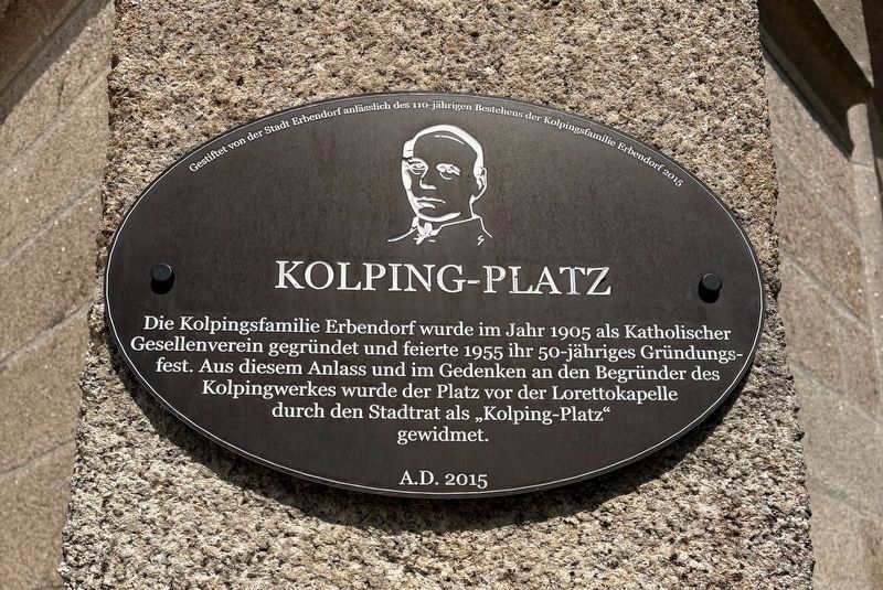
1. Kolping-Platz / Kolping Square Marker

Die Kolpingsfamilie Erbendorf wurde im Jahr 1905 als Katholischer Gesellenverein gegründet und feierte 1955 ihr 50-jähriges Gründungsfest. Aus diesem Anlass und im Gedenken an den Begründer des Kolpingwerkes wurde der Platz vor der Lorettokapelle durch den Stadtrat als „Kolping-Platz“ gewidmet.
Gestiftet von der Stadt Erbendorf anlässlich des 110-jährigen Bestehens der Kolpingsfamilie Erbendorf 2015
The Kolping family of Erbendorf was founded in 1905 as a Catholic journeymen’s association and celebrated its 50th anniversary in 1955. On this occasion, and in memory of the founder of the Kolping organization, the square in front of the Loretto Chapel was named “Kolping-Platz” by the city council.
Donated by the city of Erbendorf on the occasion of the 110th anniversary of the Kolping Family Erbendorf in 2015
Erected 2015 by City of Erbendorf.
Topics. This historical marker is listed in this topic list: Notable Places. A significant historical year for this entry is 1905.
Location. 49° 50.298′ N, 12° 2.758′ E. Marker is in Erbendorf, Bayern (Bavaria), in Tirschenreuth. It is
this page online

Regionally, it is in Europe, the European Union, Atlantic Europe, Central Europe, the Schengen Area, Western Europe, and the Western World. Historically, it finds itself in what was once the Holy Roman Empire and also the former West Germany.
Other nearby markers. At least 8 other markers are within 8 kilometers of this marker, measured as the crow flies: Loretto Kapelle / Loretto Chapel (here, next to this marker); Friedrich von Schiller (within shouting distance of this marker); Vertiefung: Koesslers Musik Koessler-Archiv / In-Depth: Koessler's Music Koessler Archive (approx. 7.4 kilometers away); Burgkapelle und Pfarrkirche / Castle chapel and parish church / Hradní kaple a farní kostel (approx. 7.4 kilometers away); Letzte Lebensphase und Tod in Ansbach / Last phase of life and death in Ansbach (approx. 7.4 kilometers away); Blick auf den Kalvarienberg / View of the Mount Calvery / Pohled na horu kalvárie
Photographed by James Hulse, June 17, 2025
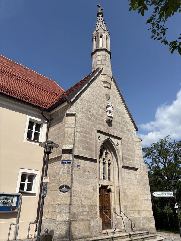
2. The Kolping Square Marker is located on the Loretto Chapel
Credits. This page was last revised on July 7, 2025. It was originally submitted on July 7, 2025, by James Hulse of Medina, Texas. This page has been viewed 65 times since then and 5 times this year. Photos: 1, 2. submitted on July 7, 2025, by James Hulse of Medina, Texas.
