
Chester in Chester County, South Carolina — The American South (South Atlantic)
Black Rock Baptist Church
⎯⎯⎯
Black Rock School

Photographed by J. J. Prats, May 19, 2025
1. Black Rock Baptist Church side of marker
As early as 1884, Black Rock Baptist Church hosted a school for African Americans. Early teachers included Mansel Phillip Hall, later founder of Friendship College in Rock Hill. Black Rock School first met in the church before moving into a one-room schoolhouse on church grounds, where it operated for several decades. The school closed in 1957 as Chester Co. consolidated its country schools.
Erected 2018 by Department of Archives and History. Sponsored by the congregation and the Golden Age Club. (Marker Number 12-11.)
Topics and series. This historical marker is listed in these topic lists: African Americans • Education • Religion & Religious Structures. In addition, it is included in the South Carolina Historical Markers
this page online
Location. 34° 43.069′ N, 81° 7.417′ W. Marker is in Chester, South Carolina, in Chester County. It is on Old Richburg Road (County Route 56) 0.6 miles east of Meador Road (County Route 74), on the right when traveling east. Touch for map. Marker is at or near this postal address: 1001 Old Richburg Rd, Chester SC 29706, United States of America. Touch for directions.

Regionally, this marker is in the Midlands and in the Olde English District. It is also in the American South and specifically in the Deep South. Globally, it is in North America, the Western Hemisphere, the Western World, and the Anglosphere. Historically, it finds itself in what was once the territory of the Mississippian Culture, one of the original Thirteen Colonies, one of the Confederate States of America, and the Antebellum South.
Other nearby markers. At least 8 other markers are within 6 miles of this marker, measured as the crow flies: Wilbur G. Grant Reservoir of Chester Metropolitan District (approx. 3.2 miles away); Original Site of Purity Presbyterian Church (approx. 4.1 miles away); Brainerd Institute

Photographed by J. J. Prats, May 19, 2025
2. Black Rock School side of marker

Photographed by J. J. Prats, May 19, 2025
3. Black Rock Baptist Church / Black Rock School Marker
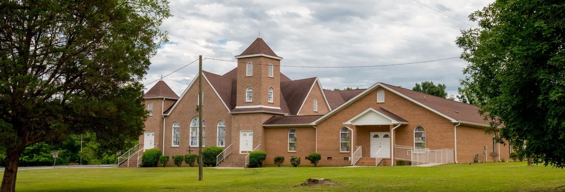
Photographed by J. J. Prats, May 19, 2025
4. Black Rock Baptist Church, near Chester, South Carolina

Photographed by J. J. Prats, May 19, 2025
5. Black Rock School, on the grounds of the Black Rock Baptist Church
Credits. This page was last revised on July 8, 2025. It was originally submitted on July 8, 2025, by J. J. Prats of Powell, Ohio. This page has been viewed 145 times since then and 25 times this year. Photos: 1, 2, 3, 4, 5. submitted on July 8, 2025, by J. J. Prats of Powell, Ohio.
