Ohio Township in Wickliffe in Ballard County, Kentucky — The American South (East South Central)
Flags! Flags! Flags!

Photographed by Mark Parker, July 5, 2025
1. Flags! Flags! Flags! Marker
Many people assume the only flag flown by Americans during the American Revolution (1775 to 1783) was the Betsy Ross flag, but nothing could be further from the truth. The Betsy Ross flag was not created until 1777, two years into the conflict when adopted by Congress. The Ross flag was a red and white striped flag with an added upper left blue field with 13 stars arranged in a circle, illustrating unity among 13 colonies. But, even then the Ross flag was seen by few soldiers outside of Washington's eastern command. Even General Washington had his own "Command Flag" consisting of a blue field with a scattering of 13 white stars.
So, if the flag made by Betsy Ross was not the 'every-day' flag used during the American Revolution, what flag was?
There were many different flags made throughout the American Revolution. Some flags represented different nations who fought alongside the Americans against the British, like the Spanish and French. Other flags were made for local militias or for campaigns. There was no standard American flag flown during the American Revolution.
Flags were revered somewhat differently than
this page online
What flags were associated with the American Revolution in the West?
French citizens of the mid-Mississippi River valley were under control of the British at the end of the French and Indian War in 1763. As a result, the British Union Jack was flown over the French villages. Indeed, French people at Kaskaskia were not aware that the
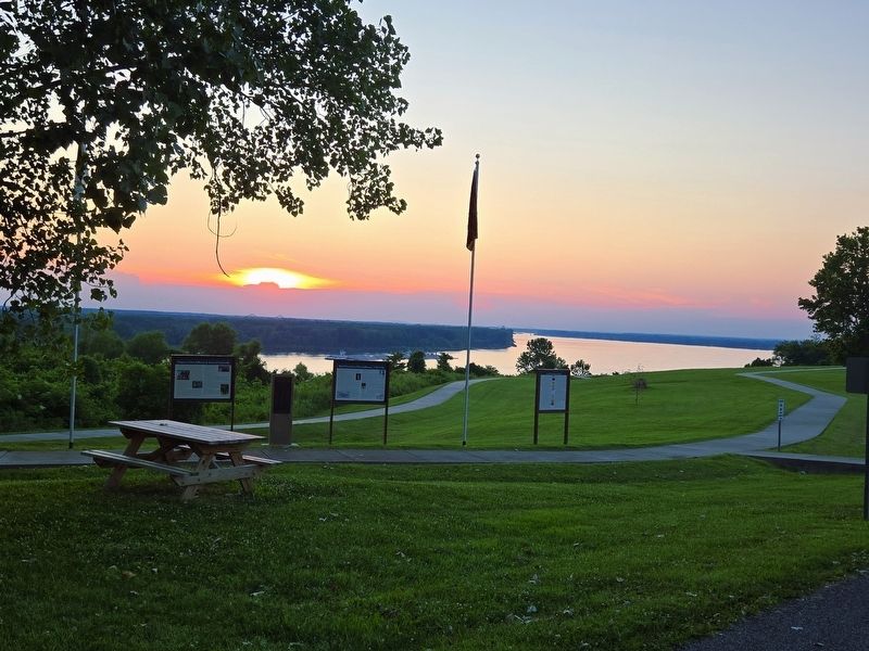
Photographed by Mark Parker, July 5, 2025
2. Flags! Flags! Flags! Marker, overlook at Ft. Jefferson Memorial Park
Marker is at the far right.
The following day Clark and his soldiers gathered the French inhabitants and informed them that the French and Americans were allies. Clark also told the Kaskaskian citizens they were now under American protection, that they could maintain their Catholic traditions and would not be imposed upon by the Virginians to follow the Anglican church. Clark also invited the men of Kaskaskia to join his army in their fight against the British and secure their own independence.
Lastly, Clark told the French they were welcome to fly their own colors once again - the Bourbon Flag - a white flag with three gold-colored fleur-de-les.
Although Spain did not formerly join the American cause unti June 1779, she had been supplying Clark's Virginians with food, clothing, and various accouterments
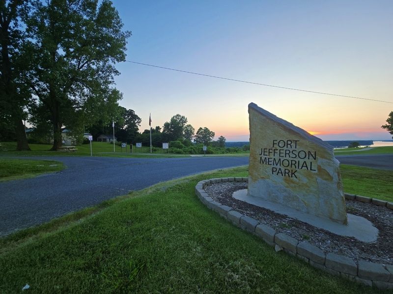
Photographed by Mark Parker, July 5, 2025
3. Flags! Flags! Flags! Marker to left of Ft. Jefferson Memorial Park entrance sign.
Supplies and accouterments of war supplied by both Spain and France were indispensable to George Rogers Clark's army. His soldiers' successes included taking and controlling the area that today includes western and central Kentucky, and the southern half of Illinois and Indiana. It is not surprising then that these regions comprise most of the Old Northwest ceded to the young United States by Great Britain after the American Revolution.
In January 1779, George Rogers Clark, and 75 of his men, wintered in Kaskaskia when an Italian merchant, Francis Vigo, informed Clark that British Lt. Governor Henry Hamilton from Detroit retaken Fort Patrick Henry

Photographed by Jason Voigt, June 10, 2026
4. Flags! Flags! Flags! Marker
To do so, Clark and his new army waded flooded, and often-ice filled streams, during the extremely cold winter of 1779 eneoute to Vincennes 180 miles to the east. Nights without fires to dry themselves or stay warm for fear of being seen and losing the surprise against Hamilton, Clark's army made one of the greatest heroic marches in military history still discussed in military academies today. Clark — in typical form —did what was unexpected, and he and his men caught Hamilton off his guard.
Entering Vincennes half-hidden behind hills, Clark's army displayed various flags they brought with them. Marching back and forth with Hamilton seeing only an ever-increasing number of flags, indicated that Clark's army must have numbered a thousand soldiers. In the evening of the first nght, Clark's army set siege to the fort with Kentucky riflemen shooting back-lit British soldiers visible between gaps in the forts wooden stockade. As Clack recorded in his journal, "Fine sport for the Sons of Liberty."
After a siege of several days, Hamilton surrendered to Clark on February 25, 1779. During the surrender, Hamilton asked Clark, "Sir, where is your army?" To Hamilton's embarrassment and with a smirk on Clark's face, Clark responded. "Sir, they stand before you — all 175 of them!"
So, what flags did Clark's army carry with them? They could have been various 3' wide by 5' long (or smaller) plain flags of differret colors. They probably included the French Bourbon Flag, too, because the French fought side-by-side with Clark's men. The historical records in the Clark papers reference only that "soldiers were to bring a set of colors." (on their march to Vincennes).
After the American & French victory at Vincennes, Clark met with his junior officers in November of 1779 as the Falls of the Ohio (Louisville) to determine where a new American fort should be built. Like the British before them, the Americans knew about the economic and strategic importance of the Confluence of the Ohio and Mississippi rivers. During the winter of 1779-1780, Clark surveyed an area five miles below the Confluence, describing the area in detail to Thomas Jefferson, who approved Clark's decision. Both men writing to each other noted that 'someday' the Confluence area would become an area of major economic importance. Neither man was correct, but this area near Wickliffe still holds hope for a growing river port industry.
Going back to Louisville from the Confluence, Clark led a party of about 225 soldiers and 40 families to the new location; another 125 soldiers arrived throughout the summer. Entering the buyou or chute of Island Number One on April 19th, 1780, Clark named the nearby creek, "Liberty Creek," because the 19th of April marked the five-year anniversary of Lexington and Concord. Eventually the creek's name would be changed permanently to "Mayfield Creek." The new fort was named Fort Jefferson, and the civilian town was named Clarksville, a wonderful honor for both Thomas Jefferson and George Rogers Clark.
What flag(s) were flown at Fort Jefferson?
An argument can be made for two different flags that might have been flown at Clark's Fort Jefferson. The first in the Bosseron flag, also called the Helm or Clark flag. Bosseron was a major in the French militia at Vincennes when Clark's Captain Helms took over the fort. Bosseron's red and green striped flag was flying at Vincennes when Hamilton took over the fort. Hamilton referred to the Bosseron flag as 'the rebel's flag'! In the spring of 1780, Helm came to Ft. Jefferson as Clark's Indian Agent, and Bosseron owned a house lot in the civilian town of Clarksville. Both, either, or neither, might have brought the green and red striped flag and flown those colors at the fort.
The other flag associated with George Rogers Clark is called the "Long Knife" flag. It is a simple white flag with a bluish-black colored long knife. Indeed, Native Americans, both allied and enemy, referred to Clark's men as the "Long Knives."
So, what flags were flown between April 19, 1780, and June 8, 1781, at Clark's Fort Jefferson? We are not sure. Perhaps both, perhaps only one, perhaps neither. Until the proverbial 'missing document' describing the flag(s) flown at Clark's Fort Jefferson is found, we will not be certain. Research with the 20,000 previously unpublished Clark papers contain numerous 'flag' entries, but the term is vague when it comes to describing the construction and color of the flags. Indeed, the term "colors" is a general term we still use today for Old Glory, and that term does not describe the composition, color pattern of Old Glory. Perhaps, it was just 'understood' what Clark's 'colors' would look like. For now, we'll proudly display the "Bosseron/Helm/Clark" red and green striped flag, and the Clark "Long Knife" flag in the Ft. Jefferson Memorial Park, along with Old Glory herself!
Informative References Used for this Exhibit
A History of Flags During the American Revolution: (https:/revolutionarywar.us/flags/).
Barnhart, John D.,ed. 1951 Henry Hamilton and George Rogers Clark in the American Revolution: With the Unpublished Journal of Lieut. Gov. Henry Hamilton. R.E Banta, Crawfordsville, Ind.
Carstens, Kenneth C. 2005 George Rogers Clark's Fort Jefferson, 1780-1781: Kentucky's Outpost on the Western Frontier. Heritage Books, Inc., Bowie, Maryland.
2020 Military Engagements at George Rogers Clarks Fort Jefferson, 1780-1781 and Clark's Role during the Battle of St. Louis/Cahokia. In: The American Revolurionary War in the West, ed. By Stephen L. Kling, Jr., St. Louis. THGC Publishing, St, Louis.
Carstens, Kenneth C.,and Nancy S. Carstens 2004 The Life of George Rogers Clark: Triumphs and Tragedies, 1752-1818. Greenwood/Praeger Press, CT.
Doughman, Frank (Superintendent, George Rogers Clark National Historic Park, Vincennes, Indiana, n.d, In-house study about flags flown during the American Revolution in the West). Vincennes, Indiana.
Unpublished Papers of George Rogers Clark - Index. Located in the Ballard Carlisle and Historical and Genealogical Society, Fort Jefferson Resarch Room, Wickliffe, KY.
[Captions:]
The Betsy Ross Flag, June 1777
George Washington's Command Flag
Gadsden Flag from South Carolina, 1775
Grand Union Flag, 1775-1776
British Union Jack Flag, 1707-1800
French National Flag, King Louie XVI, mid-to-late 18th Century, (Bourbon Flag)
Two flags associated with King Charles III of Spain, 18th century. The house of Burgundy Flag (top) and King Charles III's Royal flag (bottom).
Bosseron or Helm flag from Vincennes 1778-1781
Clark's Long Knife Flag, could be as early as 1778.
Topics and series. This historical marker is listed in these topic lists: Communications • Forts and Castles • War, US Revolutionary. In addition, it is included in the Vexillology series list. A significant historical date for this entry is February 25, 1779.
Location. 36° 57.328′ N, 89° 5.505′ W. Marker is in Wickliffe, Kentucky, in Ballard County. It is in Ohio Township. It is on Fort Jefferson Hill Road (U.S. 51/62) 0.2 miles south of Patterson Road, on the right when traveling south. The marker is on the left as you enter Fort Jefferson Memorial Park. Touch for map. Marker is at or near this postal address: 601 Fort Jefferson Hill Road, Wickliffe KY 42087, United States of America. Touch for directions.

Regionally, this marker is in the Jackson Purchase. It is also in the American Midwest, in the South, in the Upper South, in the Ohio River Valley, and in the Great River Road Region. Globally, it is in North America, the Western Hemisphere, the Western World, and the Anglosphere. Historically, it finds itself in what was once the territory of the Mississippian Culture and also the Antebellum South.
Other nearby markers. At least 8 other markers are within walking distance of this marker: Brief Overview of Fort Jefferson, 1780-1781 (here, next to this marker); Ft. Jefferson/Town of Clarksville Memorial (here, next to this marker); Purpose of Fort Jefferson & Town of Clarksville (here, next to this marker); Union Supply Base (within shouting distance of this marker); Lewis and Clark in Kentucky Fort Jefferson (within shouting distance of this marker); Fort Jefferson Site / Indian Massacre (within shouting distance of this marker); Fort Jefferson (within shouting distance of this marker); Fort Jefferson Memorial Cross at the Confluence (about 700 feet away, measured in a direct line). Touch for a list and map of all markers in Wickliffe.
Credits. This page was last revised on June 10, 2026. It was originally submitted on July 9, 2025, by Mark Parker of Hickory, North Carolina. This page has been viewed 178 times since then and 46 times this year. Photos: 1, 2, 3. submitted on July 9, 2025, by Mark Parker of Hickory, North Carolina. 4. submitted on June 10, 2026, by Jason Voigt of Glen Carbon, Illinois. • James Hulse was the editor who published this page.
