Gaslamp Quarter in San Diego in San Diego County, California — The American West (Pacific Coastal)
Old City Hall
1874
| — | Gaslamp Quarter | — |
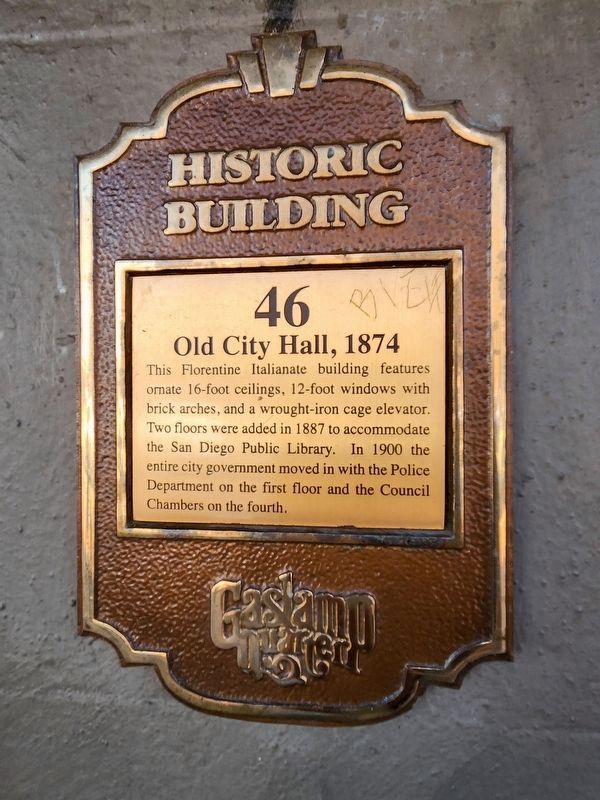
Photographed by Douglass Halvorsen, July 5, 2025
1. Old City Hall Marker
Topics and series. This historical marker is listed in these topic lists: Architecture • Government & Politics. In addition, it is included in the San Diego - Gaslamp Quarter series list. A significant historical year for this entry is 1887.
Location. 32° 42.747′ N, 117° 9.625′ W. Marker is in San Diego, California, in San Diego County. It is in the Gaslamp Quarter. It is at the intersection of G Street and Fifth Avenue, on the right when traveling east on G Street. Touch for map. Marker is at or near this postal address: 433 G St, San Diego CA 92101, United States of America. Touch for directions.

Regionally, this marker is in California’s Peninsular Ranges. It is also in the American Borderlands and on the Pacific Coast. Globally, it is in North America, on the Ring of Fire, in the Pacific Rim,
this page online
Other nearby markers. At least 8 other markers are within walking distance of this marker: The Cole Block Building, 1892 (within shouting distance of this marker); The Casino Theatre, 1912 (within shouting distance of this marker); Carriage Works, 1890 (within shouting distance of this marker); Llewelyn Building, 1887 (within shouting distance of this marker); The Yuma Building, 1882 (within shouting distance of this marker); The Combination Store (within shouting distance of this marker); The Backesto Building, 1873 (within shouting distance of this marker); Pierce-Field Building (about 300 feet away, measured in a direct line). Touch for a list and map of all markers in San Diego.
More about this marker. The marker is located on the north and center portion of the Old City Hall building, facing G Street.
Also see . . . San Diego’s Grand Old Lady. A comprehensive history of the Old City Hall building.
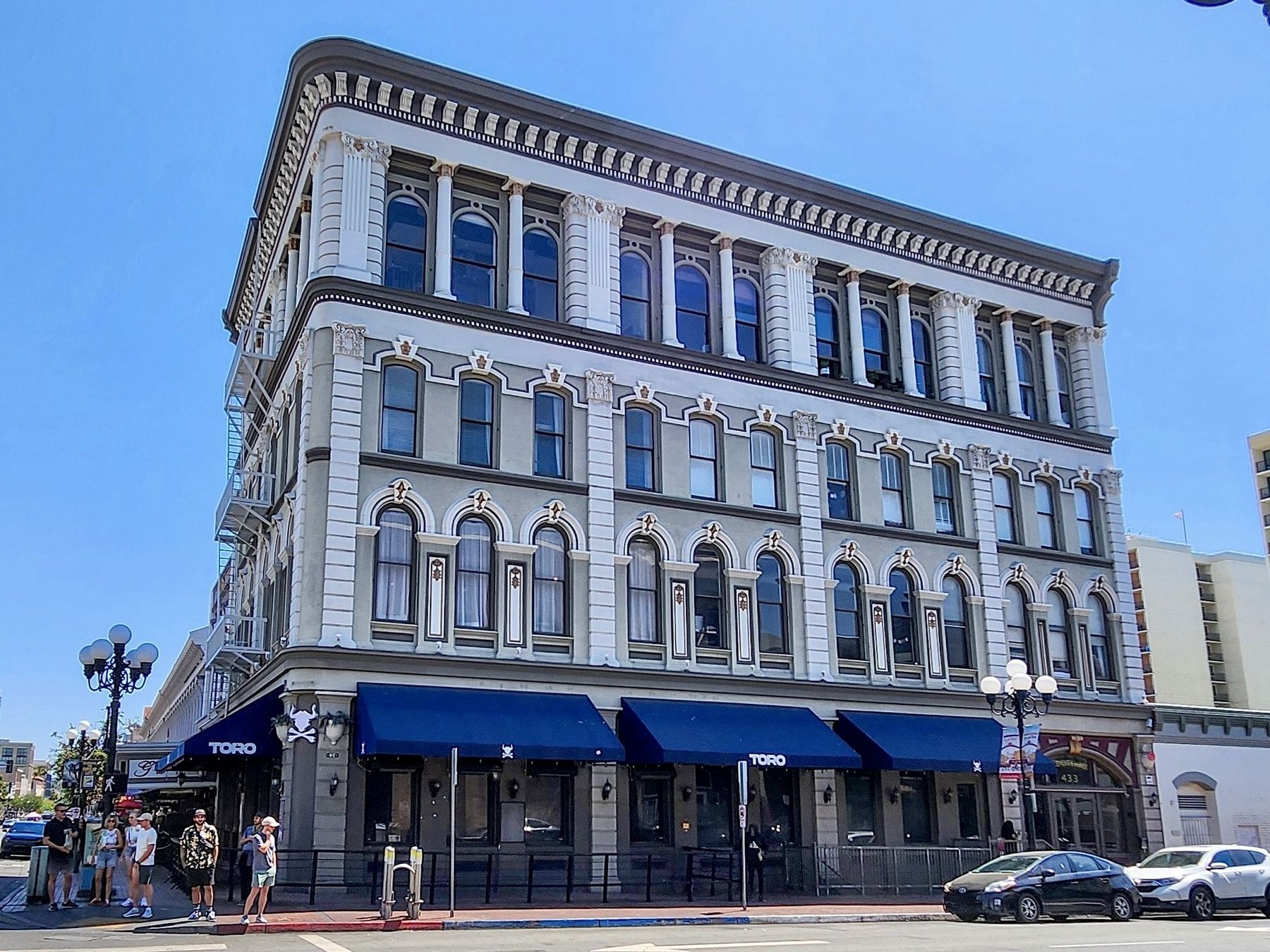
Old City Hall, a stunning example of Florentine Revival architecture, first made its debut as a(Submitted on July 11, 2025, by Douglass Halvorsen of Klamath Falls, Oregon.)two-story building housing the Commercial Bank. It has the distinction of being the first building in the Gaslamp to be constructed of all local materials. The bank hired prominent architect William Lacey of Payne and Lacey to design the edifice. Mr. Lacey went on to design the Begole Building and the Nesmith-Greeley Building.Photographed by Douglass Halvorsen, July 5, 20252. Old City Hall and MarkerThe marker is at the bottom center of the photo, by the blue awning with “Toro” on it.
San Diego City Clerk Digital Archives, 1912
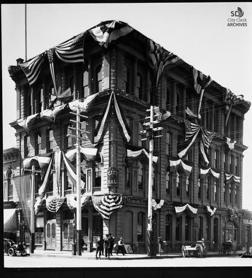
3. Old City Hall with Flags and Bunting, 664 Fifth Avenue at G
1912 photo of Old San Diego City Hall dressed with flags and bunting. It housed the City of San Diego Government offices for 35 years. It was built in 1874 as a 2-story brick building. In 1887, two more stories were added and the Public Library moved into the 3rd floor. In 1891, the city purchased it from Ralph Granger and moved in - Police on the 1st floor, government offices on the 2nd and 3rd and Council Chambers on the 4th. The building is listed as a historic building number [46] on the Gaslamp Quarter Historic Buildings registry.
Credits. This page was last revised on July 31, 2025. It was originally submitted on July 11, 2025, by Douglass Halvorsen of Klamath Falls, Oregon. This page has been viewed 251 times since then and 106 times this year. Photos: 1, 2, 3. submitted on July 11, 2025, by Douglass Halvorsen of Klamath Falls, Oregon. • Andrew Ruppenstein was the editor who published this page.
