Shannon Hill in Lee County, South Carolina — The American South (South Atlantic)
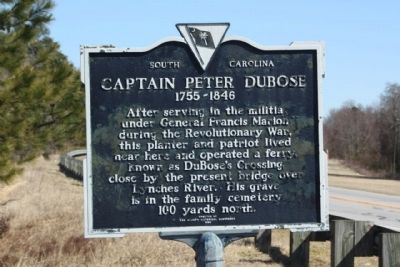
Captain Peter DuBose
1755 - 1846
Photographed by Mike Stroud, 2010
1. Captain Peter DuBose Marker
Erected 1966 by The Lee County Historical Commission. (Marker Number 31-10.)
Topics. This historical marker is listed in these topic lists: Industry & Commerce • War, US Revolutionary.
Location. 34° 14.959′ N, 80° 13.002′ W. Marker is in Shannon Hill, South Carolina, in Lee County. It is on Hartsville Highway (U.S. 15), on the left when traveling east. Located at Lynches River,west bank, 4 miles Northeast of Bishopville. Touch for map. Marker is in this post office area: Bishopville SC 29010, United States of America. Touch for directions.

Regionally, this marker is in the Pee Dee. It is also in the American South and specifically in the Deep South. Globally, it is in North America, the Western Hemisphere, the Western World, and the Anglosphere. Historically, it finds itself
this page online
Other nearby markers. At least 8 other markers are within 3 miles of this marker, measured as the crow flies: Cash-Shannon Duel (approx. 0.8 miles away); Bishopville High School (approx. 2.2 miles away); Dennis High School (approx. 2½ miles away); Flag Park (approx. 2.6 miles away); Felix Anthony "Doc" Blanchard (approx. 2.6 miles away); Felix "Doc" Blanchard (approx. 2.6 miles away); William Apollos James House (approx. 2.7 miles away); James Capers (approx. 2.7 miles away).
Photographed by Mike Stroud, February 18, 2010
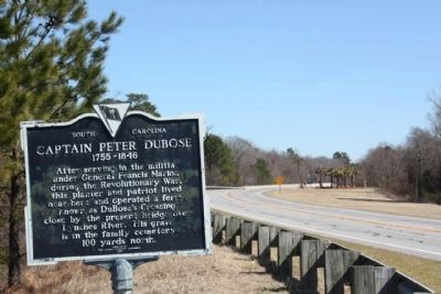
2. Captain Peter DuBose Marker, looking east at todays Lynches River Bridge
Photographed by Mike Stroud, February 18, 2010
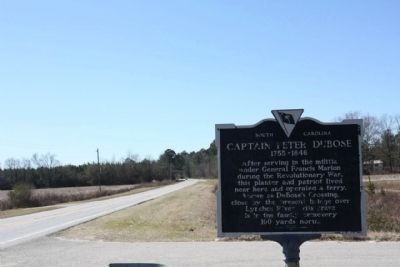
3. Captain Peter DuBose Marker, looking westward along Hartsville Highway (US 15)
Credits. This page was last revised on June 16, 2016. It was originally submitted on February 22, 2010, by Mike Stroud of Bluffton, South Carolina. This page has been viewed 3,097 times since then and 267 times this year. Photos: 1, 2, 3. submitted on February 24, 2010, by Mike Stroud of Bluffton, South Carolina. • Craig Swain was the editor who published this page.
