Crosby in Crow Wing County, Minnesota — The American Midwest (Upper Plains)
Soo Line Depot
Photographed by McGhiever, June 27, 2025
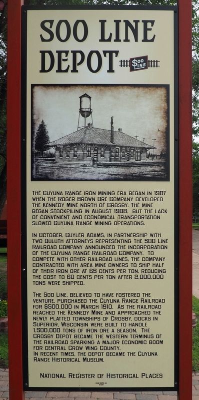
1. Soo Line Depot Marker
The Cuyuna Range iron mining era began in 1907 when the Roger Brown Ore Company developed the Kennedy Mine north of Crosby. The mine began stockpiling in August 1908, but the lack of convenient and economical transportation slowed Cuyuna Range mining operations.
In October, Cuyler Adams, in partnership with two Duluth attorneys representing the Soo Line Railroad Company announced the incorporation of the Cuyuna Range Railroad Company. To compete with other railroad lines, the company contracted with area mine owners to ship half of their iron ore at 65 cents per ton, reducing the cost to 60 cents per ton after 2,000,000 tons were shipped.
The Soo line, believed to have fostered the venture, purchased the Cuyuna Range Railroad for $500,000 in March 1910. As the railroad reached the Kennedy Mine and approached the newly platted townships of Crosby, docks in Superior, Wisconsin were built to handle 1,500,000 tons of iron ore a season. The Crosby Depot became the western terminus of the railroad sparking a major economic boom for central Crow Wing County.
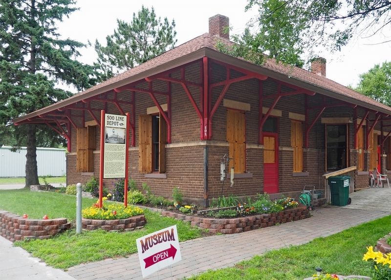
In recent times, the depot became the Cuyuna Range Historical Museum.
Erected 2017 by Cuyuna Iron Range Heritage Network.
Topics. This historical marker is listed in these topic lists: Industry & Commerce • Railroads & Streetcars. A significant historical year for this entry is 1907.
Location. 46° 29.006′ N, 93° 57.006′ W. Marker is in Crosby, Minnesota, in Crow Wing County. It is at the intersection of 1st Street NE and 1st Avenue NE, on the left when traveling east on 1st Street NE. The marker is in front of the Soo Line Depot Museum. Touch for map. Marker is at or near this postal address: 101 1st Street NE, Crosby MN 56441, United States of America. Touch for directions.

Regionally, this marker is
this page online
Other nearby markers. At least 8 other markers are within walking distance of this marker: Deerwood Mail Cart (a few steps from this marker); Fitger Brewing Company (within shouting distance of this marker); Crosby Veterans Memorial (approx. 0.4 miles away); Croft Mine Historical Park (approx. 0.4 miles away); Cuyuna Range Veterans Memorial (approx. half a mile away); Portsmouth Mine (approx. 0.6 miles away); a different marker also named Portsmouth Mine (approx. 0.6 miles away); a different marker also named Portsmouth Mine (approx. 0.6 miles away). Touch for a list and map of all markers in Crosby.
Photographed by McGhiever, June 27, 2025
2. Soo Line Depot and marker
Credits. This page was last revised on July 13, 2025. It was originally submitted on July 13, 2025, by McGhiever of Minneapolis, Minnesota. This page has been viewed 131 times since then and 37 times this year. Photos: 1, 2. submitted on July 13, 2025, by McGhiever of Minneapolis, Minnesota.
