Ligonier Township in Laughlintown in Westmoreland County, Pennsylvania — The American Northeast (Mid-Atlantic)
Laughlintown
Jenners - 9
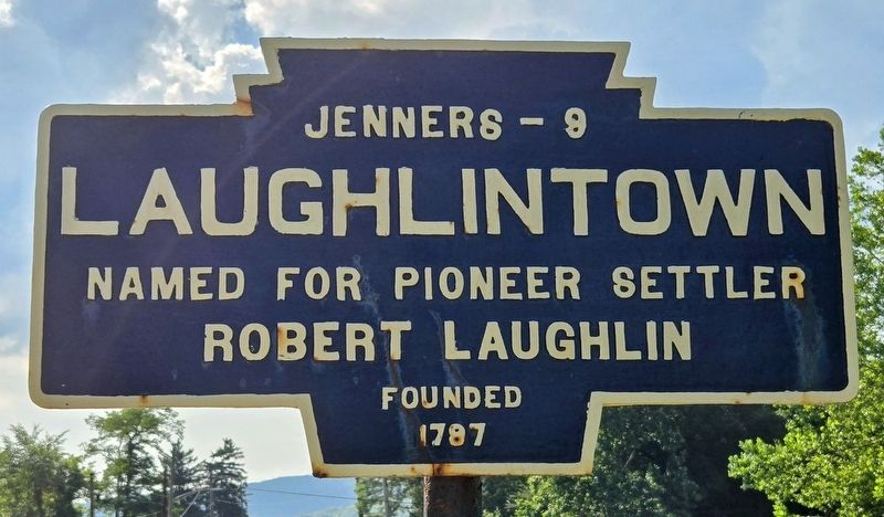
Photographed by Bradley Owen, July 12, 2025
1. Laughlintown Marker
Robert Laughlin
Founded
1787
Topics and series. This historical marker is listed in this topic list: Settlements & Settlers. In addition, it is included in the Pennsylvania Keystone Markers series list. A significant historical year for this entry is 1787.
Location. 40° 12.841′ N, 79° 12.163′ W. Marker is in Laughlintown, Pennsylvania, in Westmoreland County. It is in Ligonier Township. It is on Lincoln Highway (U.S. 30) 0.1 miles east of Baywood Road, on the right when traveling east. Touch for map. Marker is at or near this postal address: 1439 Lincoln Highway, Laughlintown PA 15655, United States of America. Touch for directions.

Regionally, this marker is in the Laurel Highlands and in Greater Pittsburgh. It is also in the American Northeast, in the Mid-Atlantic, in Appalachia, and specifically in Northern Appalachia. Globally, it is in North America, the Western Hemisphere, the Western World, and the Anglosphere. Historically, it finds itself in what was once the Viceroyalty of New France, the Haudenosaunee (Iroquois) Confederacy, and one of the original Thirteen Colonies.
this page online
Other nearby markers. At least 8 other markers are within 3 miles of this marker, measured as the crow flies: The Compass Inn (approx. ¼ mile away); a different marker also named The Compass Inn (approx. ¼ mile away); Stagecoach Travel (approx. ¼ mile away); Original Course of Forbes Road (approx. 1.8 miles away); Bullet's Defeat (approx. 1.8 miles away); Loyalhanning (approx. 2.2 miles away); Finding Your Way (approx. 2.3 miles away); Ligonier (approx. 2.3 miles away). Touch for a list and map of all markers in Laughlintown.

Photographed by Bradley Owen, July 12, 2025
2. Laughlintown Marker
View is looking southeast.

Photographed by Mike Wintermantel, October 6, 2012
3. Laughlintown Marker
Credits. This page was last revised on September 5, 2026. It was originally submitted on July 13, 2025, by Bradley Owen of Morgantown, West Virginia. This page has been viewed 162 times since then and 49 times this year. Last updated on September 3, 2026, by Carl Gordon Moore Jr. of North East, Maryland. Photos: 1, 2. submitted on July 13, 2025, by Bradley Owen of Morgantown, West Virginia. 3. submitted on April 23, 2026, by Mike Wintermantel of Pittsburgh, Pennsylvania. • Devry Becker Jones was the editor who published this page.
