
Beverley in East Riding of Yorkshire, England, United Kingdom — Northwestern Europe (the British Isles)
Welcome to Beverley
Beverley Minster and its Surroundings

Photographed by Ray Gurganus, April 15, 2025
1. Welcome to Beverley Marker
300 years after his death Bishop John was made a saint. Throughout the medieval period pilgrims came in great numbers to visit his tomb where many miracles were recorded.
In 1188 a fire in Beverley destroyed mach of the town and badly damaged the Minster church. A building programme began which lasted for 250 years. Stone was brought from quarries near Newbald and later by river from Tadcaster.
Beverley Minster grew into one of the greatest Gothic churches famous internationally for its unity of style.
At first the provost, the seven canons and clergy at the Minster lived in the Bedern (an Anglo Saxon word meaning 'house of prayer') which occupied land west of St John's Street. Later the canons' individual houses lay round the Minster. On Hall Garth Field, south of the Minster, the Archbishop of York had a moated manor house and vast parks
this page online
Five of Beverley's earliest recorded streets converge on the Minster:
• Flemingate: 1100s (the street of merchants from Flanders)
• Keldgate: 1274 ('keld' meaning spring; 'gate' the Viking name for street).
• Mister Moorgate: earliest name Moorgate; by 13th century known as Minster Moorgate (the street leading from the Minster to Westwood).
• Highgate: earliest name was Alta Via (highway) the main route between the Minster and North Bar. By 1417 it is recorded as Hegate; in 17 century known as Londoners' Street after merchants from London who had their shops here.
• Eastgate: 13th century
The canons large market (now Wednesday Market) stretched from the Minster as far as Toll Gavel. As Saturday Market became the main market of the town, encroaching buildings formed gate and Highgate. A new porch was added to the Minster giving entry to the church from Highgate. On each side of the door are statues (c. 1900) of the saints after whom Beverley's four parishes are named: St John the Evangelist, St Mary, St Nicholas and St Martin.
For 600 years the annual Ascensiontide Fair took place in this area.
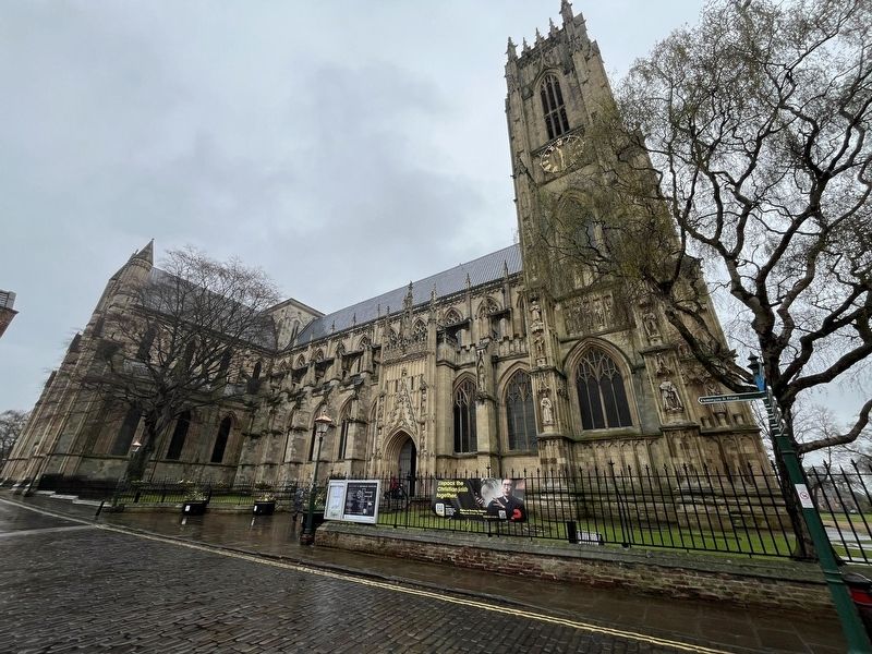
Photographed by Ray Gurganus, April 15, 2025
2. Beverley Minster
By mid 18th century the annual fair had moved to Norwood and fashionable Georgian brick replaced medieval timber.
The Monks Walk (previously the George & Dragon) in Highgate has a medieval interior, a 17th century central passage and a Georgian facade.
For many centuries the Minster has been associated with education. The medieval grammar school in the church yard was rebuilt in 1606 but the building was demolished in 1816 when the school moved to Keldgate.
Four almshouses were built close to the Minster, two of which are still used: Charles Warton's (1688) and Ann Routh's (1749). The Wartons of Beverley Parks were generous benefactors to the Minster and the town.
Almshouses provided communal living for the elderly who lived rent-free and received a weekly allowance.
Erected by Beverley Civic Society.
Topics. This historical marker is listed in these topic lists:
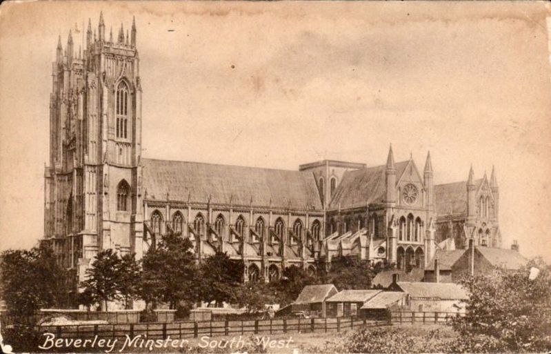
circa 1910
3. Beverly Minster
Location. 53° 50.376′ N, 0° 25.528′ W. Marker is in Beverley, England, in East Riding of Yorkshire. It is on Highgate. Touch for map. Marker is at or near this postal address: 36 Highgate, Beverley, England HU17, United Kingdom. Touch for directions.

Regionally, this marker is in England’s Yorkshire & The Humber. Globally, it is on the Atlantic Ocean, in the North Atlantic Region, in Europe, in Atlantic Europe, on one of the British Isles, in the Western World, and in the Anglosphere. Historically, it finds itself in what was once the Roman Empire.
Other nearby markers. At least 7 other markers are within 13 kilometers of this marker, measured as the crow flies: Beverley Station History (approx. 0.3 kilometers away); The Spring Bank West Quaker Burial Ground (approx. 10.5 kilometers away); Hull General Cemetery (approx. 10.6 kilometers away); Amy Johnson's Famous Flight, May 1930 (approx. 11.7 kilometers away); Amy Johnson, 1903-1941 (approx. 11.7 kilometers away); The Story of the Neptune Inn (approx. 12.3 kilometers away); Old Grammar School (approx. 12.4 kilometers away).
Credits. This page was last revised on July 22, 2025. It was originally submitted on July 14, 2025, by Ray Gurganus of Washington, District of Columbia. This page has been viewed 177 times since then and 63 times this year. Photos: 1, 2. submitted on July 14, 2025, by Ray Gurganus of Washington, District of Columbia. 3. submitted on July 22, 2025. • Andrew Ruppenstein was the editor who published this page.
