Near Corapeake in Gates County, North Carolina — The American South (South Atlantic)
North Carolina / Virginia
Inscription.
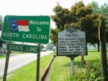
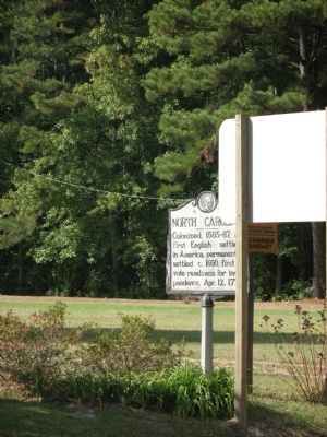
North Carolina. Colonized, 1585-87, by first English settlers in America; permanently settled c. 1650; first to vote readiness for independence, Apr. 12, 1775
Virginia. First permanent English colony in America, 1607; one of thirteen original states. Richmond, the capital, was seat of Confederate government.
Erected 1949. (Marker Number A-35.)
Topics and series. This historical marker is listed in this topic list: Political Subdivisions. In addition, it is included in the North Carolina Division of Archives and History series list. A significant historical date for this entry is April 12, 1863.
Location. 36° 33.043′ N, 76° 34.536′ W. Marker is near Corapeake, North Carolina, in Gates County. Marker is on Highway 32 N (State Highway 32) north of Adams Swamp Road, on the left when traveling north. Touch for map. Marker is in this post office area: Corapeake NC 27926, United States of America. Touch for directions.
Other nearby markers. At least 8 other markers are within 12 miles of this marker, measured as the crow flies. Nansemond County Virginia / North Carolina (a few steps from this marker in Virginia); First Post Road (approx. 1.2 miles away); George Washington (approx. 4.6 miles away); Dismal Town (approx. 6.8 miles away in Virginia); Washington Ditch (approx. 6.9 miles away in Virginia); Somerton Friends Meeting (approx. 11.2 miles away in Virginia); George Fox Monument (approx. 11.2 miles away in Virginia); Jericho Ditch (approx. 11.4 miles away in Virginia). Touch for a list and map of all markers in Corapeake.
More about this marker. This Marker sits at the Carolina/Virginia Line and across the street from marker Z-273. There is not a good place to park to view this marker.
Credits. This page was last revised on June 29, 2021. It was originally submitted on October 2, 2007, by Laura Troy of Burke, Virginia. This page has been viewed 1,302 times since then and 46 times this year. Photos: 1, 2. submitted on October 2, 2007, by Laura Troy of Burke, Virginia. • J. J. Prats was the editor who published this page.

