St. David in Cochise County, Arizona — The American Mountains (Southwest)
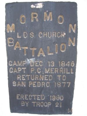
Mormon Battalion
LDS Church
Capt P.C. Merrill
Returned to
San Pedro 1877
Erected 1960
Erected 1960 by Troop 21.
Topics and series. This historical marker is listed in these topic lists: Notable Places • War, Mexican-American. In addition, it is included in the Mormon Battalion series list. A significant historical month for this entry is December 1915.
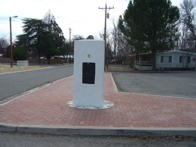
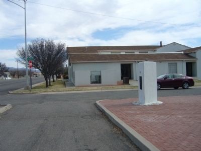
Location. 31° 54.306′ N, 110° 13.438′ W. Marker is in St. David, Arizona, in Cochise County. Marker is at the intersection of West Patton Street (Arizona Route 80 at milepost 301) and South Church Street, on the right when traveling east on West Patton Street. Touch for map. Marker is in this post office area: Saint David AZ 85630, United States of America. Touch for directions.
Other nearby markers. At least 8 other markers are within 14 miles of this marker, measured as the crow flies. Benson Pioneer Cemetery (approx. 5.8 miles away); Benson Jail (approx. 6 miles away); a different marker also named Mormon Battalion (approx. 6.6 miles away); Texas Canyon Pioneer Cemetery (approx. 12.6 miles away); Dragoon Springs Stage Stop (approx. 13.4 miles away); Confederate Graves at Dragoon Springs (approx. 13˝ miles away); Four miles southeast at Council Rocks (approx. 13.8 miles away); Edward Schieffelin (approx. 14 miles away).
Additional commentary.
1.
Description from the: Mormon Battalion Association, Map, Museums, and Trail Markers website.
The date on the marker is incorrect. The 12 December 1846 campsite is closest to this marker. It is at the base of the hill on the other side of the San Pedro River about 1 mile to the southwest, near the railroad tracks and South Apache Powder Road. The Battalion held musket drills in preparation for possible conflict upon entering Tucson, only three days march away.
— Submitted May 31, 2020, by Bill Kirchner of Tucson, Arizona.
Credits. This page was last revised on June 1, 2020. It was originally submitted on February 23, 2010, by Bill Kirchner of Tucson, Arizona. This page has been viewed 1,557 times since then and 29 times this year. Photos: 1, 2, 3. submitted on February 23, 2010, by Bill Kirchner of Tucson, Arizona. • Syd Whittle was the editor who published this page.


