Near Sierra Vista in Cochise County, Arizona — The American Mountains (Southwest)
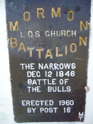
Mormon Battalion
LDS Church
Photographed by Bill Kirchner, February 19, 2010
1. Mormon Battalion Marker
Dec 12 1846
Battle of the Bulls
Erected 1960
Erected 1960 by Post 16.
Topics and series. This historical marker is listed in these topic lists: Notable Places • War, Mexican-American. In addition, it is included in the Mormon Battalion series list. A significant historical month for this entry is December 1915.
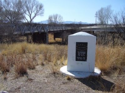
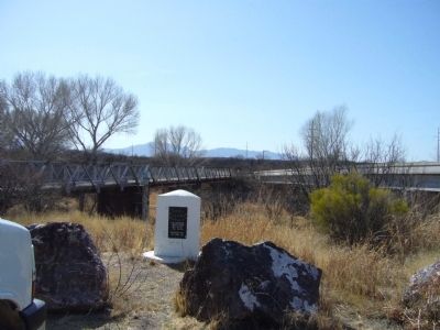
Location. 31° 37.577′ N, 110° 10.439′ W. Marker is near Sierra Vista, Arizona, in Cochise County. It is on East Charleston Road, on the right when traveling east. Marker is on southeast side of the San Pedro River Bridge. Touch for map. Marker is in this post office area: Sierra Vista AZ 85635, United States of America. Touch for directions.

Regionally, this marker is in the Sky Islands and in Southeastern Arizona. It is also in the American Borderlands and in the Southwest. Globally, it is in North America, the Western Hemisphere, the Western World, and the Anglosphere. Historically, it
this page online
Other nearby markers. At least 8 other markers are within 7 miles of this marker, measured as the crow flies: Mormon Battalion Campsite (approx. 5½ miles away); Fort Huachuca (approx. 6.7 miles away); Water... (approx. 6.7 miles away); Boom Days (approx. 6.7 miles away); On the right track (approx. 6.7 miles away); Fairbank... (approx. 6.7 miles away); A diversity of people (approx. 6.8 miles away); Welcome to Fairbank Historic Townsite (approx. 6.8 miles away).
More about this marker. This monument at one time was located about 7 miles further north along the San Pedro River near the ghost town of Fairbanks.
Additional commentary.
1. The marker is misdated
Description from the: Mormon Battalion Association, Map, Museums, and Trail Markers website.
The marker is misdated. The Battle of the Bulls actually occurred on 11 December 1846 about 3.5 miles north of
Photographed by Bill Kirchner, February 19, 2010
2. Mormon Battalion Marker
— Submitted May 31, 2020, by Bill Kirchner of Tucson, Arizona.
Photographed by Bill Kirchner, February 19, 2010
3. Mormon Battalion Marker
Credits. This page was last revised on March 14, 2025. It was originally submitted on February 23, 2010, by Bill Kirchner of Tucson, Arizona. This page has been viewed 2,267 times since then and 89 times this year. Photos: 1, 2, 3. submitted on February 23, 2010, by Bill Kirchner of Tucson, Arizona. • Syd Whittle was the editor who published this page.
