
Conisbrough in South Yorkshire, England, United Kingdom — Northwestern Europe (the British Isles)
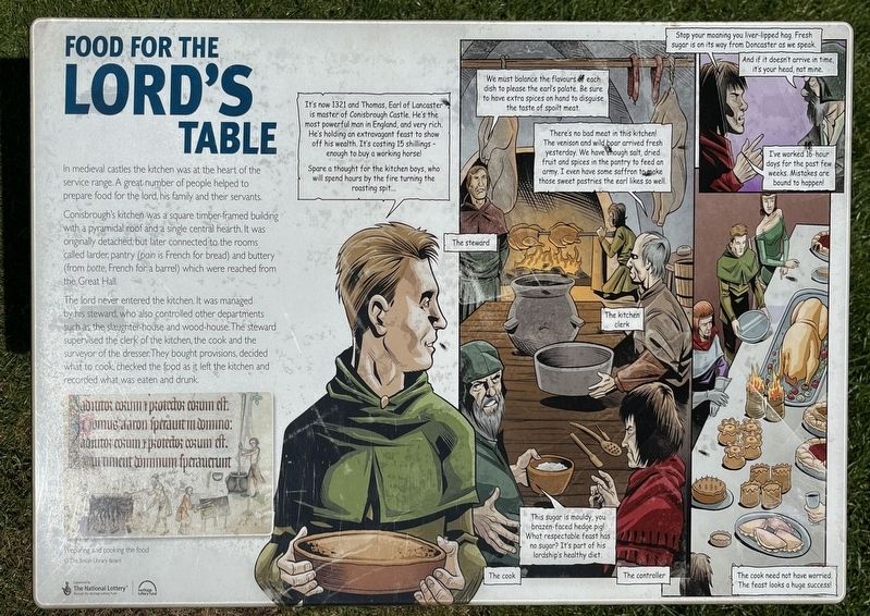
Food for the Lord's Table
Conisbrough Castle
Photographed by Ray Gurganus, April 20, 2025
1. Food for the Lord's Table Marker
Conisbrough's kitchen was a square timber framed building with a pyramidal roof and a single central hearth. It was originally detached, but later connected to the rooms called larder, pantry (pain is French for bread) and buttery (from botte, French for a barrel) which were reached from the Great Hall.
The lord never entered the kitchen. It was managed by his steward, who also controlled other departments such as the slaughter-house and wood-house. The steward supervised the clerk of the kitchen, the cook and the surveyor of the dresser. They bought provisions, decided what to cook checked the food as it left the kitchen and recorded what was eaten and drunk.
Topics. This historical marker is listed in this topic list: Forts and Castles.
Location. 53° 29.065′ N, 1° 13.557′ W. Marker is in Conisbrough, England, in South Yorkshire. It can be reached from Dale Road. On the grounds of Conisbrough Castle.
this page online

Regionally, this marker is in England’s Yorkshire & The Humber. Globally, it is on the Atlantic Ocean, in the North Atlantic Region, in Europe, in Atlantic Europe, on one of the British Isles, in the Western World, and in the Anglosphere. Historically, it finds itself in what was once the Roman Empire.
Other nearby markers. At least 8 other markers are within walking distance of this marker: The View into the Inner Bailey (a few steps from this marker); The View to the South-west (a few steps from this marker); The Lord's Home (a few steps from this marker); The View North (a few steps from this marker); The View to the South-east (a few steps from this marker); The Great Hall (within shouting distance of this marker); The Entrance Chamber and Basement (within shouting distance of this marker); Domestic Luxuries (within shouting distance of this marker). Touch for a list and map of all markers in Conisbrough.

Photographed by Ray Gurganus, April 20, 2025
2. Conisbrough Castle
Credits. This page was last revised on July 17, 2025. It was originally submitted on July 16, 2025, by Ray Gurganus of Washington, District of Columbia. This page has been viewed 57 times since then and 9 times this year. Photos: 1, 2. submitted on July 16, 2025, by Ray Gurganus of Washington, District of Columbia. • Andrew Ruppenstein was the editor who published this page.
