
Conisbrough in South Yorkshire, England, United Kingdom — Northwestern Europe (the British Isles)
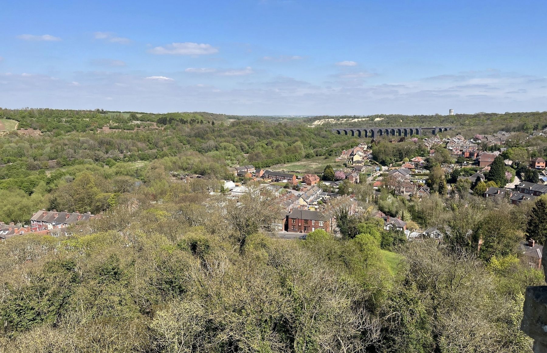
The View North
Conisbrough Castle

Photographed by Ray Gurganus, April 20, 2025
1. The View North Marker
[illegible] railway arrived in 1850s and the 465 metre long viaduct (1) is a remnant of the connection between the Hull & Barnsley Railway, Great Northern and Great Eastern lines. The architectural language of the 1951 water tower (2) a testament to the lasting legacy of Conisbrough keep.
Topics. This historical marker is listed in this topic list: Forts and Castles.
Location. 53° 29.066′ N, 1° 13.542′ W. Marker is in Conisbrough, England, in South Yorkshire. It can be reached from Low Road. On top of
this page online

Regionally, this marker is in England’s Yorkshire & The Humber. Globally, it is on the Atlantic Ocean, in the North Atlantic Region, in Europe, in Atlantic Europe, on one of the British Isles, in the Western World, and in the Anglosphere. Historically, it finds itself in what was once the Roman Empire.
Other nearby markers. At least 8 other markers are within walking distance of this marker: The View into the Inner Bailey (a few steps from this marker); The View to the South-west (a few steps from this marker); The View to the South-east (a few steps from this marker); Food for the Lord's Table (a few steps from this marker); The Lord's Home (a few steps from this marker); The Entrance Chamber and Basement (within shouting distance of this marker); The Great Hall (within shouting distance of this marker); Protecting the Castle (within shouting distance of this marker). Touch for a list and map of all markers in Conisbrough.
Photographed by Ray Gurganus, April 20, 2025
2. Current view to the north
Credits. This page was last revised on July 19, 2025. It was originally submitted on July 16, 2025, by Ray Gurganus of Washington, District of Columbia. This page has been viewed 65 times since then and 8 times this year. Photos: 1, 2. submitted on July 16, 2025, by Ray Gurganus of Washington, District of Columbia. • Andrew Ruppenstein was the editor who published this page.
