
Southwest Area in Cedar Rapids in Linn County, Iowa — The American Midwest (Upper Plains)
Landfill History
Photographed by Jason Voigt, June 18, 2025
1. Landfill History Marker
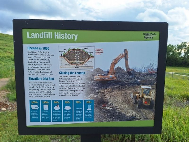
Opened in 1965
The City of Cedar Rapids opened this landfill in a former quarry. The property came under control of the Cedar Rapids Linn County Solid Waste Agency in 1994 when a partnership was formed between Linn County, the City of Cedar Rapids and all communities in Linn County.
Elevation: 948 feet
This site is estimated to hold 6.4 million tons of waste. It took decades for the fill to rise above neighboring Czech Village. The mound is now 208 feet taller than the surrounding landscape or 948 feet above sea level.
Closing the Landfill
The landfill closed in 2006, but reopened in 2008 after the historic Cedar River flood. More than 431,000 tons of flood debris were added to the landfill raising the height by 30 feet. The landfill was closed permanently in 2013. The trails and scenic overlook opened in 2018.
(aside:)
·1670 ft. - The natural highpoint of Iowa is located north of the town of Sibley.
·1,100 ft. - Linn County's natural highpoint is located in a farm field at the far northeast corner.
·948 ft. - Mount Trashmore sits across the river from NewBo City Market - the lowest point in Cedar Rapids
this page online
·932 ft. - Mount Mercy University sits on a naturally formed hill overlooking the city.
·702 ft. - The broadcast tower along Collins Rd. NE is dwarfed by the station's main tower near Rowley which is 1,919 ft.
·285 ft. - Alliant Energy Tower (built in 1972) is the tallest building in Cedar Rapids.
Erected by Solid Waste Agency.
Topics. This historical marker is listed in this topic list: Industry & Commerce. A significant historical year for this entry is 1965.
Location. 41° 57.872′ N, 91° 38.924′ W. Marker is in Cedar Rapids, Iowa, in Linn County. It is in the Southwest Area. It can be reached from A Street Southwest near C Street Southwest. Marker is located off a trail on the grounds of Mount Trashmore. Touch for map. Marker is at or near this postal address: 2216 A St SW, Cedar Rapids IA 52404, United States of America. Touch for directions.

Regionally, this marker is in Eastern Iowa. It is also in the American Midwest and in the Corn Belt. Globally, it is in North America, the Western Hemisphere, the Western World, and the Anglosphere. Historically, it finds itself in what was once the territory of the
Photographed by Jason Voigt, June 18, 2025
2. Landfill History Marker
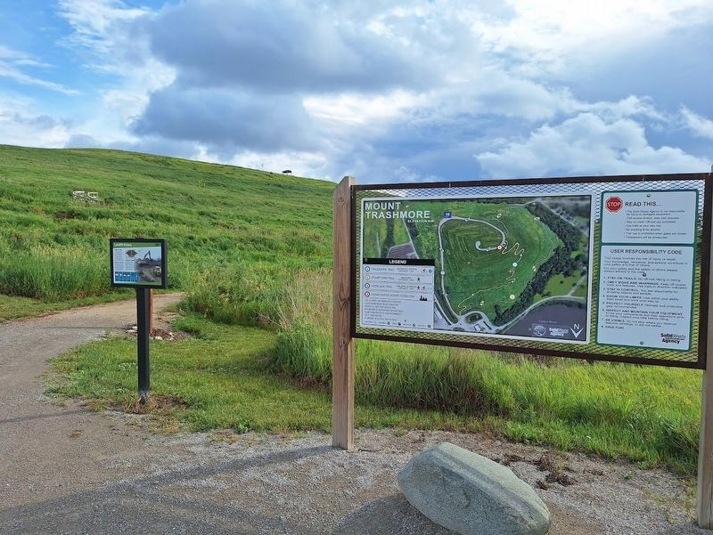
Marker is located off the trails of Mount Trashmore.
Other nearby markers. At least 8 other markers are within walking distance of this marker: The Quarry (within shouting distance of this marker); Wastewater Plant (about 600 feet away, measured in a direct line); Stumptown (approx. 0.3 miles away); The Floods of 2008 (approx. 0.3 miles away); World War II Memorial (approx. 0.4 miles away); Bohemian Commercial Historic District (approx. 0.6 miles away); Oak Hill Neighborhood (approx. 0.6 miles away); Welcome to Novak Plaza (approx. 0.6 miles away). Touch for a list and map of all markers in Cedar Rapids.
Regarding Landfill History. Access to view all markers on the grounds of Mount Trashmore requires a check-in on site.
Also see . . . Mount Trashmore. This landfill turned nature park has become an icon in the Cedar Rapids area, attracting locals and outside visitors. Before coming there, it is best to check the hours they are open. (Submitted on July 16, 2025, by Jason Voigt of Glen Carbon, Illinois.)
Credits. This page was last revised on July 16, 2025. It was originally submitted on July 16, 2025, by Jason Voigt of Glen Carbon, Illinois. This page has been viewed 229 times since then and 77 times this year. Photos: 1, 2. submitted on July 16, 2025, by Jason Voigt of Glen Carbon, Illinois.
