Norman in Cleveland County, Oklahoma — The American South (West South Central)
The City of Norman 1889-1907
Photographed by Duane and Tracy Marsteller, June 20, 2025
1. The City of Norman 1889-1907 Marker
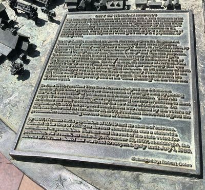
On May 2, 1890, President Benjamin Harrison signed the Organic Act which officially established Oklahoma Territory and also recognized Norman as the county seat of “Third County”. Later, on August 5, 1890, by popular vote of the citizens of “Third County” chose as a permanent name “Cleveland County” rather than “Lincoln County” that was also proposed. On December 19, 1890, the first Oklahoma Territory Legislature gave Norman an incredible breath of life by selecting it to be the future site of the University of Oklahoma. On July 8, 1891, the leaders of Norman paid $1,000.00 for 40 acres of land for the site of the new
this page online
In June 1906, President Theodore Roosevelt signed the Oklahoma Enabling Act which provided for the creation of a single state by joining the “Twin Territories” of Oklahoma and Indian Territories. This Act required a convention of delegates representing the two territories to meet in Guthrie and draft a constitution for the new state of Oklahoma. On September 17, 1907, the proposed constitution was ratified by the voters of both territories and on November 16, 1907, President Roosevelt signed the proclamation establishing the new State of Oklahoma.
By 1907, Norman had a population of 3,040 and its share of saloons. Included at the time of voting on the new constitution was a statewide amendment on prohibition. Norman and the rest of the state voted for prohibition. As a result, on Saturday, November
Photographed by Duane and Tracy Marsteller, June 20, 2025
2. The City of Norman 1889-1907 Marker
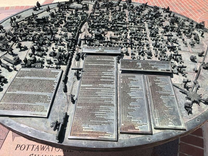
Featured marker is on the bottom left of the three-dimensional tabletop model, which depicts the town of Norman in 1907.
– Submitted by Robert Goins
Erected by City of Norman, Oklahoma.
Topics. This historical marker is listed in these topic lists: Political Subdivisions • Settlements & Settlers. A significant historical date for this entry is April 22, 1889.
Location. 35° 12.979′ N, 97° 26.43′ W. Marker is in Norman, Oklahoma, in Cleveland County. It can be reached from South Jones Avenue south of Castro Street, on the right when traveling south. Marker is on the Norman Legacy Trail, which runs parallel and to the west of South Jones Street. Touch for map. Marker is in this post office area: Norman OK 73069, United States of America. Touch for directions.

Regionally, this marker is in Central Oklahoma—Frontier Country and in Greater Oklahoma City. It is also in the American South, specifically on the prairies, and on the Southern Plains. Globally, it is in North America, the Western Hemisphere, the Western World, and the Anglosphere. Historically, it finds itself in what was once the territory of the Mississippian Culture and also the
Photographed by Duane and Tracy Marsteller, June 20, 2025
3. The City of Norman 1889-1907 Marker
Other nearby markers. At least 8 other markers are within walking distance of this marker: The Great Land Run of 1889 (here, next to this marker); Extra! Extra! Read All About It! (here, next to this marker); Native Oklahoma (about 400 feet away, measured in a direct line); Indian Territory, 1866-1889 (about 400 feet away); University on the Prairie (about 700 feet away); A Tough Decade (about 700 feet away); The Brooks Years and World War One (about 700 feet away); Norman the University City (about 700 feet away). Touch for a list and map of all markers in Norman.
Credits. This page was last revised on July 17, 2025. It was originally submitted on July 17, 2025, by Duane and Tracy Marsteller of Murfreesboro, Tennessee. This page has been viewed 157 times since then and 40 times this year. Photos: 1, 2, 3. submitted on July 17, 2025, by Duane and Tracy Marsteller of Murfreesboro, Tennessee.
