Southwest Area in Cedar Rapids in Linn County, Iowa — The American Midwest (Upper Plains)
The Floods of 2008
Photographed by Jason Voigt, June 18, 2025
1. The Floods of 2008 Marker
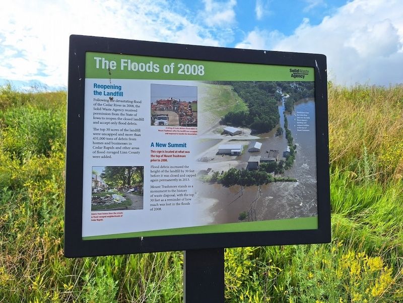
Reopening the Landfill
Following the devastating flood of the Cedar River in 2008, the Solid Waste Agency received permission from the State of Iowa to reopen the closed landfill and accept only flood debris.
The top 30 acres of the landfill were uncapped and more than 431,000 tons of debris from homes and businesses in Cedar Rapids and other areas of flood-ravaged Linn County were added.
A New Summit
This sign is located at what was the top of Mount Trashmore prior to 2008.
Flood debris increased the height of the landfill by 30 feet before it was closed and capped again permanently in 2013.
Mount Trashmore stands as a monument to the history of waste disposal, with the top 30 feet as a reminder of how much was lost in the floods of 2008.
Erected by Solid Waste Agency.
Topics. This historical marker is listed in this topic list: Disasters. A significant historical year for this entry is 2008.
Location. 41° 57.612′ N, 91° 38.88′ W. Marker is in Cedar Rapids, Iowa, in Linn County. It is in the Southwest Area. It can be reached from C Street Southwest east of C Street Southwest. Marker is located off a
this page online

Regionally, this marker is in Eastern Iowa. It is also in the American Midwest and in the Corn Belt. Globally, it is in North America, the Western Hemisphere, the Western World, and the Anglosphere. Historically, it finds itself in what was once the territory of the Mississippian Culture and also the Louisiana Purchase.
Other nearby markers. At least 8 other markers are within walking distance of this marker: Stumptown (within shouting distance of this marker); Wastewater Plant (approx. 0.2 miles away); World War II Memorial (approx. 0.3 miles away); Landfill History (approx. 0.3 miles away); The Quarry (approx. 0.3 miles away); Bohemian Commercial Historic District (approx. ¾ mile away); Welcome to Novak Plaza (approx. ¾ mile away); Kosek Bandstand (approx. ¾ mile away). Touch for a list and map of all markers in Cedar Rapids.
Regarding The Floods of 2008. Access to view all markers on the grounds of Mount Trashmore requires a check-in

Photographed by Jason Voigt, June 18, 2025
2. The Floods of 2008 Marker
Marker is located off a trail on the grounds of Mount Trashmore.
Also see . . . Mount Trashmore. This landfill turned nature park has become an icon in the Cedar Rapids area, attracting locals and outside visitors. Before coming there, it is best to check the hours they are open. (Submitted on July 17, 2025, by Jason Voigt of Glen Carbon, Illinois.)
Credits. This page was last revised on July 17, 2025. It was originally submitted on July 17, 2025, by Jason Voigt of Glen Carbon, Illinois. This page has been viewed 114 times since then and 24 times this year. Photos: 1, 2. submitted on July 17, 2025, by Jason Voigt of Glen Carbon, Illinois.
