Conisbrough in South Yorkshire, England, United Kingdom — Northwestern Europe (the British Isles)
The Lord's Home
Conisbrough Castle

Photographed by Ray Gurganus, April 20, 2025
1. The Lord's Home Marker
It was probably Hamelin who built a similar tower in the de Warennes' Norman town of Mortemer. These circular buildings stood out amongst rectangular towers owned by other English barons, and rivalled those built by King Henry II and his sons, such as Orford and Tickhill.
Topics. This historical marker is listed in this topic list: Forts and Castles. A significant historical year for this entry is 1170.
Location. 53° 29.056′ N, 1° 13.556′ W. Marker is in Conisbrough, England, in South Yorkshire. It can be reached from Low Road. On the
this page online

Regionally, this marker is in Yorkshire & The Humber. Globally, it is on the Atlantic Ocean, in the North Atlantic Region, in Europe, in Atlantic Europe, on one of the British Isles, in the Western World, and in the Anglosphere. Historically, it finds itself in what was once the Roman Empire.
Other nearby markers. At least 8 other markers are within walking distance of this marker: The View to the South-east (a few steps from this marker); The View to the South-west (a few steps from this marker); The View into the Inner Bailey (a few steps from this marker); Food for the Lord's Table (a few steps from this marker); The Entrance Chamber and Basement (a few steps from this marker); The View North (a few steps from this marker); Protecting the Castle (within shouting distance of this marker); Domestic Luxuries (within shouting distance of this marker). Touch for a list and map of all markers in Conisbrough.
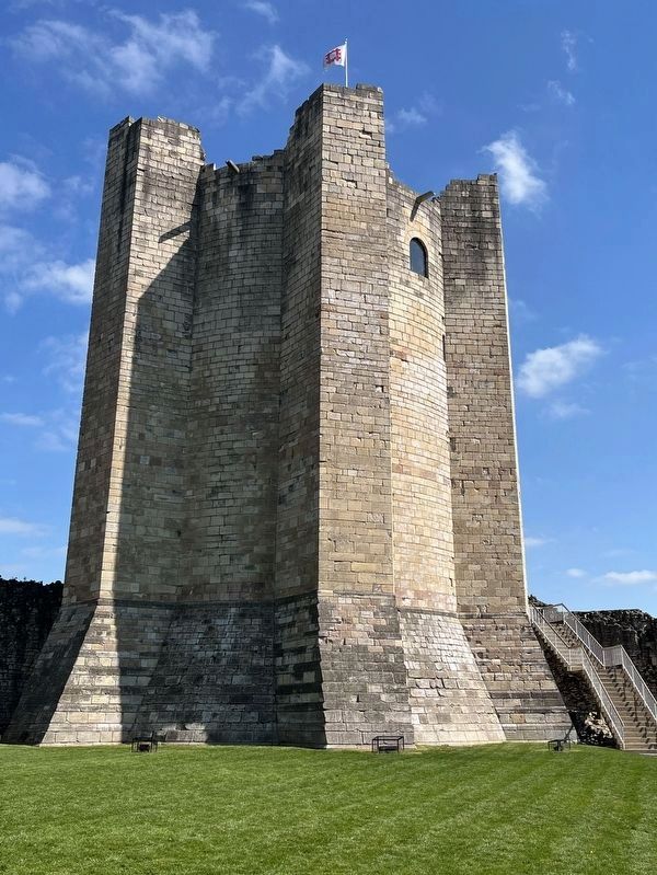
Photographed by Ray Gurganus, April 20, 2025
2. Conisbrough Castle
Credits. This page was last revised on July 18, 2025. It was originally submitted on July 18, 2025, by Ray Gurganus of Washington, District of Columbia. This page has been viewed 63 times since then and 9 times this year. Photos: 1, 2. submitted on July 18, 2025, by Ray Gurganus of Washington, District of Columbia. • Andrew Ruppenstein was the editor who published this page.
