Ogden in Weber County, Utah — The American Mountains (Southwest)
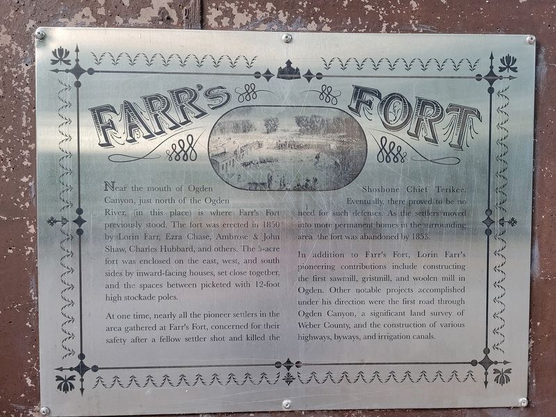
Farr's Fort
⎯⎯⎯
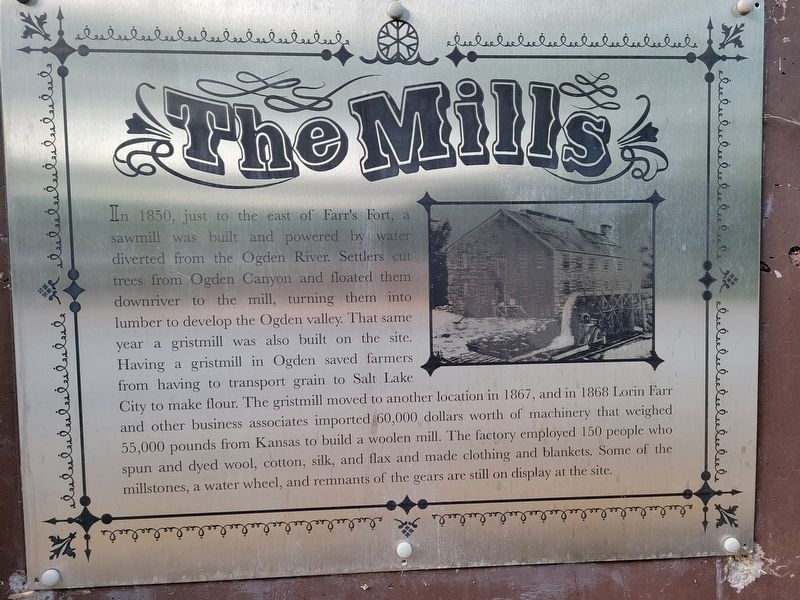
The Mills
⎯⎯⎯
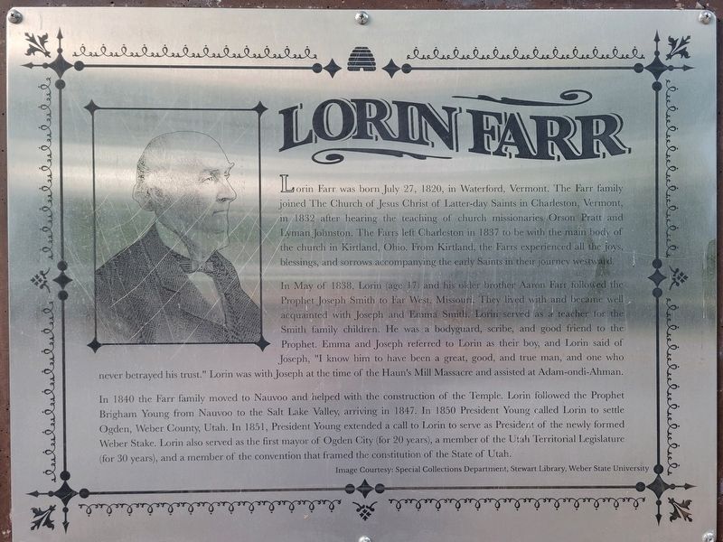
Lorin Farr
Photographed by Jeremy Snow, June 21, 2025
1. Farr's Fort marker
Farr's Fort
Near the mouth of Ogden Canyon, just north of the Ogden River (in this place) is where Farr's Fort previously stood. The fort was erected in 1850 by Lorin Farr, Ezra Chase, Ambrose & John Shaw, Charles Hubbard, and others. The 5-acre fort was enclosed on the east, west, and south sides by inward-facing houses, set close together, and the spaces between picketed with 12-foot high stockade poles.
At one time, nearly all the pioneer settlers in the area gathered at Farr's Fort, concerned for their safety after a fellow settler shot and killed the Shoshone Chief Terikee. Eventually, there proved to be no need for such defenses. As the settlers moved into more permanent homes in the surrounding area the fort was abandoned by 1853.
In addition to Farr's Fort, Lorin Farr's pioneering contributions include constructing the first sawmill, gristmill, and woolen mill in Ogden. Other notable projects accomplished under his direction were the first road through Ogden Canyon, a significant land survey of Weber County, and the construction of various highways, byways, and irrigation canals.
The Mills
In 1850,
this page online
Lorin Farr
Lorin Farr was born July 27, 1820, in Waterford, Vermont. The Farr family joined The Church of Jesus Christ of Latter-day Saints in Charleston, Vermont, in 1832 after hearing the teaching of church missionaries Orson Pratt and Lyman Johnston. The Farrs left Charleston in 1837 to be with the main body of the church
Photographed by Jeremy Snow, June 21, 2025
2. The Mills marker
In May of 1838, Lorin (age 17) and his older brother Aaron Farr followed the Prophet Joseph Smith to Far West, Missouri. They lived with and became well acquainted with Joseph and Emma Smith. Lorin served as a teacher for the Smith family children. He was a bodyguard, scribe, and good friend to the Prophet. Emma and Joseph referred to Lorin as their boy, and Lorin said of Joseph, "I know him to have been a great, good, and true man, and one who never betrayed his trust." Lorin was with Joseph at the time of the Haun's Mill Massacre and assisted at Adam-ondi-Ahman.
In 1840 the Farr family moved to Nauvoo and helped with the construction of the Temple. Lorin followed the Prophet Brigham Young from Nauvoo to the Salt Lake Valley, arriving in 1847. In 1850 President Young called Lorin to settle Ogden, Weber County, Utah. In 1851, President Young extended a call to Lorin to serve as President of the newly formed Weber Stake. Lorin also served as the first mayor of Ogden City (for 20
Photographed by Jeremy Snow, June 21, 2025
3. Lorin Farr marker
Image Courtesy: Special Collections Department, Stewart Library, Weber State University
Topics. This historical marker is listed in these topic lists: Forts and Castles • Settlements & Settlers. A significant historical year for this entry is 1850.
Location. 41° 14.47′ N, 111° 57.107′ W. Marker is in Ogden, Utah, in Weber County. It is on Creekside Drive, on the right when traveling east. Touch for map. Marker is at or near this postal address: 1032 Creekside Drive, Ogden UT 84404, United States of America. Touch for directions.

Regionally, this marker is in the Wasatch Front and in Greater Salt Lake. It is also in the American Mountain West and on the Colorado Plateau. Globally, it is in North America, the Rocky Mountains, the Western Hemisphere, the Western World, and the Anglosphere. Historically, it finds itself in what was once New Spain and also Mexico’s Alta California.
Other nearby markers. At least 8 other markers are within 2 miles of this marker, measured
Photographed by Jeremy Snow, June 21, 2025
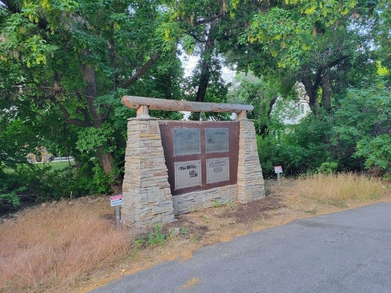
4. Farr's Fort / The Mills / Lorin Farr Marker
Credits. This page was last revised on August 17, 2025. It was originally submitted on July 18, 2025, by Jeremy Snow of Cedar City, Utah. This page has been viewed 186 times since then and 89 times this year. Photos: 1, 2, 3, 4. submitted on July 19, 2025, by Jeremy Snow of Cedar City, Utah. • Andrew Ruppenstein was the editor who published this page.
